<< Our Photo Pages >> Migvie Cupmarked Stone - Rock Art in Scotland in Aberdeenshire
Submitted by hamilton on Monday, 10 April 2017 Page Views: 1945
Rock ArtSite Name: Migvie Cupmarked StoneCountry: Scotland County: Aberdeenshire Type: Rock Art
Nearest Town: Tarland Nearest Village: Logie Coldstone
Map Ref: NJ4369606817
Latitude: 57.148766N Longitude: 2.932188W
Condition:
| 5 | Perfect |
| 4 | Almost Perfect |
| 3 | Reasonable but with some damage |
| 2 | Ruined but still recognisable as an ancient site |
| 1 | Pretty much destroyed, possibly visible as crop marks |
| 0 | No data. |
| -1 | Completely destroyed |
| 5 | Superb |
| 4 | Good |
| 3 | Ordinary |
| 2 | Not Good |
| 1 | Awful |
| 0 | No data. |
| 5 | Can be driven to, probably with disabled access |
| 4 | Short walk on a footpath |
| 3 | Requiring a bit more of a walk |
| 2 | A long walk |
| 1 | In the middle of nowhere, a nightmare to find |
| 0 | No data. |
| 5 | co-ordinates taken by GPS or official recorded co-ordinates |
| 4 | co-ordinates scaled from a detailed map |
| 3 | co-ordinates scaled from a bad map |
| 2 | co-ordinates of the nearest village |
| 1 | co-ordinates of the nearest town |
| 0 | no data |
Internal Links:
External Links:
")
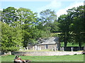
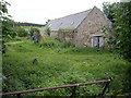
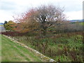
The Migvie cupmarked stone, unearthed during the 19th century, lay until very recently just a few metres south of Glack Farmhouse, a short distance east of Migvie kirkyard. The boulder consists of red sandstone and, according to Canmore, carries on its upper surface some 42 cupmarks about 10 millimetres deep and averaging 40 millimetres in diameter.
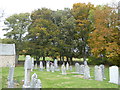
The rock has now been placed in the neighbouring Migvie Churchyard, where it sits near the wall on its east side. Most importantly, the cupmarked stone is now in a much safer place.
You may be viewing yesterday's version of this page. To see the most up to date information please register for a free account.
")
")
Do not use the above information on other web sites or publications without permission of the contributor.
Nearby Images from Geograph Britain and Ireland:
©2018(licence)
©2007(licence)
©2007(licence)
©2010(licence)
©2018(licence)
The above images may not be of the site on this page, they are loaded from Geograph.
Please Submit an Image of this site or go out and take one for us!
Click here to see more info for this site
Nearby sites
Key: Red: member's photo, Blue: 3rd party photo, Yellow: other image, Green: no photo - please go there and take one, Grey: site destroyed
Download sites to:
KML (Google Earth)
GPX (GPS waypoints)
CSV (Garmin/Navman)
CSV (Excel)
To unlock full downloads you need to sign up as a Contributory Member. Otherwise downloads are limited to 50 sites.
Turn off the page maps and other distractions
Nearby sites listing. In the following links * = Image available
49m W 276° Migvie Stone* Class II Pictish Symbol Stone (NJ4364706823)
912m E 98° Milton of Migvie* Souterrain (Fogou, Earth House) (NJ44600668)
1.2km NNW 335° Tillypronie 1 Class I Pictish Symbol Stone (NJ432079)
1.2km NNW 338° Tillypronie 2 Class I Pictish Symbol Stone (NJ43250796)
2.6km ESE 120° Logie Coldstone Stone Circle (NJ459055)
2.6km WSW 258° Blue Cairn Circle* Stone Circle (NJ411063)
3.2km SE 130° Corrachree* Class I Pictish Symbol Stone (NJ46160470)
3.3km SW 216° Milton of Whitehouse* Souterrain (Fogou, Earth House) (NJ417042)
3.7km ESE 113° Melgum NW Stone Circle (NJ471053)
3.8km ESE 115° Melgum Centre* Stone Circle (NJ471052)
4.3km ESE 114° Waulkmill* Stone Circle (NJ47630500)
4.4km E 100° Doune Hill Stone Circle (NJ480060)
6.0km ESE 123° Tomnaverie* Stone Circle (NJ48650348)
6.6km S 176° Old Kinord Ancient Village or Settlement (NJ441002)
6.6km S 173° Hut Circles at Old Kinord* Ancient Village or Settlement (NJ444002)
6.7km SSE 165° Monandavan Ring Cairn (NJ453003)
6.9km E 100° Culsh* Souterrain (Fogou, Earth House) (NJ5048305488)
6.9km N 0° Glenkindie* Standing Stone (Menhir) (NJ4382813751)
7.0km E 87° Hillhead Stone Circle Stone Circle (NJ50720714)
7.0km S 177° Loch Kinord Cross Slab* Class III Pictish Cross Slab (NO44009978)
7.1km ESE 122° North Gellan Ancient Village or Settlement (NJ497030)
7.3km SE 145° Balnacraig Cairn Aberdeenshire Chambered Cairn (NJ47830082)
7.3km S 175° Loch Kinord Crannog* Crannog (NO443995)
7.4km SSE 157° Knockenzie Ancient Village or Settlement (NJ465000)
7.8km NW 325° Buchaam* Souterrain (Fogou, Earth House) (NJ39261324)
View more nearby sites and additional images


 We would like to know more about this location. Please feel free to add a brief description and any relevant information in your own language.
 Wir möchten mehr über diese Stätte erfahren. Bitte zögern Sie nicht, eine kurze Beschreibung und relevante Informationen in Deutsch hinzuzufügen.
 Nous aimerions en savoir encore un peu sur les lieux. S'il vous plaît n'hesitez pas à ajouter une courte description et tous les renseignements pertinents dans votre propre langue.
 Quisieramos informarnos un poco más de las lugares. No dude en añadir una breve descripción y otros datos relevantes en su propio idioma.