<< Text Pages >> Tank Cottage - Standing Stone (Menhir) in England in Herefordshire
Submitted by Northernchief on Tuesday, 17 January 2023 Page Views: 655
Neolithic and Bronze AgeSite Name: Tank CottageCountry: England
NOTE: This site is 4.5 km away from the location you searched for.
County: Herefordshire Type: Standing Stone (Menhir)
Nearest Town: Hereford Nearest Village: Pembridge
Map Ref: SO36615640
Latitude: 52.202167N Longitude: 2.928957W
Condition:
| 5 | Perfect |
| 4 | Almost Perfect |
| 3 | Reasonable but with some damage |
| 2 | Ruined but still recognisable as an ancient site |
| 1 | Pretty much destroyed, possibly visible as crop marks |
| 0 | No data. |
| -1 | Completely destroyed |
| 5 | Superb |
| 4 | Good |
| 3 | Ordinary |
| 2 | Not Good |
| 1 | Awful |
| 0 | No data. |
| 5 | Can be driven to, probably with disabled access |
| 4 | Short walk on a footpath |
| 3 | Requiring a bit more of a walk |
| 2 | A long walk |
| 1 | In the middle of nowhere, a nightmare to find |
| 0 | No data. |
| 5 | co-ordinates taken by GPS or official recorded co-ordinates |
| 4 | co-ordinates scaled from a detailed map |
| 3 | co-ordinates scaled from a bad map |
| 2 | co-ordinates of the nearest village |
| 1 | co-ordinates of the nearest town |
| 0 | no data |
Be the first person to rate this site - see the 'Contribute!' box in the right hand menu.
Internal Links:
External Links:
Standing Stone (Menhir) near Weston, England
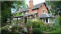
I have seen this on a separate Facebook post, there appears to be a standing stone in the cottage garden.
You may be viewing yesterday's version of this page. To see the most up to date information please register for a free account.
Do not use the above information on other web sites or publications without permission of the contributor.
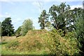
Nearby Images from Geograph Britain and Ireland:
©2007(licence)
©2014(licence)
©2018(licence)

©2014(licence)
©2014(licence)
The above images may not be of the site on this page, they are loaded from Geograph.
Please Submit an Image of this site or go out and take one for us!
Click here to see more info for this site
Nearby sites
Key: Red: member's photo, Blue: 3rd party photo, Yellow: other image, Green: no photo - please go there and take one, Grey: site destroyed
Download sites to:
KML (Google Earth)
GPX (GPS waypoints)
CSV (Garmin/Navman)
CSV (Excel)
To unlock full downloads you need to sign up as a Contributory Member. Otherwise downloads are limited to 50 sites.
Turn off the page maps and other distractions
Nearby sites listing. In the following links * = Image available
6.4km NNW 341° Wapley Camp* Hillfort (SO3457162465)
8.0km NNW 334° Cat and Fiddle Enclosure Cropmark Ancient Village or Settlement (SO33146362)
8.5km WNW 298° St Michael's Churchyard Cross (Knill)* Ancient Cross (SO2911860448)
8.9km WNW 284° Bradnor Hill 1 Stone Row / Alignment (SO27945860)
9.3km WNW 299° Burfa Camp* Hillfort (SO285610)
9.4km ENE 58° St Michael's Church (Kingsland)* Ancient Cross (SO4468461269)
9.6km NNW 328° St Andrew's Church (Presteigne)* Ancient Cross (SO3156864528)
9.6km W 274° Yeld Wood Stone Row / Alignment (SO26995724)
9.7km NNW 333° Stapleton Henge Henge (SO32356510)
9.7km ESE 120° Bush Bank* Standing Stone (Menhir) (SO4496251449)
10.4km WNW 290° Walton Cursus Cursus (SO26826001)
10.5km W 271° The Whet Stone (Hergest Ridge)* Natural Stone / Erratic / Other Natural Feature (SO26055680)
10.6km NNE 33° St John the Baptist and St Alkmund (Aymestrey)* Ancient Cross (SO4256065130)
10.6km WNW 288° Walton Green Cursus (SO26525989)
10.9km WNW 287° Walton Cursus Cursus (SO26195978)
11.3km WNW 293° Hindwell Causewayed Enclosure* Causewayed Enclosure (SO26246092)
11.4km WNW 295° Knobley Stone* Standing Stone (Menhir) (SO26296132)
11.5km NNE 29° Pyon Wood* Hillfort (SO424664)
11.9km WNW 293° Hindwell Ash* Round Barrow(s) (SO25706111)
11.9km E 97° Ivington Camp* Hillfort (SO484547)
11.9km WNW 287° Walton Palisaded Enclosure* Timber Circle (SO25235996)
11.9km WNW 282° Old Radnor Church* Standing Stone (Menhir) (SO24995909)
11.9km WNW 290° Hindwell Enclosure* Timber Circle (SO2544560720)
12.0km WNW 290° Hindwell Farm 1* Round Barrow(s) (SO25376064)
12.2km WNW 291° Hindwell Farm 2* Round Barrow(s) (SO25226091)
View more nearby sites and additional images


 We would like to know more about this location. Please feel free to add a brief description and any relevant information in your own language.
 Wir möchten mehr über diese Stätte erfahren. Bitte zögern Sie nicht, eine kurze Beschreibung und relevante Informationen in Deutsch hinzuzufügen.
 Nous aimerions en savoir encore un peu sur les lieux. S'il vous plaît n'hesitez pas à ajouter une courte description et tous les renseignements pertinents dans votre propre langue.
 Quisieramos informarnos un poco más de las lugares. No dude en añadir una breve descripción y otros datos relevantes en su propio idioma.