<< Our Photo Pages >> Balgrummo - Standing Stone (Menhir) in Scotland in Fife
Submitted by vicky on Saturday, 06 December 2003 Page Views: 11737
Neolithic and Bronze AgeSite Name: BalgrummoCountry: Scotland County: Fife Type: Standing Stone (Menhir)
Nearest Town: Kennoway Nearest Village: Bonnybank
Map Ref: NO375029 Landranger Map Number: 59
Latitude: 56.214554N Longitude: 3.009289W
Condition:
| 5 | Perfect |
| 4 | Almost Perfect |
| 3 | Reasonable but with some damage |
| 2 | Ruined but still recognisable as an ancient site |
| 1 | Pretty much destroyed, possibly visible as crop marks |
| 0 | No data. |
| -1 | Completely destroyed |
| 5 | Superb |
| 4 | Good |
| 3 | Ordinary |
| 2 | Not Good |
| 1 | Awful |
| 0 | No data. |
| 5 | Can be driven to, probably with disabled access |
| 4 | Short walk on a footpath |
| 3 | Requiring a bit more of a walk |
| 2 | A long walk |
| 1 | In the middle of nowhere, a nightmare to find |
| 0 | No data. |
| 5 | co-ordinates taken by GPS or official recorded co-ordinates |
| 4 | co-ordinates scaled from a detailed map |
| 3 | co-ordinates scaled from a bad map |
| 2 | co-ordinates of the nearest village |
| 1 | co-ordinates of the nearest town |
| 0 | no data |
Internal Links:
External Links:
")
Have you visited this site? Please add a comment below.
You may be viewing yesterday's version of this page. To see the most up to date information please register for a free account.
")
Do not use the above information on other web sites or publications without permission of the contributor.
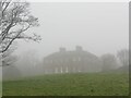
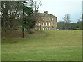
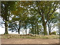
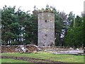
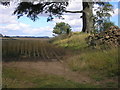
Nearby Images from Geograph Britain and Ireland:
©2020(licence)
©2006(licence)
©2014(licence)
©2008(licence)
©2018(licence)
The above images may not be of the site on this page, they are loaded from Geograph.
Please Submit an Image of this site or go out and take one for us!
Click here to see more info for this site
Nearby sites
Key: Red: member's photo, Blue: 3rd party photo, Yellow: other image, Green: no photo - please go there and take one, Grey: site destroyed
Download sites to:
KML (Google Earth)
GPX (GPS waypoints)
CSV (Garmin/Navman)
CSV (Excel)
To unlock full downloads you need to sign up as a Contributory Member. Otherwise downloads are limited to 50 sites.
Turn off the page maps and other distractions
Nearby sites listing. In the following links * = Image available
525m NNE 20° Aithernie (Scoonie) Cairn (NO37690339)
3.0km E 93° Lundin Links* Stone Circle (NO40480272)
4.9km E 82° Largo Pictish Stone* Class II Pictish Symbol Stone (NO42340347)
5.6km NE 37° Norrie's Law* Round Barrow(s) (NO409073)
6.3km SSW 206° Sloping Cave* Cave or Rock Shelter (NT34619727)
6.5km SSW 206° Well Cave (East Wemyss)* Cave or Rock Shelter (NT345971)
6.7km SSW 207° Jonathan’s Cave* Cave or Rock Shelter (NT344970)
6.7km SSW 207° West Doo Cave* Cave or Rock Shelter (NT3433097007)
6.8km SSW 208° Court Cave* Cave or Rock Shelter (NT34279694)
7.7km SW 224° Earlseat* Standing Stone (Menhir) (NT3197797452)
8.8km NNE 16° Spout Well* Holy Well or Sacred Spring (NO400114)
8.9km W 270° Balbirnie* Stone Circle (NO2858702969)
8.9km NNW 341° Walton Symbol Stone Class I Pictish Symbol Stone (NO34651135)
9.0km W 271° Balfarg Riding School mortuary enclosure and henge* Henge (NO28480314)
9.3km W 271° Balfarg Henge* Henge (NO2819803123)
11.1km SW 224° Bogleys* Standing Stone (Menhir) (NT296951)
12.2km E 84° Easter Pitcorthie* Standing Stone (Menhir) (NO497039)
13.0km E 98° Ardross souterrain* Souterrain (Fogou, Earth House) (NO5037500950)
13.0km WNW 289° Westfield Farm Class I Pictish Symbol Stone (NO25260735)
13.1km NW 321° Collessie* Standing Stone (Menhir) (NO293132)
13.2km NW 320° Newton of Collessie Class I Pictish Symbol Stone (NO292132)
13.3km NE 38° Drumcarrow Craig* Broch or Nuraghe (NO459132)
13.5km WNW 283° East Lomond Hill Hillfort (NO24400620)
14.5km W 263° Strathhendry* Stone Circle (NO23050145)
15.1km WSW 246° Dogton* Class III Pictish Cross Slab (NT2360996863)
View more nearby sites and additional images


 We would like to know more about this location. Please feel free to add a brief description and any relevant information in your own language.
 Wir möchten mehr über diese Stätte erfahren. Bitte zögern Sie nicht, eine kurze Beschreibung und relevante Informationen in Deutsch hinzuzufügen.
 Nous aimerions en savoir encore un peu sur les lieux. S'il vous plaît n'hesitez pas à ajouter une courte description et tous les renseignements pertinents dans votre propre langue.
 Quisieramos informarnos un poco más de las lugares. No dude en añadir una breve descripción y otros datos relevantes en su propio idioma.