<< Text Pages >> Poston Camp - Hillfort in England in Herefordshire
Submitted by Andy B on Wednesday, 12 October 2022 Page Views: 623
Iron Age and Later PrehistorySite Name: Poston CampCountry: England County: Herefordshire Type: Hillfort
Nearest Village: Vowchurch
Map Ref: SO3598937647
Latitude: 52.033518N Longitude: 2.934509W
Condition:
| 5 | Perfect |
| 4 | Almost Perfect |
| 3 | Reasonable but with some damage |
| 2 | Ruined but still recognisable as an ancient site |
| 1 | Pretty much destroyed, possibly visible as crop marks |
| 0 | No data. |
| -1 | Completely destroyed |
| 5 | Superb |
| 4 | Good |
| 3 | Ordinary |
| 2 | Not Good |
| 1 | Awful |
| 0 | No data. |
| 5 | Can be driven to, probably with disabled access |
| 4 | Short walk on a footpath |
| 3 | Requiring a bit more of a walk |
| 2 | A long walk |
| 1 | In the middle of nowhere, a nightmare to find |
| 0 | No data. |
| 5 | co-ordinates taken by GPS or official recorded co-ordinates |
| 4 | co-ordinates scaled from a detailed map |
| 3 | co-ordinates scaled from a bad map |
| 2 | co-ordinates of the nearest village |
| 1 | co-ordinates of the nearest town |
| 0 | no data |
Be the first person to rate this site - see the 'Contribute!' box in the right hand menu.
Internal Links:
External Links:
Hillfort in Herefordshire
Poston Camp is an Iron Age hill fort located just south of Vowchurch, Herefordshire.
Ref: Children, G; Nash, G (1994) Prehistoric Sites of Herefordshire Logaston Press ISBN 1873827091
You may be viewing yesterday's version of this page. To see the most up to date information please register for a free account.
Do not use the above information on other web sites or publications without permission of the contributor.
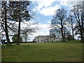
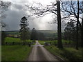
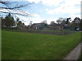
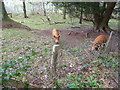
Nearby Images from Geograph Britain and Ireland:
©2012(licence)

©2006(licence)
©2012(licence)
©2012(licence)
©2012(licence)
The above images may not be of the site on this page, they are loaded from Geograph.
Please Submit an Image of this site or go out and take one for us!
Click here to see more info for this site
Nearby sites
Key: Red: member's photo, Blue: 3rd party photo, Yellow: other image, Green: no photo - please go there and take one, Grey: site destroyed
Download sites to:
KML (Google Earth)
GPX (GPS waypoints)
CSV (Garmin/Navman)
CSV (Excel)
To unlock full downloads you need to sign up as a Contributory Member. Otherwise downloads are limited to 50 sites.
Turn off the page maps and other distractions
Nearby sites listing. In the following links * = Image available
1.3km NNW 330° Peterchurch St Peter's Well* Holy Well or Sacred Spring (SO35333880)
2.9km ESE 109° Timberline Camp Hillfort (SO387367)
3.5km N 3° Blakemere Church Stone* Marker Stone (SO362411)
3.8km NNE 18° Holy Well (Blakemere)* Holy Well or Sacred Spring (SO37254128)
4.9km NW 325° Great Llanavon Farm* Long Barrow (SO3322441689)
4.9km SE 140° Dunseal* Round Barrow(s) (SO391338)
5.6km W 265° Wern Derys* Standing Stone (Menhir) (SO30363726)
5.7km NW 323° Dorstone Hill* Ancient Village or Settlement (SO32604230)
6.1km NNW 332° Pentre House Standing Stone* Standing Stone (Menhir) (SO33154307)
6.6km SSE 155° Minns Close Tump Wood* Causewayed Enclosure (SO38693162)
6.8km NW 323° Arthur's Stone* Chambered Tomb (SO3188843124)
6.9km NW 311° The Golden Well (Dorstone)* Holy Well or Sacred Spring (SO30804228)
7.3km NNW 339° Bredwardine Church* Carving (SO33484450)
7.5km NNW 331° Chapel field Hillfort (SO32404425)
7.9km NNW 333° The Knapp (Bredwardine)* Ancient Village or Settlement (SO32454467)
8.5km SW 221° Llanveyno Crosses* Ancient Cross (SO3031131361)
8.7km ENE 61° Holy Well (Swainshill)* Holy Well or Sacred Spring (SO43724177)
9.4km SW 232° St. Thomas' Well* Holy Well or Sacred Spring (SO28433201)
9.5km E 79° Eaton Camp* Promontory Fort / Cliff Castle (SO454393)
10.5km SW 221° Crucorney Fawr 1 Round Cairn (SO290298)
10.6km ENE 64° Holy Well (Garway)* Holy Well or Sacred Spring (SO45554224)
10.6km SW 218° Crucorney Fawr 2 Round Cairn (SO293294)
10.7km SSW 198° Clodock Inscribed Stone* Carving (SO32642751)
10.8km SSW 197° St. Clodock's Well* Holy Well or Sacred Spring (SO32692738)
10.8km SSW 214° Wiral Cairn* Cairn (SO2985028710)
View more nearby sites and additional images


 We would like to know more about this location. Please feel free to add a brief description and any relevant information in your own language.
 Wir möchten mehr über diese Stätte erfahren. Bitte zögern Sie nicht, eine kurze Beschreibung und relevante Informationen in Deutsch hinzuzufügen.
 Nous aimerions en savoir encore un peu sur les lieux. S'il vous plaît n'hesitez pas à ajouter une courte description et tous les renseignements pertinents dans votre propre langue.
 Quisieramos informarnos un poco más de las lugares. No dude en añadir una breve descripción y otros datos relevantes en su propio idioma.