<< Our Photo Pages >> St. Clodock's Well - Holy Well or Sacred Spring in England in Herefordshire
Submitted by HOLYWELL on Thursday, 03 April 2008 Page Views: 5521
Springs and Holy WellsSite Name: St. Clodock's WellCountry: England
NOTE: This site is 3.2 km away from the location you searched for.
County: Herefordshire Type: Holy Well or Sacred Spring
Nearest Village: Clodock
Map Ref: SO32692738
Latitude: 51.940833N Longitude: 2.980573W
Condition:
| 5 | Perfect |
| 4 | Almost Perfect |
| 3 | Reasonable but with some damage |
| 2 | Ruined but still recognisable as an ancient site |
| 1 | Pretty much destroyed, possibly visible as crop marks |
| 0 | No data. |
| -1 | Completely destroyed |
| 5 | Superb |
| 4 | Good |
| 3 | Ordinary |
| 2 | Not Good |
| 1 | Awful |
| 0 | No data. |
| 5 | Can be driven to, probably with disabled access |
| 4 | Short walk on a footpath |
| 3 | Requiring a bit more of a walk |
| 2 | A long walk |
| 1 | In the middle of nowhere, a nightmare to find |
| 0 | No data. |
| 5 | co-ordinates taken by GPS or official recorded co-ordinates |
| 4 | co-ordinates scaled from a detailed map |
| 3 | co-ordinates scaled from a bad map |
| 2 | co-ordinates of the nearest village |
| 1 | co-ordinates of the nearest town |
| 0 | no data |
Internal Links:
External Links:
I have visited· I would like to visit
AJHL visited on 16th Feb 2023 - their rating: Cond: 4 Amb: 4 Access: 4 Short walk and easy to find.
geoffstickland have visited here
")
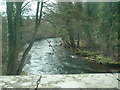
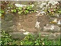
The spring arises in a stone lined pool covered by a large slab. It is named after a 5th century missionary prince who was killed by a rival in love. When his body neared the river his body became too heavy and he was buried near the river presumably near the spring which is found by the footpath the opposite side of the river from the church.
You may be viewing yesterday's version of this page. To see the most up to date information please register for a free account.
")
Do not use the above information on other web sites or publications without permission of the contributor.
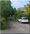
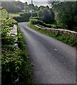
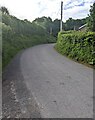
Nearby Images from Geograph Britain and Ireland:
©2019(licence)
©2022(licence)
©2022(licence)
©2022(licence)
©2022(licence)
The above images may not be of the site on this page, they are loaded from Geograph.
Please Submit an Image of this site or go out and take one for us!
Click here to see more info for this site
Nearby sites
Key: Red: member's photo, Blue: 3rd party photo, Yellow: other image, Green: no photo - please go there and take one, Grey: site destroyed
Download sites to:
KML (Google Earth)
GPX (GPS waypoints)
CSV (Garmin/Navman)
CSV (Excel)
To unlock full downloads you need to sign up as a Contributory Member. Otherwise downloads are limited to 50 sites.
Turn off the page maps and other distractions
Nearby sites listing. In the following links * = Image available
139m NNW 338° Clodock Inscribed Stone* Carving (SO32642751)
3.1km WNW 294° Wiral Cairn* Cairn (SO2985028710)
3.9km WNW 300° Crucorney Fawr 2 Round Cairn (SO293294)
4.4km WNW 303° Crucorney Fawr 1 Round Cairn (SO290298)
4.4km S 187° Pen-Twyn Hillfort (SO321230)
4.6km NNW 328° Llanveyno Crosses* Ancient Cross (SO3031131361)
4.9km SW 214° St Martin's Church (Cwmyoy)* Ancient Cross (SO29902340)
5.0km WSW 247° Garn Wen (Monmouthshire)* Stone Circle (SO28072545)
5.2km WSW 242° Llanthony Barrow Cemetery (SO2825)
6.3km NW 317° St. Thomas' Well* Holy Well or Sacred Spring (SO28433201)
6.4km SSW 210° Twyn-y-Gaer (Monmouthshire) Hillfort (SO2938721948)
6.9km SW 223° Partrishow Churchyard Cross* Ancient Cross (SO2788822434)
6.9km SW 224° Ffynnon Ishow* Holy Well or Sacred Spring (SO2784322428)
7.3km NE 54° Minns Close Tump Wood* Causewayed Enclosure (SO38693162)
7.8km WSW 239° Disgwylfa, Cairn I* Cairn (SO2597023440)
8.1km WNW 297° Capel-y-ffin Standing Stone (Menhir) (SO2550031118)
8.1km WSW 256° Nant Yr Ychen Round Cairn* Cairn (SO2476025470)
8.3km ESE 111° Grosmont Churchyard Cross* Ancient Cross (SO40462432)
8.8km SSW 204° Blaenawey Well (Bettws)* Holy Well or Sacred Spring (SO290194)
8.9km SE 135° Grosmont Fawr Hillfort (SO389210)
9.1km NE 44° Dunseal* Round Barrow(s) (SO391338)
9.1km S 177° Ysgyryd Fawr* Hillfort (SO331183)
9.4km WNW 295° Darren Esgob* Stone Circle (SO242315)
10.0km S 187° Trillech Stone Row / Alignment (SO314175)
10.1km W 271° Maen Llwyd (Powys)* Standing Stone (Menhir) (SO22602762)
View more nearby sites and additional images


 We would like to know more about this location. Please feel free to add a brief description and any relevant information in your own language.
 Wir möchten mehr über diese Stätte erfahren. Bitte zögern Sie nicht, eine kurze Beschreibung und relevante Informationen in Deutsch hinzuzufügen.
 Nous aimerions en savoir encore un peu sur les lieux. S'il vous plaît n'hesitez pas à ajouter une courte description et tous les renseignements pertinents dans votre propre langue.
 Quisieramos informarnos un poco más de las lugares. No dude en añadir una breve descripción y otros datos relevantes en su propio idioma.