


<< Text Pages >> Round Knott - Cairn in England in Cumbria
Submitted by vicky on Saturday, 06 December 2003 Page Views: 6115
Neolithic and Bronze AgeSite Name: Round KnottCountry: England
NOTE: This site is 0.5 km away from the location you searched for.
County: Cumbria Type: Cairn
Nearest Town: Keswick Nearest Village: Mosedale
Map Ref: NY334337 Landranger Map Number: 90
Latitude: 54.693912N Longitude: 3.034793W
Condition:
| 5 | Perfect |
| 4 | Almost Perfect |
| 3 | Reasonable but with some damage |
| 2 | Ruined but still recognisable as an ancient site |
| 1 | Pretty much destroyed, possibly visible as crop marks |
| 0 | No data. |
| -1 | Completely destroyed |
| 5 | Superb |
| 4 | Good |
| 3 | Ordinary |
| 2 | Not Good |
| 1 | Awful |
| 0 | No data. |
| 5 | Can be driven to, probably with disabled access |
| 4 | Short walk on a footpath |
| 3 | Requiring a bit more of a walk |
| 2 | A long walk |
| 1 | In the middle of nowhere, a nightmare to find |
| 0 | No data. |
| 5 | co-ordinates taken by GPS or official recorded co-ordinates |
| 4 | co-ordinates scaled from a detailed map |
| 3 | co-ordinates scaled from a bad map |
| 2 | co-ordinates of the nearest village |
| 1 | co-ordinates of the nearest town |
| 0 | no data |
Internal Links:
External Links:
Cairn in Cumbria
Have you visited this site? Please add a comment below.
You may be viewing yesterday's version of this page. To see the most up to date information please register for a free account.
Do not use the above information on other web sites or publications without permission of the contributor.
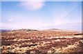
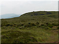
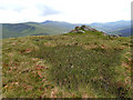
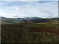
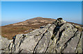
Nearby Images from Geograph Britain and Ireland:
©2005(licence)
©2006(licence)
©2016(licence)
©2016(licence)
©2011(licence)
The above images may not be of the site on this page, they are loaded from Geograph.
Please Submit an Image of this site or go out and take one for us!
Click here to see more info for this site
Nearby sites
Key: Red: member's photo, Blue: 3rd party photo, Yellow: other image, Green: no photo - please go there and take one, Grey: site destroyed
Download sites to:
KML (Google Earth)
GPX (GPS waypoints)
CSV (Garmin/Navman)
CSV (Excel)
To unlock full downloads you need to sign up as a Contributory Member. Otherwise downloads are limited to 50 sites.
Turn off the page maps and other distractions
Nearby sites listing. In the following links * = Image available
804m E 96° Carrock Fell* Hillfort (NY342336)
1.9km E 89° Mungrisedale* Cairn (NY353337)
6.3km N 351° St Mungo's Well (Cumbria)* Holy Well or Sacred Spring (NY3251339910)
7.2km NW 323° Faulds Brow Standing stones alignment* Stone Row / Alignment (NY2919339540)
7.9km NNW 326° Faulds Brow Banjo Enclosure* Misc. Earthwork (NY2912340331)
7.9km NNW 330° Faulds Brow Holed stone and Enclosure* Holed Stone (NY2950340623)
8.0km NNW 329° Faulds Brow Banked Cairn Cairn (NY2937140629)
8.1km NW 304° Aughertree Fell outlier standing stones* Stone Row / Alignment (NY2675338384)
8.1km WNW 302° Aughertree Fell stone circle* Stone Circle (NY2658138140)
8.1km WNW 299° Aughertree fell standing stones* Standing Stones (NY2627837699)
8.5km ESE 106° Berrier Hill Earthworks Misc. Earthwork (NY416313)
8.5km WNW 296° Green How Enclosure* Causewayed Enclosure (NY25753751)
9.0km WNW 303° Daleside Tumulus* Round Barrow(s) (NY259387)
9.6km S 182° Threlkeld Knott* Ancient Village or Settlement (NY330241)
10.1km ESE 122° Motherby Stone Circle (NY419282)
10.1km ESE 122° Penruddock Stone Circle (NY419282)
10.4km SE 142° Great Mell Fell Tumulus* Round Cairn (NY3967825366)
10.5km WNW 287° High Ireby Standing Stone* Standing Stone (Menhir) (NY234369)
10.9km SSW 202° Castlerigg* Stone Circle (NY29132363)
11.0km ESE 104° Greystoke Village Cross* Ancient Cross (NY4401230870)
11.0km ESE 119° Motherby (Cumbria)* Holy Well or Sacred Spring (NY4293428212)
11.0km SSW 202° Castlerigg W* Stone Circle (NY29062360)
11.1km ESE 106° Eye Keld Well* Holy Well or Sacred Spring (NY441305)
11.3km ESE 104° Sanctuary Stone (Greystoke)* Early Christian Sculptured Stone (NY4433530785)
11.6km SSW 193° Holy Well of St John the Baptist* Holy Well or Sacred Spring (NY30622245)
View more nearby sites and additional images


 We would like to know more about this location. Please feel free to add a brief description and any relevant information in your own language.
 Wir möchten mehr über diese Stätte erfahren. Bitte zögern Sie nicht, eine kurze Beschreibung und relevante Informationen in Deutsch hinzuzufügen.
 Nous aimerions en savoir encore un peu sur les lieux. S'il vous plaît n'hesitez pas à ajouter une courte description et tous les renseignements pertinents dans votre propre langue.
 Quisieramos informarnos un poco más de las lugares. No dude en añadir una breve descripción y otros datos relevantes en su propio idioma.