


<< Text Pages >> Woodspring Priory Field System - Misc. Earthwork in England in Somerset
Submitted by coldrum on Friday, 13 July 2007 Page Views: 6137
Multi-periodSite Name: Woodspring Priory Field SystemCountry: England
NOTE: This site is 2.0 km away from the location you searched for.
County: Somerset Type: Misc. Earthwork
Nearest Village: Woodspring Priory
Map Ref: ST345668
Latitude: 51.396437N Longitude: 2.942869W
Condition:
| 5 | Perfect |
| 4 | Almost Perfect |
| 3 | Reasonable but with some damage |
| 2 | Ruined but still recognisable as an ancient site |
| 1 | Pretty much destroyed, possibly visible as crop marks |
| 0 | No data. |
| -1 | Completely destroyed |
| 5 | Superb |
| 4 | Good |
| 3 | Ordinary |
| 2 | Not Good |
| 1 | Awful |
| 0 | No data. |
| 5 | Can be driven to, probably with disabled access |
| 4 | Short walk on a footpath |
| 3 | Requiring a bit more of a walk |
| 2 | A long walk |
| 1 | In the middle of nowhere, a nightmare to find |
| 0 | No data. |
| 5 | co-ordinates taken by GPS or official recorded co-ordinates |
| 4 | co-ordinates scaled from a detailed map |
| 3 | co-ordinates scaled from a bad map |
| 2 | co-ordinates of the nearest village |
| 1 | co-ordinates of the nearest town |
| 0 | no data |
Be the first person to rate this site - see the 'Contribute!' box in the right hand menu.
Internal Links:
External Links:
Misc. Earthwork in Somerset
Field systems.
You may be viewing yesterday's version of this page. To see the most up to date information please register for a free account.
Do not use the above information on other web sites or publications without permission of the contributor.
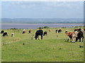
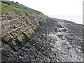
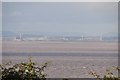
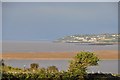
Nearby Images from Geograph Britain and Ireland:
©2009(licence)
©2015(licence)
©2009(licence)
©2012(licence)
©2012(licence)
The above images may not be of the site on this page, they are loaded from Geograph.
Please Submit an Image of this site or go out and take one for us!
Click here to see more info for this site
Nearby sites
Key: Red: member's photo, Blue: 3rd party photo, Yellow: other image, Green: no photo - please go there and take one, Grey: site destroyed
Download sites to:
KML (Google Earth)
GPX (GPS waypoints)
CSV (Garmin/Navman)
CSV (Excel)
To unlock full downloads you need to sign up as a Contributory Member. Otherwise downloads are limited to 50 sites.
Turn off the page maps and other distractions
Nearby sites listing. In the following links * = Image available
155m ESE 104° Middle Hope Round Barrow(s) (ST34656676)
2.5km ESE 123° Wick St Lawrence Village Cross* Ancient Cross (ST3660565388)
5.2km SW 214° Worlebury Camp* Hillfort (ST315625)
5.6km E 89° Kingston Seymour Churchyard Cross* Ancient Cross (ST4010166846)
5.7km E 88° Kingston Seymour Village Cross* Ancient Cross (ST4022366941)
5.7km SSW 203° Weston-super-Mare Museum* Museum (ST3217061568)
5.8km SSW 203° North Somerset Museum Museum (ST322615)
6.0km NE 49° Wain's Hill* Promontory Fort / Cliff Castle (ST39087066)
6.3km NE 50° St Andrews Churchyard Cross* Ancient Cross (ST3936470808)
6.3km NE 50° Clevedon Sheila Na Gig* Carving (ST3938370827)
7.0km SE 142° Rolstone* Standing Stone (Menhir) (ST38736120)
7.1km SE 133° Banwell Moor Stone 4 Marker Stone (ST39576188)
7.2km SE 141° Banwell Moor Stone 1 Marker Stone (ST39036113)
7.4km ENE 72° Kenn Churchyard Cross* Ancient Cross (ST4159968963)
8.4km SE 135° Banwell Moor Stone 2 Marker Stone (ST40406086)
8.7km NE 47° Walton St Mary Cross Ancient Cross (ST4096172635)
8.7km E 99° Yatton Churchyard Cross* Ancient Cross (ST4312665395)
9.3km SSW 197° Walborough Barrows Round Barrow(s) (ST31615791)
9.4km NE 48° Walton Hill Fort Hillfort (ST41597292)
9.4km SE 145° Butstone (Banwell) Marker Stone (ST398590)
9.6km ESE 108° Congresbury Church Cross* Ancient Cross (ST4359863744)
9.7km ESE 107° Congresbury Village Cross* Ancient Cross (ST4373263818)
9.8km SSE 159° Flagstaff Hill* Stone Circle (ST3785257630)
9.8km SW 217° Brean Down* Hillfort (ST28535898)
9.9km E 100° Cadbury Hill* Hillfort (ST442649)
View more nearby sites and additional images


 We would like to know more about this location. Please feel free to add a brief description and any relevant information in your own language.
 Wir möchten mehr über diese Stätte erfahren. Bitte zögern Sie nicht, eine kurze Beschreibung und relevante Informationen in Deutsch hinzuzufügen.
 Nous aimerions en savoir encore un peu sur les lieux. S'il vous plaît n'hesitez pas à ajouter une courte description et tous les renseignements pertinents dans votre propre langue.
 Quisieramos informarnos un poco más de las lugares. No dude en añadir una breve descripción y otros datos relevantes en su propio idioma.