<< Text Pages >> Stapleton Henge - Henge in England in Herefordshire
Submitted by Andy B on Monday, 27 February 2006 Page Views: 6872
Neolithic and Bronze AgeSite Name: Stapleton HengeCountry: England County: Herefordshire Type: Henge
Nearest Village: Stapleton
Map Ref: SO32356510
Latitude: 52.279863N Longitude: 2.993025W
Condition:
| 5 | Perfect |
| 4 | Almost Perfect |
| 3 | Reasonable but with some damage |
| 2 | Ruined but still recognisable as an ancient site |
| 1 | Pretty much destroyed, possibly visible as crop marks |
| 0 | No data. |
| -1 | Completely destroyed |
| 5 | Superb |
| 4 | Good |
| 3 | Ordinary |
| 2 | Not Good |
| 1 | Awful |
| 0 | No data. |
| 5 | Can be driven to, probably with disabled access |
| 4 | Short walk on a footpath |
| 3 | Requiring a bit more of a walk |
| 2 | A long walk |
| 1 | In the middle of nowhere, a nightmare to find |
| 0 | No data. |
| 5 | co-ordinates taken by GPS or official recorded co-ordinates |
| 4 | co-ordinates scaled from a detailed map |
| 3 | co-ordinates scaled from a bad map |
| 2 | co-ordinates of the nearest village |
| 1 | co-ordinates of the nearest town |
| 0 | no data |
Be the first person to rate this site - see the 'Contribute!' box in the right hand menu.
Internal Links:
External Links:
Henge in Herefordshire. A Neolithic henge at Stapleton, near Prest-eigne, is the first find of its kind in the county. Experts from Herefordshire Archaeology, the county archaeological service, spotted the outline of a henge in aerial photographs taken for a land survey. A dig last month revealed what was there.
County archaeologist Dr Keith Ray said deposits found during the dig dated the henge at around 2,500 BC - the Neolithic period.
But there was further evidence of it being used around 1,000 BC or the Bronze Age.
Henges were sacred sites for ceremonies and rituals, especially those associated with death. Built as chambers and protected by ditches, they were dug into sites of geographic or seasonal significance. "In a way they were like village halls, focal points for a community," said Dr Ray.
The Stapleton henge was the first of its kind found in the county, he said. His team is looking for others.
Source: This is Herefordshire
The location given is approximate, but I think it may just be visible on the Multimap aerial photo, have a look.
From Herefordshire SMR: record 21791
Site name Flints, Field 449, Stapleton
Description 20 acre field with many flints and much pottery, mainly in north part of field. Many burnt flints suggest a Neolithic settlement site rather than the cropmarked area in the neighbouring field 465.
You may be viewing yesterday's version of this page. To see the most up to date information please register for a free account.
Do not use the above information on other web sites or publications without permission of the contributor.
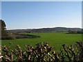
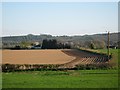
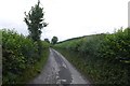
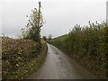
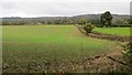
Nearby Images from Geograph Britain and Ireland:
©2007(licence)
©2007(licence)
©2015(licence)
©2015(licence)
©2015(licence)
The above images may not be of the site on this page, they are loaded from Geograph.
Please Submit an Image of this site or go out and take one for us!
Click here to see more info for this site
Nearby sites
Key: Red: member's photo, Blue: 3rd party photo, Yellow: other image, Green: no photo - please go there and take one, Grey: site destroyed
Download sites to:
KML (Google Earth)
GPX (GPS waypoints)
CSV (Garmin/Navman)
CSV (Excel)
To unlock full downloads you need to sign up as a Contributory Member. Otherwise downloads are limited to 50 sites.
Turn off the page maps and other distractions
Nearby sites listing. In the following links * = Image available
967m SW 233° St Andrew's Church (Presteigne)* Ancient Cross (SO3156864528)
1.7km SSE 151° Cat and Fiddle Enclosure Cropmark Ancient Village or Settlement (SO33146362)
3.4km SE 139° Wapley Camp* Hillfort (SO3457162465)
5.3km NNW 341° Spaceguard Centre* Modern Stone Circle etc (SO3066970104)
5.6km SW 222° Burfa Camp* Hillfort (SO285610)
5.7km SW 214° St Michael's Churchyard Cross (Knill)* Ancient Cross (SO2911860448)
5.9km WSW 254° Castle Ring (Powys)* Hillfort (SO26646360)
6.3km W 261° Beggar's Bush Barrow* Round Barrow(s) (SO26096417)
7.1km WSW 237° Knobley Stone* Standing Stone (Menhir) (SO26296132)
7.4km SW 235° Hindwell Causewayed Enclosure* Causewayed Enclosure (SO26246092)
7.4km WNW 294° St Mary (Pilleth)* Holy Well or Sacred Spring (SO25636824)
7.5km SW 227° Walton Cursus Cursus (SO26826001)
7.6km NNE 28° Brampton Bryan Lady Well* Holy Well or Sacred Spring (SO36007172)
7.7km WSW 238° Hindwell Ash* Round Barrow(s) (SO25706111)
7.8km SW 227° Walton Green Cursus (SO26525989)
7.8km SSW 213° Bradnor Hill 1 Stone Row / Alignment (SO27945860)
8.1km WSW 252° Kinnerton* Standing Stones (SO24566274)
8.1km SW 228° Walton Cursus Cursus (SO26195978)
8.1km NW 325° Jacket's Well, The Jackets, Jackets Well* Holy Well or Sacred Spring (SO2776271836)
8.2km WSW 237° Hindwell Enclosure* Timber Circle (SO2544560720)
8.2km WSW 241° Upper Ninepence barrow and Neolithic enclosure Round Barrow(s) (SO251613)
8.3km WSW 239° Hindwell Farm 2* Round Barrow(s) (SO25226091)
8.3km WSW 237° Hindwell Farm 1* Round Barrow(s) (SO25376064)
8.3km NNW 332° Offa's Dyke Centre* Museum (SO2850172430)
8.4km WSW 251° Crossfield Lane Barrow (Kinnerton)* Round Barrow(s) (SO24356243)
View more nearby sites and additional images


 We would like to know more about this location. Please feel free to add a brief description and any relevant information in your own language.
 Wir möchten mehr über diese Stätte erfahren. Bitte zögern Sie nicht, eine kurze Beschreibung und relevante Informationen in Deutsch hinzuzufügen.
 Nous aimerions en savoir encore un peu sur les lieux. S'il vous plaît n'hesitez pas à ajouter une courte description et tous les renseignements pertinents dans votre propre langue.
 Quisieramos informarnos un poco más de las lugares. No dude en añadir una breve descripción y otros datos relevantes en su propio idioma.