<< Our Photo Pages >> Wiral Cairn - Cairn in Wales in Monmouthshire
Submitted by dooclay on Tuesday, 03 October 2023 Page Views: 348
Neolithic and Bronze AgeSite Name: Wiral CairnCountry: Wales County: Monmouthshire Type: Cairn
Nearest Village: Llanthony
Map Ref: SO2985028710
Latitude: 51.952437N Longitude: 3.022152W
Condition:
| 5 | Perfect |
| 4 | Almost Perfect |
| 3 | Reasonable but with some damage |
| 2 | Ruined but still recognisable as an ancient site |
| 1 | Pretty much destroyed, possibly visible as crop marks |
| 0 | No data. |
| -1 | Completely destroyed |
| 5 | Superb |
| 4 | Good |
| 3 | Ordinary |
| 2 | Not Good |
| 1 | Awful |
| 0 | No data. |
| 5 | Can be driven to, probably with disabled access |
| 4 | Short walk on a footpath |
| 3 | Requiring a bit more of a walk |
| 2 | A long walk |
| 1 | In the middle of nowhere, a nightmare to find |
| 0 | No data. |
| 5 | co-ordinates taken by GPS or official recorded co-ordinates |
| 4 | co-ordinates scaled from a detailed map |
| 3 | co-ordinates scaled from a bad map |
| 2 | co-ordinates of the nearest village |
| 1 | co-ordinates of the nearest town |
| 0 | no data |
Internal Links:
External Links:
")
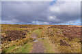
From Coflein: A centrally disturbed cairn, 14m by 12m and 1.4m high. Period: Unknown. After much searching, I belive this to be what I was looking at, using Google maps I 'walked' the Offas Dyke Path to confirm location so hopefully this is accurate.
You may be viewing yesterday's version of this page. To see the most up to date information please register for a free account.
Do not use the above information on other web sites or publications without permission of the contributor.
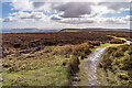
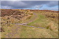
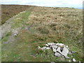
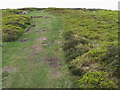
Nearby Images from Geograph Britain and Ireland:
©2022(licence)
©2022(licence)
©2014(licence)
©2010(licence)
©2022(licence)
The above images may not be of the site on this page, they are loaded from Geograph.
Please Submit an Image of this site or go out and take one for us!
Click here to see more info for this site
Nearby sites
Key: Red: member's photo, Blue: 3rd party photo, Yellow: other image, Green: no photo - please go there and take one, Grey: site destroyed
Download sites to:
KML (Google Earth)
GPX (GPS waypoints)
CSV (Garmin/Navman)
CSV (Excel)
To unlock full downloads you need to sign up as a Contributory Member. Otherwise downloads are limited to 50 sites.
Turn off the page maps and other distractions
Nearby sites listing. In the following links * = Image available
881m NW 321° Crucorney Fawr 2 Round Cairn (SO293294)
1.4km NW 321° Crucorney Fawr 1 Round Cairn (SO290298)
2.7km N 9° Llanveyno Crosses* Ancient Cross (SO3031131361)
3.0km ESE 113° Clodock Inscribed Stone* Carving (SO32642751)
3.1km ESE 114° St. Clodock's Well* Holy Well or Sacred Spring (SO32692738)
3.6km NNW 336° St. Thomas' Well* Holy Well or Sacred Spring (SO28433201)
3.7km SSW 208° Garn Wen (Monmouthshire)* Stone Circle (SO28072545)
4.1km SSW 206° Llanthony Barrow Cemetery (SO2825)
5.0km WNW 298° Capel-y-ffin Standing Stone (Menhir) (SO2550031118)
5.3km S 179° St Martin's Church (Cwmyoy)* Ancient Cross (SO29902340)
6.0km WSW 237° Nant Yr Ychen Round Cairn* Cairn (SO2476025470)
6.1km SSE 158° Pen-Twyn Hillfort (SO321230)
6.3km WNW 296° Darren Esgob* Stone Circle (SO242315)
6.5km SW 215° Disgwylfa, Cairn I* Cairn (SO2597023440)
6.6km SSW 197° Partrishow Churchyard Cross* Ancient Cross (SO2788822434)
6.6km SSW 197° Ffynnon Ishow* Holy Well or Sacred Spring (SO2784322428)
6.8km S 183° Twyn-y-Gaer (Monmouthshire) Hillfort (SO2938721948)
7.3km W 261° Maen Llwyd (Powys)* Standing Stone (Menhir) (SO22602762)
7.4km WNW 302° Blaenbwch* Standing Stone (Menhir) (SO23633271)
8.6km N 3° Wern Derys* Standing Stone (Menhir) (SO30363726)
9.3km ENE 71° Minns Close Tump Wood* Causewayed Enclosure (SO38693162)
9.3km S 184° Blaenawey Well (Bettws)* Holy Well or Sacred Spring (SO290194)
10.1km WSW 244° Pen Alltmawr Cairns* Cairn (SO2069024330)
10.2km W 272° Pen Trumau Ring Cairn (SO196292)
10.3km SW 231° Pen Cerrig-calch* Cairn (SO21702236)
View more nearby sites and additional images


 We would like to know more about this location. Please feel free to add a brief description and any relevant information in your own language.
 Wir möchten mehr über diese Stätte erfahren. Bitte zögern Sie nicht, eine kurze Beschreibung und relevante Informationen in Deutsch hinzuzufügen.
 Nous aimerions en savoir encore un peu sur les lieux. S'il vous plaît n'hesitez pas à ajouter une courte description et tous les renseignements pertinents dans votre propre langue.
 Quisieramos informarnos un poco más de las lugares. No dude en añadir una breve descripción y otros datos relevantes en su propio idioma.