<< Our Photo Pages >> New Pieces Enclosure - Ancient Village or Settlement in Wales in Powys
Submitted by w650marion on Thursday, 15 April 2021 Page Views: 342
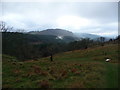
Multi-periodSite Name: New Pieces EnclosureCountry: Wales County: Powys Type: Ancient Village or Settlement
Nearest Town: Criggion
Map Ref: SJ2975014000
Latitude: 52.719072N Longitude: 3.041467W
Condition:
| 5 | Perfect |
| 4 | Almost Perfect |
| 3 | Reasonable but with some damage |
| 2 | Ruined but still recognisable as an ancient site |
| 1 | Pretty much destroyed, possibly visible as crop marks |
| 0 | No data. |
| -1 | Completely destroyed |
| 5 | Superb |
| 4 | Good |
| 3 | Ordinary |
| 2 | Not Good |
| 1 | Awful |
| 0 | No data. |
| 5 | Can be driven to, probably with disabled access |
| 4 | Short walk on a footpath |
| 3 | Requiring a bit more of a walk |
| 2 | A long walk |
| 1 | In the middle of nowhere, a nightmare to find |
| 0 | No data. |
| 5 | co-ordinates taken by GPS or official recorded co-ordinates |
| 4 | co-ordinates scaled from a detailed map |
| 3 | co-ordinates scaled from a bad map |
| 2 | co-ordinates of the nearest village |
| 1 | co-ordinates of the nearest town |
| 0 | no data |
Internal Links:
External Links:
")
The enclosure has been associated with the field system between it and the Breiddin Hillfort.
Coflein link
Photo of two fragments of glass dating from the sixth or seventh centuries.
https://www.peoplescollection.wales/items/8945
You may be viewing yesterday's version of this page. To see the most up to date information please register for a free account.
")
")
Do not use the above information on other web sites or publications without permission of the contributor.
Nearby Images from Geograph Britain and Ireland:
©2011(licence)
©2018(licence)
©2014(licence)
©2014(licence)
©2009(licence)
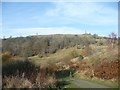
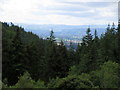
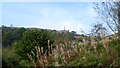
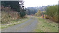
The above images may not be of the site on this page, they are loaded from Geograph.
Please Submit an Image of this site or go out and take one for us!
Click here to see more info for this site
Nearby sites
Key: Red: member's photo, Blue: 3rd party photo, Yellow: other image, Green: no photo - please go there and take one, Grey: site destroyed
Download sites to:
KML (Google Earth)
GPX (GPS waypoints)
CSV (Garmin/Navman)
CSV (Excel)
To unlock full downloads you need to sign up as a Contributory Member. Otherwise downloads are limited to 50 sites.
Turn off the page maps and other distractions
Nearby sites listing. In the following links * = Image available
403m N 6° White Well (Breidden Hill)* Holy Well or Sacred Spring (SJ298144)
679m NW 305° Breiddin Hillfort* Hillfort (SJ292144)
1.0km SE 124° Cefn y Castell* Hillfort (SJ306134)
2.0km SSW 211° Trinity Well (Trewern) Holy Well or Sacred Spring (SJ287123)
2.5km ENE 78° Bausley Hill Camp* Hillfort (SJ322145)
4.3km WNW 296° Trinity Well, Arddleen Holy Well or Sacred Spring (SJ25951594)
6.1km E 85° Alberbury Cross* Ancient Cross (SJ3585514425)
6.9km SSW 206° Trinity Well, Cletterwood Holy Well or Sacred Spring (SJ26650780)
7.3km SSE 147° Caus Castle* Hillfort (SJ337078)
7.5km W 262° Gaer Fawr (Guilsfield)* Hillfort (SJ223130)
7.9km W 262° Trinity Well, Guilsfield Holy Well or Sacred Spring (SJ21881297)
8.0km NNE 30° Kinnerley Cross* Ancient Cross (SJ3382520934)
8.3km WNW 287° Collfryn Ring Ditch Misc. Earthwork (SJ21861650)
8.3km S 177° Walton Camp* Hillfort (SJ301057)
8.6km NNW 337° Llanymynech Hill Hillfort (SJ265220)
8.8km SSW 201° Beacon Ring* Hillfort (SJ265058)
9.6km SW 225° Welshpool Eisteddfod Circle* Modern Stone Circle etc (SJ2286307263)
9.7km SW 228° Maen Llog* Standing Stone (Menhir) (SJ225076)
9.8km SW 226° Powysland Museum* Museum (SJ226073)
10.0km NNE 17° Woolstone Causewayed Enclosure (SJ32752355)
10.0km ENE 57° Nesscliffe* Hillfort (SJ383193)
10.2km NE 41° The Knockin Hoarstone* Natural Stone / Erratic / Other Natural Feature (SJ36542168)
10.7km NNE 12° St Winifred's Well* Holy Well or Sacred Spring (SJ3222624437)
11.7km SW 221° Sarn-y-bryn-caled II Cursus Cursus (SJ21970523)
11.9km SW 221° Sarn-y-bryn-caled II Cursus Cursus (SJ21830505)
View more nearby sites and additional images


 We would like to know more about this location. Please feel free to add a brief description and any relevant information in your own language.
 Wir möchten mehr über diese Stätte erfahren. Bitte zögern Sie nicht, eine kurze Beschreibung und relevante Informationen in Deutsch hinzuzufügen.
 Nous aimerions en savoir encore un peu sur les lieux. S'il vous plaît n'hesitez pas à ajouter une courte description et tous les renseignements pertinents dans votre propre langue.
 Quisieramos informarnos un poco más de las lugares. No dude en añadir una breve descripción y otros datos relevantes en su propio idioma.