


<< Other Photo Pages >> Park in the Past - Museum in Wales in Flintshire (Sir y Fflint)
Submitted by TheCaptain on Tuesday, 13 February 2024 Page Views: 2053
MuseumsSite Name: Park in the PastCountry: Wales
NOTE: This site is 2.5 km away from the location you searched for.
County: Flintshire (Sir y Fflint) Type: Museum
Nearest Town: Chester Nearest Village: Hope
Map Ref: SJ301588
Latitude: 53.121771N Longitude: 3.045948W
Condition:
| 5 | Perfect |
| 4 | Almost Perfect |
| 3 | Reasonable but with some damage |
| 2 | Ruined but still recognisable as an ancient site |
| 1 | Pretty much destroyed, possibly visible as crop marks |
| 0 | No data. |
| -1 | Completely destroyed |
| 5 | Superb |
| 4 | Good |
| 3 | Ordinary |
| 2 | Not Good |
| 1 | Awful |
| 0 | No data. |
| 5 | Can be driven to, probably with disabled access |
| 4 | Short walk on a footpath |
| 3 | Requiring a bit more of a walk |
| 2 | A long walk |
| 1 | In the middle of nowhere, a nightmare to find |
| 0 | No data. |
| 5 | co-ordinates taken by GPS or official recorded co-ordinates |
| 4 | co-ordinates scaled from a detailed map |
| 3 | co-ordinates scaled from a bad map |
| 2 | co-ordinates of the nearest village |
| 1 | co-ordinates of the nearest town |
| 0 | no data |
Internal Links:
External Links:
I have visited· I would like to visit
Chrissy visited on 1st Jan 2023 - their rating: Cond: 5 Amb: 5 Access: 4 A very interesting site, managed by a gentleman who has a passion for recreating history, along with the flora native to the area. There is genuinely something of interest for all ages
")
See parkinthepast.org.uk/
"Set in an ancient Welsh landscape, the park comprises 120 acres of outstanding natural beauty offering woodlands and wetlands, a magnificent 35-acre lake and the gorgeous River Alyn, as well as wonderful walks and spacious fields. We need your help to build an amazing prehistoric realm and a full-scale Roman fort and Celtic village. Explore and experience your heritage - the landscape of your ancestors."
You may be viewing yesterday's version of this page. To see the most up to date information please register for a free account.
Do not use the above information on other web sites or publications without permission of the contributor.
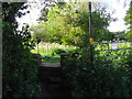
Nearby Images from Geograph Britain and Ireland:

©2025(licence)

©2025(licence)
©2017(licence)
©2023(licence)

©2025(licence)
The above images may not be of the site on this page, they are loaded from Geograph.
Please Submit an Image of this site or go out and take one for us!
Click here to see more info for this site
Nearby sites
Key: Red: member's photo, Blue: 3rd party photo, Yellow: other image, Green: no photo - please go there and take one, Grey: site destroyed
Download sites to:
KML (Google Earth)
GPX (GPS waypoints)
CSV (Garmin/Navman)
CSV (Excel)
To unlock full downloads you need to sign up as a Contributory Member. Otherwise downloads are limited to 50 sites.
Turn off the page maps and other distractions
Nearby sites listing. In the following links * = Image available
982m ESE 113° Hope Church Early Medieval Stones* Ancient Cross (SJ310584)
1.9km SE 136° Caer Estyn* Hillfort (SJ314574)
2.4km SSE 165° Siambr Gladdu Abermorddu* Cairn (SJ30695648)
3.0km S 178° Plas Maen Stone* Rock Art (SJ3015555755)
4.5km SSE 147° Wat's Dyke, River Alyn Misc. Earthwork (SJ3247154969)
5.2km W 264° Carreg-y-Llech* Standing Stone (Menhir) (SJ24875835)
5.5km S 174° Bryn Y Gaer Hillfort and St Paul's Church Hillfort (SJ30585334)
5.7km W 263° Bryntirion Round Barrows* Round Barrow(s) (SJ2445058160)
5.9km SSE 149° Bryn Alyn* Hillfort (SJ33125370)
5.9km SE 129° The Atropos Altar Stone* Sculptured Stone (SJ34645497)
5.9km W 260° Pen Y Stryt Barrow* Round Barrow(s) (SJ2423057830)
6.2km WSW 257° Pentre Round Barrow* Round Barrow(s) (SJ2401057440)
6.4km SSE 149° Wat's Dyke, Pandy Misc. Earthwork (SJ3329953217)
6.7km E 97° St Peter's Well (Denbighshire) Holy Well or Sacred Spring (SJ36735784)
7.2km SSE 152° Wat's Dyke, Ty Gwyn Lane Misc. Earthwork (SJ3342252436)
7.3km SSW 205° Minera Cup Stone* Rock Art (SJ26875225)
7.7km NW 311° Bryn-yr-Ellyllon* Round Barrow(s) (SJ2434063930)
8.0km SSE 147° Wrexham Gorsedd Circle Modern Stone Circle etc (SJ3436752064)
8.0km SSE 158° Wat's Dyke, Racecourse Ground Misc. Earthwork (SJ3307151328)
8.0km W 264° Nercwys Cairn* Cairn (SJ2207058064)
8.2km NW 308° Mold Library and Museum* Museum (SJ237639)
8.4km NW 309° Standing Stone St Mary's Church* Standing Stone (Menhir) (SJ2363864213)
8.6km SE 137° Borras Quarry Neolithic Village Ancient Village or Settlement (SJ35855243)
8.6km SSW 207° Esclusham Mountain Cairn* Cairn (SJ2611151172)
8.6km NW 310° Mold Gorsedd Circle Modern Stone Circle etc (SJ2352364421)
View more nearby sites and additional images


 We would like to know more about this location. Please feel free to add a brief description and any relevant information in your own language.
 Wir möchten mehr über diese Stätte erfahren. Bitte zögern Sie nicht, eine kurze Beschreibung und relevante Informationen in Deutsch hinzuzufügen.
 Nous aimerions en savoir encore un peu sur les lieux. S'il vous plaît n'hesitez pas à ajouter une courte description et tous les renseignements pertinents dans votre propre langue.
 Quisieramos informarnos un poco más de las lugares. No dude en añadir una breve descripción y otros datos relevantes en su propio idioma.