<< Our Photo Pages >> Balfarg Riding School mortuary enclosure and henge - Henge in Scotland in Fife
Submitted by SandyG on Sunday, 04 January 2015 Page Views: 3723
Neolithic and Bronze AgeSite Name: Balfarg Riding School mortuary enclosure and hengeCountry: Scotland
NOTE: This site is 4.137 km away from the location you searched for.
County: Fife Type: Henge
Nearest Town: Glenrothes
Map Ref: NO28480314
Latitude: 56.215438N Longitude: 3.154753W
Condition:
| 5 | Perfect |
| 4 | Almost Perfect |
| 3 | Reasonable but with some damage |
| 2 | Ruined but still recognisable as an ancient site |
| 1 | Pretty much destroyed, possibly visible as crop marks |
| 0 | No data. |
| -1 | Completely destroyed |
| 5 | Superb |
| 4 | Good |
| 3 | Ordinary |
| 2 | Not Good |
| 1 | Awful |
| 0 | No data. |
| 5 | Can be driven to, probably with disabled access |
| 4 | Short walk on a footpath |
| 3 | Requiring a bit more of a walk |
| 2 | A long walk |
| 1 | In the middle of nowhere, a nightmare to find |
| 0 | No data. |
| 5 | co-ordinates taken by GPS or official recorded co-ordinates |
| 4 | co-ordinates scaled from a detailed map |
| 3 | co-ordinates scaled from a bad map |
| 2 | co-ordinates of the nearest village |
| 1 | co-ordinates of the nearest town |
| 0 | no data |
Internal Links:
External Links:
I have visited· I would like to visit
SumDoood would like to visit
Anne T visited on 1st Nov 2018 - their rating: Cond: 3 Amb: 3 Access: 4 Balfarg Riding School Henge Reconstruction: This now recreated henge is just by the A92, at the end of Old Leslie Road, with part of it seeming to have been cut by the construction of the A92. Traffic streams by constantly.
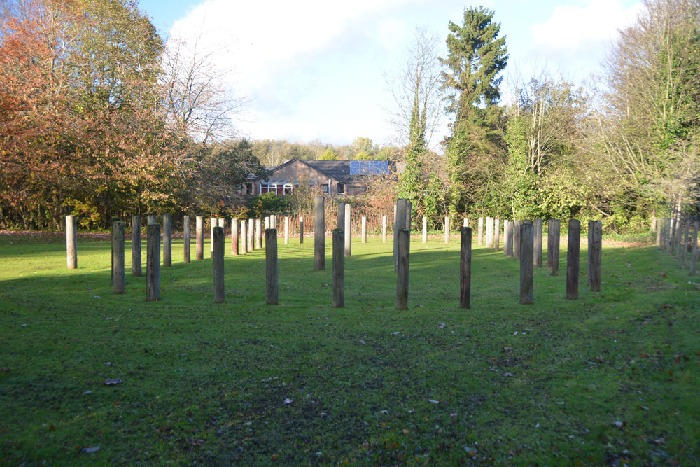
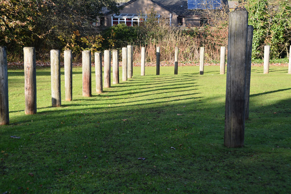
We arrived with the sun high in the sky and deep shadows, which tested my photography skills. I had expected a circular henge, but this was oval. I didn't pick up any atmosphere at this site at all. Sadly, it was just like walking through some old fence posts set up to cast some interesting shadows.
The information board reads: “You are standing in a revered landscape where ceremonies were performed by generations of prehistoric people. Here is an artist’s reconstruction of how the stone circle looked around 4,000 years ago. By this time it had already been in use for 1,000 years, when it became a place of burial. It stood close to the Coul Burn which then enclosed a wider sacred landscape. The picture shows the site of the Balfarg Henge and timber enclosure in the distance.”
SandyG visited on 19th Apr 2014 - their rating: Cond: -1 Amb: 1 Access: 5 A reconstruction and worth visiting despite the ambience.
Average ratings for this site from all visit loggers: Condition: 1 Ambience: 2 Access: 4.5
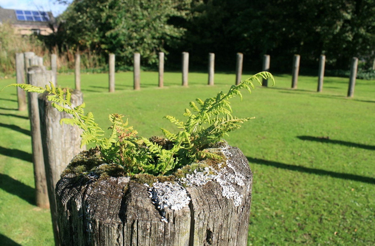
A reconstructed mortuary enclosure sits in the middle of a later henge. The site forms part of an extensive ritual complex which was excavated by Historic Scotland in the mid 1980’s. The reconstructed mortuary enclosure is one of two similar structures that were found in this area and they were probably built in the early/mid third millennium BC. At a later time a mound was erected over this mortuary enclosure and a ditch (probably a henge) cut around it. The reconstruction denotes the position of post holes found during the excavation and the earthwork of the western part of the henge is still visible.
Canmore ID 29959.
You may be viewing yesterday's version of this page. To see the most up to date information please register for a free account.


Do not use the above information on other web sites or publications without permission of the contributor.
Click here to see more info for this site
Nearby sites
Key: Red: member's photo, Blue: 3rd party photo, Yellow: other image, Green: no photo - please go there and take one, Grey: site destroyed
Download sites to:
KML (Google Earth)
GPX (GPS waypoints)
CSV (Garmin/Navman)
CSV (Excel)
To unlock full downloads you need to sign up as a Contributory Member. Otherwise downloads are limited to 50 sites.
Turn off the page maps and other distractions
Nearby sites listing. In the following links * = Image available
201m SSE 147° Balbirnie* Stone Circle (NO2858702969)
282m W 266° Balfarg Henge* Henge (NO2819803123)
5.1km NW 306° East Lomond Hill Hillfort (NO24400620)
5.3km NW 322° Westfield Farm Class I Pictish Symbol Stone (NO25260735)
5.7km WSW 252° Strathhendry* Stone Circle (NO23050145)
6.7km SSE 148° Earlseat* Standing Stone (Menhir) (NT3197797452)
7.6km NW 305° Kilgour Class I Pictish Symbol Stone (NO223076)
7.9km SW 217° Dogton* Class III Pictish Cross Slab (NT2360996863)
8.1km S 171° Bogleys* Standing Stone (Menhir) (NT296951)
8.5km SE 135° West Doo Cave* Cave or Rock Shelter (NT3433097007)
8.5km SE 136° Court Cave* Cave or Rock Shelter (NT34279694)
8.5km SE 133° Sloping Cave* Cave or Rock Shelter (NT34619727)
8.5km SE 134° Well Cave (East Wemyss)* Cave or Rock Shelter (NT345971)
8.5km SE 135° Jonathan’s Cave* Cave or Rock Shelter (NT344970)
9.0km E 91° Balgrummo* Standing Stone (Menhir) (NO375029)
9.1km NW 322° Auchtermuchty Cursus Cursus (NO22951043)
9.2km E 87° Aithernie (Scoonie) Cairn (NO37690339)
9.8km NW 315° Strathmiglo* Class I Pictish Symbol Stone (NO2166810219)
10.1km N 3° Newton of Collessie Class I Pictish Symbol Stone (NO292132)
10.1km W 261° Scotlandwell* Holy Well or Sacred Spring (NO1847801656)
10.1km N 4° Collessie* Standing Stone (Menhir) (NO293132)
10.3km NE 36° Walton Symbol Stone Class I Pictish Symbol Stone (NO34651135)
10.4km W 263° Kilmagadwood Early Bronze Age cemetery Barrow Cemetery (NO1805702119)
12.0km E 91° Lundin Links* Stone Circle (NO40480272)
12.0km SW 233° Hare Law (Fife)* Cairn (NT187961)
View more nearby sites and additional images


 We would like to know more about this location. Please feel free to add a brief description and any relevant information in your own language.
 Wir möchten mehr über diese Stätte erfahren. Bitte zögern Sie nicht, eine kurze Beschreibung und relevante Informationen in Deutsch hinzuzufügen.
 Nous aimerions en savoir encore un peu sur les lieux. S'il vous plaît n'hesitez pas à ajouter une courte description et tous les renseignements pertinents dans votre propre langue.
 Quisieramos informarnos un poco más de las lugares. No dude en añadir una breve descripción y otros datos relevantes en su propio idioma.