


<< Text Pages >> Arthurstone - Standing Stone (Menhir) in Scotland in Perth and Kinross
Submitted by BigSweetie on Friday, 26 March 2004 Page Views: 6630
Neolithic and Bronze AgeSite Name: Arthurstone Alternative Name: Arthurstone HouseCountry: Scotland County: Perth and Kinross Type: Standing Stone (Menhir)
Nearest Town: Coupar Angus Nearest Village: Meigle
Map Ref: NO261429 Landranger Map Number: 53
Latitude: 56.572204N Longitude: 3.204343W
Condition:
| 5 | Perfect |
| 4 | Almost Perfect |
| 3 | Reasonable but with some damage |
| 2 | Ruined but still recognisable as an ancient site |
| 1 | Pretty much destroyed, possibly visible as crop marks |
| 0 | No data. |
| -1 | Completely destroyed |
| 5 | Superb |
| 4 | Good |
| 3 | Ordinary |
| 2 | Not Good |
| 1 | Awful |
| 0 | No data. |
| 5 | Can be driven to, probably with disabled access |
| 4 | Short walk on a footpath |
| 3 | Requiring a bit more of a walk |
| 2 | A long walk |
| 1 | In the middle of nowhere, a nightmare to find |
| 0 | No data. |
| 5 | co-ordinates taken by GPS or official recorded co-ordinates |
| 4 | co-ordinates scaled from a detailed map |
| 3 | co-ordinates scaled from a bad map |
| 2 | co-ordinates of the nearest village |
| 1 | co-ordinates of the nearest town |
| 0 | no data |
Internal Links:
External Links:
Standing Stone in Perthshire
Standing stone was removed and broken up in 1792 for building purposes.
Have you visited this site? Please add a comment below.
You may be viewing yesterday's version of this page. To see the most up to date information please register for a free account.
Do not use the above information on other web sites or publications without permission of the contributor.
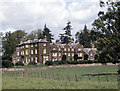
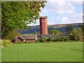
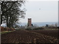
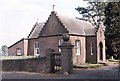
Nearby Images from Geograph Britain and Ireland:
©2007(licence)
©2006(licence)
©2018(licence)
©2007(licence)
©2007(licence)
The above images may not be of the site on this page, they are loaded from Geograph.
Please Submit an Image of this site or go out and take one for us!
Click here to see more info for this site
Nearby sites
Key: Red: member's photo, Blue: 3rd party photo, Yellow: other image, Green: no photo - please go there and take one, Grey: site destroyed
Download sites to:
KML (Google Earth)
GPX (GPS waypoints)
CSV (Garmin/Navman)
CSV (Excel)
To unlock full downloads you need to sign up as a Contributory Member. Otherwise downloads are limited to 50 sites.
Turn off the page maps and other distractions
Nearby sites listing. In the following links * = Image available
727m NW 306° Bankhead of Kinloch Barrow Cemetery (NO2551443333)
2.0km ENE 72° Macbeth's Stone* Standing Stone (Menhir) (NO27994346)
2.6km ENE 72° Seward's Stone Standing Stone (Menhir) (NO28584366)
3.0km SE 137° Kinpurnie Castle (Newtyle) Cairn (NO2807740693)
3.1km NE 56° Meigle Sculptured Stone Museum* Museum (NO28724459)
3.1km NE 56° Vanora's Mound* Round Barrow(s) (NO28734462)
3.4km SSE 158° Keillor* Class I Pictish Symbol Stone (NO2733139760)
4.0km S 173° Hill of Ballunie Stone Circle (NO265389)
4.5km SSW 210° Kettins Burn* Class II Pictish Symbol Stone (NO23783906)
6.0km N 354° Pitcrocknie* Standing Stone (Menhir) (NO2554648860)
6.1km N 11° Balloch Mill Cairn (NO27384885)
6.1km NNW 342° Alyth* Class II Pictish Symbol Stone (NO24324878)
6.6km WNW 295° Drumend* Holy Well or Sacred Spring (NO202458)
6.6km WNW 295° Drumend* Standing Stone (Menhir) (NO20184582)
6.6km WNW 286° Rattray Cursus Cursus (NO19744479)
6.8km W 276° The Welton Stone Circle (NO1937243766)
7.4km N 360° Barry Hillfort Hillfort (NO262503)
7.9km NW 306° Broad Moss (Glendams)* Stone Circle (NO19804762)
7.9km NW 307° Broad Moss Stones (Rattray) Standing Stones (NO19844771)
8.0km NNE 13° Drumderrach* Standing Stones (NO280507)
8.0km NNE 13° Shanzie Standing Stone (Menhir) (NO280507)
8.0km NNE 20° Bruceton* Class I Pictish Symbol Stone (NO290504)
8.1km NNE 29° Philpie Stones* Standing Stone (Menhir) (NO302499)
8.6km NW 308° Broadmoss (South West) Misc. Earthwork (NO194483)
8.8km NNW 345° Shealwalls Enclosure (Alyth) Ancient Village or Settlement (NO2392251484)
View more nearby sites and additional images


 We would like to know more about this location. Please feel free to add a brief description and any relevant information in your own language.
 Wir möchten mehr über diese Stätte erfahren. Bitte zögern Sie nicht, eine kurze Beschreibung und relevante Informationen in Deutsch hinzuzufügen.
 Nous aimerions en savoir encore un peu sur les lieux. S'il vous plaît n'hesitez pas à ajouter une courte description et tous les renseignements pertinents dans votre propre langue.
 Quisieramos informarnos un poco más de las lugares. No dude en añadir una breve descripción y otros datos relevantes en su propio idioma.