<< Our Photo Pages >> Bailiehill Fort - Hillfort in Scotland in Dumfries and Galloway
Submitted by markj99 on Wednesday, 05 May 2021 Page Views: 5462
Iron Age and Later PrehistorySite Name: Bailiehill FortCountry: Scotland County: Dumfries and Galloway Type: Hillfort
Nearest Town: Langholm
Map Ref: NY2558090520
Latitude: 55.203307N Longitude: 3.17084W
Condition:
| 5 | Perfect |
| 4 | Almost Perfect |
| 3 | Reasonable but with some damage |
| 2 | Ruined but still recognisable as an ancient site |
| 1 | Pretty much destroyed, possibly visible as crop marks |
| 0 | No data. |
| -1 | Completely destroyed |
| 5 | Superb |
| 4 | Good |
| 3 | Ordinary |
| 2 | Not Good |
| 1 | Awful |
| 0 | No data. |
| 5 | Can be driven to, probably with disabled access |
| 4 | Short walk on a footpath |
| 3 | Requiring a bit more of a walk |
| 2 | A long walk |
| 1 | In the middle of nowhere, a nightmare to find |
| 0 | No data. |
| 5 | co-ordinates taken by GPS or official recorded co-ordinates |
| 4 | co-ordinates scaled from a detailed map |
| 3 | co-ordinates scaled from a bad map |
| 2 | co-ordinates of the nearest village |
| 1 | co-ordinates of the nearest town |
| 0 | no data |
Internal Links:
External Links:
I have visited· I would like to visit
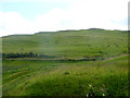
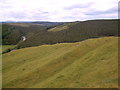
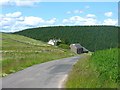
markj99 visited on 19th May 2012 - their rating: Cond: 2 Amb: 4 Access: 3 Baliehill Fort is located between Lockerbie and Langholm in a rural setting. It is situated atop a steep climb up Camp Hill from a lay-by at NY 25315 90657. The remnants of the forts defenses are visible on the slope of the hill but the enclosures are relatively featureless.
")
For more information about this multi-phase defended settlement see Canmore ID 67373
The second phase is represented by little more than a length of the ditch of a small summit enclosure that has otherwise been destroyed or masked by subsequent activity. The ditch lies to the W of the summit, some way down the steep rocky slope, and its outer lip appears to cut into the inner face of earlier rampart.
In the third phase, an oval enclosure, measuring about 78m from NNE to SSW by 43m internally was constructed, with an entrance on the ESE. For most of its length, this rampart follows the line taken by the first-phase enclosure and has probably reused an existing entrance gap, but on the W it climbs up onto the line of the crest of the summit, and overlies the second phase rampart. The successive defensive circuits on the summit fall within a larger enclosure, measuring about 143m from NNE to SSW by 114m within double banks and a medial ditch. Most of the E half of this enclosure has been destroyed by cultivation but the W half is well-preserved. Its place in the defensive sequence is unclear, but at two places on the W side, the inner bank departs from the line of the ditch and outer bank to butt on to, and thus overlie, the phase one rampart. Without excavation, however, it is impossible to determine whether this large enclosure represents an independent phase of defence or an element of one of the other fortifications.
Within the latest settlement, the stances of at least thirty-five timber round-houses can be identified; several are of ring-groove type and many have been built on platforms, but none can be assigned to any particular phase of enclosure. Several have been built across the line of the phase two defences and others have been cut into the inner face of the phase three bank. Later occupation or use of the hill is indicated by the presence of a sub-rectangular building platform, which has been built upon a round-house stance, and a small pen, the footings of which are visible towards the S side of the interior of the largest enclosure."
Page originally by Coldrum
You may be viewing yesterday's version of this page. To see the most up to date information please register for a free account.
")
")
Do not use the above information on other web sites or publications without permission of the contributor.
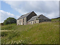
Nearby Images from Geograph Britain and Ireland:
©2015(licence)
©2005(licence)
©2015(licence)
©2008(licence)
©2015(licence)
The above images may not be of the site on this page, they are loaded from Geograph.
Please Submit an Image of this site or go out and take one for us!
Click here to see more info for this site
Nearby sites
Key: Red: member's photo, Blue: 3rd party photo, Yellow: other image, Green: no photo - please go there and take one, Grey: site destroyed
Download sites to:
KML (Google Earth)
GPX (GPS waypoints)
CSV (Garmin/Navman)
CSV (Excel)
To unlock full downloads you need to sign up as a Contributory Member. Otherwise downloads are limited to 50 sites.
Turn off the page maps and other distractions
Nearby sites listing. In the following links * = Image available
1.9km NNW 335° The Knowe* Ancient Village or Settlement (NY24799226)
2.0km ENE 60° White Birren* Hillfort (NY27329148)
2.2km NE 37° Green Hill (Lyneholm)* Misc. Earthwork (NY26939223)
2.4km NNE 21° Bank Head Hill Ancient Village or Settlement (NY2648992760)
2.7km N 6° King Shaw's Grave* Cairn (NY25939320)
2.7km NNW 328° Castle O'er Fort* Hillfort (NY2419092850)
3.1km NNW 340° Over Rig* Misc. Earthwork (NY2455693475)
3.7km ENE 78° Bogle Walls* Hillfort (NY29249124)
3.8km WSW 237° Kirkslight Rig Stone Circle (NY223885)
4.0km SW 231° Whitcastles* Stone Circle (NY22408806)
4.8km E 95° Boonies Ancient Village or Settlement (NY304900)
5.0km N 351° Bessie's Hill Settlement Ancient Village or Settlement (NY249955)
5.1km N 351° Bessie's Hill Fort* Hillfort (NY2490095540)
5.3km ESE 113° Shaw Hill (Westerkirk) Hillfort (NY30458834)
5.4km E 95° Westerkirk Stone Circle (NY3190)
5.6km N 357° Girdle Stanes* Stone Circle (NY2535196153)
6.1km N 0° Loupin' Stanes SE* Stone Row / Alignment (NY25729660)
6.1km N 0° Loupin' Stanes NW* Stone Circle (NY25709663)
7.0km SSW 194° Newhall Hill (Paddockhole)* Ancient Village or Settlement (NY23808372)
8.6km ESE 105° Little Hill (Craig)* Hillfort (NY3383088160)
8.7km SSW 205° Whiteholme Rig* Stone Circle (NY21718269)
9.6km N 353° Naga Stupa(cairn)* Modern Stone Circle etc (NT246001)
10.0km ESE 105° Barntalloch (Langholm)* Misc. Earthwork (NY35258776)
12.6km SE 143° Bloch Well (Langholm)* Holy Well or Sacred Spring (NY33018034)
12.8km WNW 294° Kirkhill* Stone Circle (NY1397895929)
View more nearby sites and additional images


 We would like to know more about this location. Please feel free to add a brief description and any relevant information in your own language.
 Wir möchten mehr über diese Stätte erfahren. Bitte zögern Sie nicht, eine kurze Beschreibung und relevante Informationen in Deutsch hinzuzufügen.
 Nous aimerions en savoir encore un peu sur les lieux. S'il vous plaît n'hesitez pas à ajouter une courte description et tous les renseignements pertinents dans votre propre langue.
 Quisieramos informarnos un poco más de las lugares. No dude en añadir una breve descripción y otros datos relevantes en su propio idioma.