<< Our Photo Pages >> Disgwylfa, Cairn I - Cairn in Wales in Powys
Submitted by dooclay on Tuesday, 27 June 2023 Page Views: 443
Neolithic and Bronze AgeSite Name: Disgwylfa, Cairn ICountry: Wales County: Powys Type: Cairn
Nearest Village: Partrishow
Map Ref: SO2597023440
Latitude: 51.904560N Longitude: 3.077463W
Condition:
| 5 | Perfect |
| 4 | Almost Perfect |
| 3 | Reasonable but with some damage |
| 2 | Ruined but still recognisable as an ancient site |
| 1 | Pretty much destroyed, possibly visible as crop marks |
| 0 | No data. |
| -1 | Completely destroyed |
| 5 | Superb |
| 4 | Good |
| 3 | Ordinary |
| 2 | Not Good |
| 1 | Awful |
| 0 | No data. |
| 5 | Can be driven to, probably with disabled access |
| 4 | Short walk on a footpath |
| 3 | Requiring a bit more of a walk |
| 2 | A long walk |
| 1 | In the middle of nowhere, a nightmare to find |
| 0 | No data. |
| 5 | co-ordinates taken by GPS or official recorded co-ordinates |
| 4 | co-ordinates scaled from a detailed map |
| 3 | co-ordinates scaled from a bad map |
| 2 | co-ordinates of the nearest village |
| 1 | co-ordinates of the nearest town |
| 0 | no data |
Internal Links:
External Links:
")
Source: Coflein
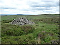
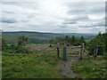
The cairn is located on the east facing slope, just beneath the top of Disgwylfa.
It seems that the cairn has been constructed in recent times out of an older monument, probably a barrow.
You may be viewing yesterday's version of this page. To see the most up to date information please register for a free account.
Do not use the above information on other web sites or publications without permission of the contributor.
Nearby Images from Geograph Britain and Ireland:
©2012(licence)
©2006(licence)
©2016(licence)
©2016(licence)
©2012(licence)
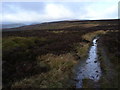
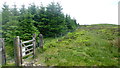
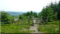
The above images may not be of the site on this page, they are loaded from Geograph.
Please Submit an Image of this site or go out and take one for us!
Click here to see more info for this site
Nearby sites
Key: Red: member's photo, Blue: 3rd party photo, Yellow: other image, Green: no photo - please go there and take one, Grey: site destroyed
Download sites to:
KML (Google Earth)
GPX (GPS waypoints)
CSV (Garmin/Navman)
CSV (Excel)
To unlock full downloads you need to sign up as a Contributory Member. Otherwise downloads are limited to 50 sites.
Turn off the page maps and other distractions
Nearby sites listing. In the following links * = Image available
2.1km ESE 118° Ffynnon Ishow* Holy Well or Sacred Spring (SO2784322428)
2.2km ESE 117° Partrishow Churchyard Cross* Ancient Cross (SO2788822434)
2.4km NNW 328° Nant Yr Ychen Round Cairn* Cairn (SO2476025470)
2.6km NE 52° Llanthony Barrow Cemetery (SO2825)
2.9km NE 45° Garn Wen (Monmouthshire)* Stone Circle (SO28072545)
3.7km ESE 113° Twyn-y-Gaer (Monmouthshire) Hillfort (SO2938721948)
3.9km E 90° St Martin's Church (Cwmyoy)* Ancient Cross (SO29902340)
4.3km SW 230° Crug Hywel* Hillfort (SO226207)
4.4km WSW 255° Pen Cerrig-calch* Cairn (SO21702236)
5.0km SE 142° Blaenawey Well (Bettws)* Holy Well or Sacred Spring (SO290194)
5.2km SSW 205° Coed Ynys Faen* Standing Stones (SO237188)
5.3km W 279° Pen Alltmawr Cairns* Cairn (SO2069024330)
5.4km NW 320° Maen Llwyd (Powys)* Standing Stone (Menhir) (SO22602762)
5.8km W 267° Pen Gloch Y Pibwr* Cairn (SO2020123205)
5.8km SSW 212° Llangenny Camp* Hillfort (SO228186)
5.8km WSW 246° Craig Llwyn* Ancient Village or Settlement (SO206212)
6.0km SSW 199° Golden Grove* Standing Stone (Menhir) (SO2396217829)
6.1km E 93° Pen-Twyn Hillfort (SO321230)
6.3km SW 216° Great Oak Stone* Standing Stone (Menhir) (SO22181846)
6.4km SW 228° Gwernvale* Chambered Tomb (SO2111119217)
6.5km NE 35° Wiral Cairn* Cairn (SO2985028710)
6.8km NNE 28° Crucorney Fawr 2 Round Cairn (SO293294)
7.0km NNE 25° Crucorney Fawr 1 Round Cairn (SO290298)
7.1km SSW 202° Cwrt-y-Gollen* Standing Stone (Menhir) (SO2324116860)
7.2km SW 227° Llan-Wysg Well* Holy Well or Sacred Spring (SO2060318584)
View more nearby sites and additional images


 We would like to know more about this location. Please feel free to add a brief description and any relevant information in your own language.
 Wir möchten mehr über diese Stätte erfahren. Bitte zögern Sie nicht, eine kurze Beschreibung und relevante Informationen in Deutsch hinzuzufügen.
 Nous aimerions en savoir encore un peu sur les lieux. S'il vous plaît n'hesitez pas à ajouter une courte description et tous les renseignements pertinents dans votre propre langue.
 Quisieramos informarnos un poco más de las lugares. No dude en añadir una breve descripción y otros datos relevantes en su propio idioma.