<< Our Photo Pages >> Four Stones (Powys) - Stone Circle in Wales in Powys
Submitted by TimPrevett on Sunday, 24 September 2023 Page Views: 39783
Neolithic and Bronze AgeSite Name: Four Stones (Powys)Country: Wales County: Powys Type: Stone Circle
Nearest Town: New Radnor Nearest Village: Presteigne
Map Ref: SO24576080 Landranger Map Number: 137
Latitude: 52.240198N Longitude: 3.106079W
Condition:
| 5 | Perfect |
| 4 | Almost Perfect |
| 3 | Reasonable but with some damage |
| 2 | Ruined but still recognisable as an ancient site |
| 1 | Pretty much destroyed, possibly visible as crop marks |
| 0 | No data. |
| -1 | Completely destroyed |
| 5 | Superb |
| 4 | Good |
| 3 | Ordinary |
| 2 | Not Good |
| 1 | Awful |
| 0 | No data. |
| 5 | Can be driven to, probably with disabled access |
| 4 | Short walk on a footpath |
| 3 | Requiring a bit more of a walk |
| 2 | A long walk |
| 1 | In the middle of nowhere, a nightmare to find |
| 0 | No data. |
| 5 | co-ordinates taken by GPS or official recorded co-ordinates |
| 4 | co-ordinates scaled from a detailed map |
| 3 | co-ordinates scaled from a bad map |
| 2 | co-ordinates of the nearest village |
| 1 | co-ordinates of the nearest town |
| 0 | no data |
Internal Links:
External Links:
I have visited· I would like to visit
kith elad13 chocorua would like to visit
bishop_pam visited on 26th Jun 2022 - their rating: Cond: 4 Amb: 4 Access: 4
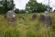
Anne T visited on 14th Aug 2021 - their rating: Cond: 3 Access: 4 Four Stones (Powys): Well worth the stop to see this four-poster. We parked at SO 24562 60871, opposite a small, but complicated road junction, where there was plenty of room for tractors and cars to pass, and walked back to the field.
My first reaction was: "Is this the right place?" on walking into the field, because the grass and weeds were so high, but walking towards the stones, the grass around them had been partly mowed, mostly trodden down by other visitors.
Starting at the southern-most stone, I photographed them all from different angles, in an anti-clockwise direction. Didn't spot any cup marks, but then the grass was still pretty tall around the base of each stone.
grandmasterglitch visited on 7th Apr 2021 - their rating: Cond: 4 Amb: 4 Access: 5
SumDoood visited on 30th Jul 2015 - their rating: Cond: 3 Amb: 4 Access: 4 Well worth a visit. Ambience varies depending on the crops being grown around the site.
NickyD visited on 1st Sep 2013 - their rating: Cond: 2 Amb: 3 Access: 5
SolarMegalith visited on 1st Jul 2008 - their rating: Cond: 4 Amb: 3 Access: 4
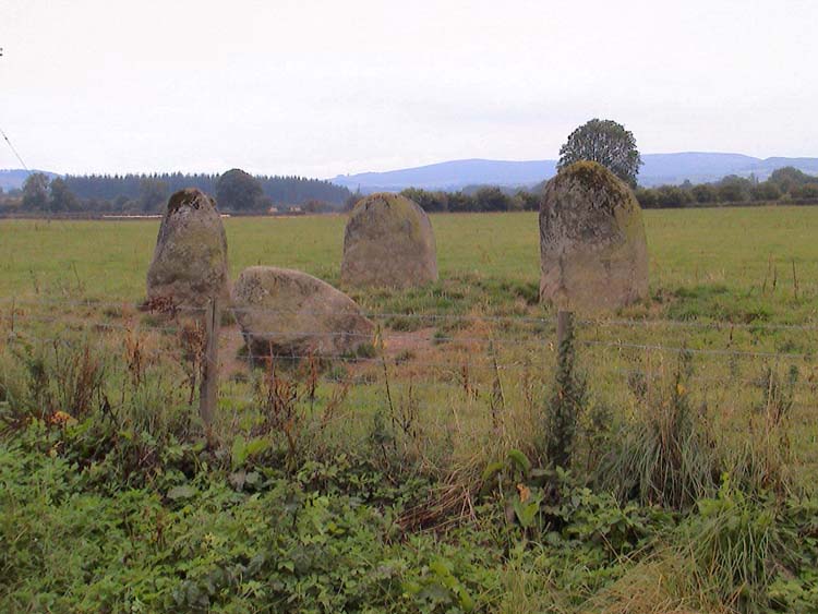
wildtalents visited on 1st Jun 2000 - their rating: Cond: 5 Amb: 4 Access: 5 Compact and intense, the four stones stand at the edge of a field, the tallest is just high enough to peep over the wall at the edge of the lane. Judging by photos of my then wife next to the stones three of the four are above five feet, the tallest nearer six. The fourth stone is somewhat stumpier but still a boulder of some stature. They appear to be arranged in more a square than a circle.
BolshieBoris visited on 1st Sep 1998 - their rating: Cond: 4 Amb: 4 Access: 4
BolshieBoris visited on 1st Sep 1997 - their rating: Cond: 4 Amb: 3 Access: 4
FrothNinja saw from a distance - their rating: Cond: 2
Bladup myf AngieLake TimPrevett TheWhiteRider jeniferj have visited here
Average ratings for this site from all visit loggers: Condition: 3.5 Ambience: 3.63 Access: 4.33

Note: The Neolithic Monuments of the Walton Basin, a talk with archaeologist Jack Rowe, Evenjobb Village Hall, Weds 27th September, details in the comments on our page
You may be viewing yesterday's version of this page. To see the most up to date information please register for a free account.


These are just the first 25 photos of Four Stones (Powys). If you log in with a free user account you will be able to see our entire collection.
Do not use the above information on other web sites or publications without permission of the contributor.
Click here to see more info for this site
Nearby sites
Key: Red: member's photo, Blue: 3rd party photo, Yellow: other image, Green: no photo - please go there and take one, Grey: site destroyed
Download sites to:
KML (Google Earth)
GPX (GPS waypoints)
CSV (Garmin/Navman)
CSV (Excel)
To unlock full downloads you need to sign up as a Contributory Member. Otherwise downloads are limited to 50 sites.
Turn off the page maps and other distractions
Nearby sites listing. In the following links * = Image available
112m N 9° Four Stones Barrow Cemetary* Barrow Cemetery (SO24596091)
291m SSW 195° Hindwell Cursus* Cursus (SO24496052)
354m E 99° Hindwell Cursus* Cursus (SO24926074)
363m ENE 68° The Hindwell Stone* Standing Stone (Menhir) (SO24916093)
657m E 79° Hindwell Farm 2* Round Barrow(s) (SO25226091)
727m NE 46° Upper Ninepence barrow and Neolithic enclosure Round Barrow(s) (SO251613)
814m E 100° Hindwell Farm 1* Round Barrow(s) (SO25376064)
825m S 178° Knapp Mount Barrow* Barrow Cemetery (SO2458659975)
876m E 94° Hindwell Enclosure* Timber Circle (SO2544560720)
891m SSW 202° Harpton Round Barrows* Round Barrow(s) (SO24225998)
1.1km SE 141° Walton Palisaded Enclosure* Timber Circle (SO25235996)
1.2km ENE 74° Hindwell Ash* Round Barrow(s) (SO25706111)
1.6km N 351° Crossfield Lane Barrow (Kinnerton)* Round Barrow(s) (SO24356243)
1.7km E 85° Hindwell Causewayed Enclosure* Causewayed Enclosure (SO26246092)
1.8km SSE 165° Old Radnor Church* Standing Stone (Menhir) (SO24995909)
1.8km ENE 72° Knobley Stone* Standing Stone (Menhir) (SO26296132)
1.9km ESE 121° Walton Cursus Cursus (SO26195978)
1.9km N 359° Kinnerton* Standing Stones (SO24566274)
2.1km ESE 114° Walton Green Cursus (SO26525989)
2.4km ESE 109° Walton Cursus Cursus (SO26826001)
3.5km NE 36° Castle Ring (Powys)* Hillfort (SO26646360)
3.7km NNE 23° Beggar's Bush Barrow* Round Barrow(s) (SO26096417)
3.9km E 86° Burfa Camp* Hillfort (SO285610)
4.0km ESE 122° Bradnor Hill 1 Stone Row / Alignment (SO27945860)
4.3km SSE 159° The Whet Stone (Hergest Ridge)* Natural Stone / Erratic / Other Natural Feature (SO26055680)
View more nearby sites and additional images


 We would like to know more about this location. Please feel free to add a brief description and any relevant information in your own language.
 Wir möchten mehr über diese Stätte erfahren. Bitte zögern Sie nicht, eine kurze Beschreibung und relevante Informationen in Deutsch hinzuzufügen.
 Nous aimerions en savoir encore un peu sur les lieux. S'il vous plaît n'hesitez pas à ajouter une courte description et tous les renseignements pertinents dans votre propre langue.
 Quisieramos informarnos un poco más de las lugares. No dude en añadir una breve descripción y otros datos relevantes en su propio idioma.