<< Our Photo Pages >> Hindwell Cursus - Cursus in Wales in Powys
Submitted by EssexMan on Wednesday, 07 April 2010 Page Views: 5128
Neolithic and Bronze AgeSite Name: Hindwell CursusCountry: Wales County: Powys Type: Cursus
Nearest Town: Llandrindod Wells Nearest Village: Hindwell
Map Ref: SO24496052 Landranger Map Number: 137
Latitude: 52.237670N Longitude: 3.107188W
Condition:
| 5 | Perfect |
| 4 | Almost Perfect |
| 3 | Reasonable but with some damage |
| 2 | Ruined but still recognisable as an ancient site |
| 1 | Pretty much destroyed, possibly visible as crop marks |
| 0 | No data. |
| -1 | Completely destroyed |
| 5 | Superb |
| 4 | Good |
| 3 | Ordinary |
| 2 | Not Good |
| 1 | Awful |
| 0 | No data. |
| 5 | Can be driven to, probably with disabled access |
| 4 | Short walk on a footpath |
| 3 | Requiring a bit more of a walk |
| 2 | A long walk |
| 1 | In the middle of nowhere, a nightmare to find |
| 0 | No data. |
| 5 | co-ordinates taken by GPS or official recorded co-ordinates |
| 4 | co-ordinates scaled from a detailed map |
| 3 | co-ordinates scaled from a bad map |
| 2 | co-ordinates of the nearest village |
| 1 | co-ordinates of the nearest town |
| 0 | no data |
Internal Links:
External Links:
")
Status: Possible
NMR No. PRN 33109
Extent: 474mx54m
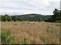
Note: This location marks one terminal (end) of a cursus monument. The location of the other terminal can be found in the Nearby Site list below.
You may be viewing yesterday's version of this page. To see the most up to date information please register for a free account.
")
")
")
")
Do not use the above information on other web sites or publications without permission of the contributor.
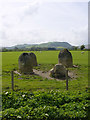
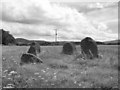
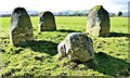
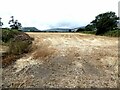
Nearby Images from Geograph Britain and Ireland:
©2007(licence)
©2007(licence)
©2015(licence)
©2021(licence)
©2007(licence)
The above images may not be of the site on this page, they are loaded from Geograph.
Please Submit an Image of this site or go out and take one for us!
Click here to see more info for this site
Nearby sites
Key: Red: member's photo, Blue: 3rd party photo, Yellow: other image, Green: no photo - please go there and take one, Grey: site destroyed
Download sites to:
KML (Google Earth)
GPX (GPS waypoints)
CSV (Garmin/Navman)
CSV (Excel)
To unlock full downloads you need to sign up as a Contributory Member. Otherwise downloads are limited to 50 sites.
Turn off the page maps and other distractions
Nearby sites listing. In the following links * = Image available
291m NNE 15° Four Stones (Powys)* Stone Circle (SO24576080)
402m NNE 13° Four Stones Barrow Cemetary* Barrow Cemetery (SO24596091)
482m ENE 62° Hindwell Cursus* Cursus (SO24926074)
553m S 169° Knapp Mount Barrow* Barrow Cemetery (SO2458659975)
586m NE 45° The Hindwell Stone* Standing Stone (Menhir) (SO24916093)
603m SSW 206° Harpton Round Barrows* Round Barrow(s) (SO24225998)
826m ENE 61° Hindwell Farm 2* Round Barrow(s) (SO25226091)
886m E 81° Hindwell Farm 1* Round Barrow(s) (SO25376064)
926m SE 126° Walton Palisaded Enclosure* Timber Circle (SO25235996)
973m ENE 77° Hindwell Enclosure* Timber Circle (SO2544560720)
989m NE 37° Upper Ninepence barrow and Neolithic enclosure Round Barrow(s) (SO251613)
1.3km ENE 63° Hindwell Ash* Round Barrow(s) (SO25706111)
1.5km SSE 160° Old Radnor Church* Standing Stone (Menhir) (SO24995909)
1.8km ENE 76° Hindwell Causewayed Enclosure* Causewayed Enclosure (SO26246092)
1.8km ESE 113° Walton Cursus Cursus (SO26195978)
1.9km N 355° Crossfield Lane Barrow (Kinnerton)* Round Barrow(s) (SO24356243)
2.0km ENE 65° Knobley Stone* Standing Stone (Menhir) (SO26296132)
2.1km ESE 106° Walton Green Cursus (SO26525989)
2.2km N 1° Kinnerton* Standing Stones (SO24566274)
2.4km ESE 101° Walton Cursus Cursus (SO26826001)
3.8km NE 34° Castle Ring (Powys)* Hillfort (SO26646360)
3.9km ESE 118° Bradnor Hill 1 Stone Row / Alignment (SO27945860)
4.0km NNE 23° Beggar's Bush Barrow* Round Barrow(s) (SO26096417)
4.0km E 82° Burfa Camp* Hillfort (SO285610)
4.0km SSE 156° The Whet Stone (Hergest Ridge)* Natural Stone / Erratic / Other Natural Feature (SO26055680)
View more nearby sites and additional images


 We would like to know more about this location. Please feel free to add a brief description and any relevant information in your own language.
 Wir möchten mehr über diese Stätte erfahren. Bitte zögern Sie nicht, eine kurze Beschreibung und relevante Informationen in Deutsch hinzuzufügen.
 Nous aimerions en savoir encore un peu sur les lieux. S'il vous plaît n'hesitez pas à ajouter une courte description et tous les renseignements pertinents dans votre propre langue.
 Quisieramos informarnos un poco más de las lugares. No dude en añadir una breve descripción y otros datos relevantes en su propio idioma.