


<< Image Pages >> Castle O'er Fort - Hillfort in Scotland in Dumfries and Galloway
Submitted by coldrum on Thursday, 21 June 2007 Page Views: 8960
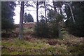
Iron Age and Later PrehistorySite Name: Castle O'er FortCountry: Scotland County: Dumfries and Galloway Type: Hillfort
Nearest Town: Langholm
Map Ref: NY2419092850
Latitude: 55.224028N Longitude: 3.193301W
Condition:
| 5 | Perfect |
| 4 | Almost Perfect |
| 3 | Reasonable but with some damage |
| 2 | Ruined but still recognisable as an ancient site |
| 1 | Pretty much destroyed, possibly visible as crop marks |
| 0 | No data. |
| -1 | Completely destroyed |
| 5 | Superb |
| 4 | Good |
| 3 | Ordinary |
| 2 | Not Good |
| 1 | Awful |
| 0 | No data. |
| 5 | Can be driven to, probably with disabled access |
| 4 | Short walk on a footpath |
| 3 | Requiring a bit more of a walk |
| 2 | A long walk |
| 1 | In the middle of nowhere, a nightmare to find |
| 0 | No data. |
| 5 | co-ordinates taken by GPS or official recorded co-ordinates |
| 4 | co-ordinates scaled from a detailed map |
| 3 | co-ordinates scaled from a bad map |
| 2 | co-ordinates of the nearest village |
| 1 | co-ordinates of the nearest town |
| 0 | no data |
Internal Links:
External Links:
")
More information on this hillfort in the Esk Valley is given in Canmore ID 67376 which describes this as a multi-period fort, "situated on a knoll in a clearing in a forestry plantation. In the earliest phase it was defended by twin ramparts and a medial ditch which enclosed an area measuring 120 by 60m. Subsequently the inner rampart was replaced by a wall, reducing the enclosed area to 95 by 53m. There were entrances on the E and SW in both phases. In the interior, and probably contemporary with the second phase defences, there are at least three ring-groove houses (one of which has double grooves) and several possible house-platforms. A crescentic bank of bedrock NE of the SW entrance through the wall may be a result of the quarrying that has disturbed the W part of the interior. On the S of the fort, and probably contemporary with the ramparts, there are two annexes, each formed by a bank accompanied by an internal ditch and slight inner bank."
In 1993 the site was re-surveyed and more detail was added about the site, including 'the stances of at least 29 houses ... can be identified within the interior of the fort."
You may be viewing yesterday's version of this page. To see the most up to date information please register for a free account.
")
")
")
")
Do not use the above information on other web sites or publications without permission of the contributor.
Nearby Images from Geograph Britain and Ireland:
©2005(licence)
©2019(licence)
©2019(licence)
©2019(licence)
©2019(licence)
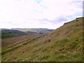
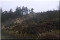
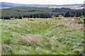
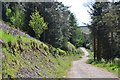
The above images may not be of the site on this page, they are loaded from Geograph.
Please Submit an Image of this site or go out and take one for us!
Click here to see more info for this site
Nearby sites
Key: Red: member's photo, Blue: 3rd party photo, Yellow: other image, Green: no photo - please go there and take one, Grey: site destroyed
Download sites to:
KML (Google Earth)
GPX (GPS waypoints)
CSV (Garmin/Navman)
CSV (Excel)
To unlock full downloads you need to sign up as a Contributory Member. Otherwise downloads are limited to 50 sites.
Turn off the page maps and other distractions
Nearby sites listing. In the following links * = Image available
723m NNE 29° Over Rig* Misc. Earthwork (NY2455693475)
840m SE 134° The Knowe* Ancient Village or Settlement (NY24799226)
1.8km ENE 78° King Shaw's Grave* Cairn (NY25939320)
2.3km E 91° Bank Head Hill Ancient Village or Settlement (NY2648992760)
2.7km SSE 148° Bailiehill Fort* Hillfort (NY2558090520)
2.7km NNE 14° Bessie's Hill Settlement Ancient Village or Settlement (NY249955)
2.8km NNE 14° Bessie's Hill Fort* Hillfort (NY2490095540)
2.8km ESE 102° Green Hill (Lyneholm)* Misc. Earthwork (NY26939223)
3.4km ESE 113° White Birren* Hillfort (NY27329148)
3.5km NNE 18° Girdle Stanes* Stone Circle (NY2535196153)
4.0km NNE 21° Loupin' Stanes SE* Stone Row / Alignment (NY25729660)
4.1km NNE 21° Loupin' Stanes NW* Stone Circle (NY25709663)
4.7km SSW 202° Kirkslight Rig Stone Circle (NY223885)
5.1km SSW 199° Whitcastles* Stone Circle (NY22408806)
5.3km ESE 107° Bogle Walls* Hillfort (NY29249124)
6.8km ESE 114° Boonies Ancient Village or Settlement (NY304900)
7.3km N 2° Naga Stupa(cairn)* Modern Stone Circle etc (NT246001)
7.4km ESE 112° Westerkirk Stone Circle (NY3190)
7.7km SE 125° Shaw Hill (Westerkirk) Hillfort (NY30458834)
9.1km S 181° Newhall Hill (Paddockhole)* Ancient Village or Settlement (NY23808372)
10.4km SSW 193° Whiteholme Rig* Stone Circle (NY21718269)
10.6km WNW 286° Kirkhill* Stone Circle (NY1397895929)
10.7km ESE 115° Little Hill (Craig)* Hillfort (NY3383088160)
11.7km WNW 287° St Cuthbert's Church (Wamphray)* Ancient Cross (NY1307096462)
11.9km WNW 287° Wamphray Place* Misc. Earthwork (NY12829648)
View more nearby sites and additional images


 We would like to know more about this location. Please feel free to add a brief description and any relevant information in your own language.
 Wir möchten mehr über diese Stätte erfahren. Bitte zögern Sie nicht, eine kurze Beschreibung und relevante Informationen in Deutsch hinzuzufügen.
 Nous aimerions en savoir encore un peu sur les lieux. S'il vous plaît n'hesitez pas à ajouter une courte description et tous les renseignements pertinents dans votre propre langue.
 Quisieramos informarnos un poco más de las lugares. No dude en añadir una breve descripción y otros datos relevantes en su propio idioma.