<< Our Photo Pages >> Llangenny Camp - Hillfort in Wales in Powys
Submitted by vicky on Wednesday, 03 March 2004 Page Views: 8148
Iron Age and Later PrehistorySite Name: Llangenny CampCountry: Wales County: Powys Type: Hillfort
Nearest Town: Abergavenny Nearest Village: Crickhowell
Map Ref: SO228186 Landranger Map Number: 161
Latitude: 51.860622N Longitude: 3.122447W
Condition:
| 5 | Perfect |
| 4 | Almost Perfect |
| 3 | Reasonable but with some damage |
| 2 | Ruined but still recognisable as an ancient site |
| 1 | Pretty much destroyed, possibly visible as crop marks |
| 0 | No data. |
| -1 | Completely destroyed |
| 5 | Superb |
| 4 | Good |
| 3 | Ordinary |
| 2 | Not Good |
| 1 | Awful |
| 0 | No data. |
| 5 | Can be driven to, probably with disabled access |
| 4 | Short walk on a footpath |
| 3 | Requiring a bit more of a walk |
| 2 | A long walk |
| 1 | In the middle of nowhere, a nightmare to find |
| 0 | No data. |
| 5 | co-ordinates taken by GPS or official recorded co-ordinates |
| 4 | co-ordinates scaled from a detailed map |
| 3 | co-ordinates scaled from a bad map |
| 2 | co-ordinates of the nearest village |
| 1 | co-ordinates of the nearest town |
| 0 | no data |
Internal Links:
External Links:
I have visited· I would like to visit
coin visited on 24th Apr 2015 - their rating: Cond: 2 Amb: 4 Access: 4
eyesopen have visited here
")
Have you visited this site? Please add a comment below.
You may be viewing yesterday's version of this page. To see the most up to date information please register for a free account.
")
")
")
Do not use the above information on other web sites or publications without permission of the contributor.
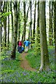
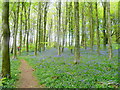
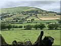
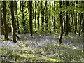
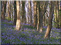
Nearby Images from Geograph Britain and Ireland:
©2009(licence)
©2009(licence)
©2022(licence)
©2023(licence)
©2008(licence)
The above images may not be of the site on this page, they are loaded from Geograph.
Please Submit an Image of this site or go out and take one for us!
Click here to see more info for this site
Nearby sites
Key: Red: member's photo, Blue: 3rd party photo, Yellow: other image, Green: no photo - please go there and take one, Grey: site destroyed
Download sites to:
KML (Google Earth)
GPX (GPS waypoints)
CSV (Garmin/Navman)
CSV (Excel)
To unlock full downloads you need to sign up as a Contributory Member. Otherwise downloads are limited to 50 sites.
Turn off the page maps and other distractions
Nearby sites listing. In the following links * = Image available
634m WSW 256° Great Oak Stone* Standing Stone (Menhir) (SO22181846)
919m ENE 77° Coed Ynys Faen* Standing Stones (SO237188)
1.4km ESE 123° Golden Grove* Standing Stone (Menhir) (SO2396217829)
1.8km WNW 289° Gwernvale* Chambered Tomb (SO2111119217)
1.8km SSE 165° Cwrt-y-Gollen* Standing Stone (Menhir) (SO2324116860)
1.8km WSW 239° Garn Coch (Powys)* Chambered Tomb (SO2123617708)
1.8km WSW 246° Llangattock Cross* Ancient Cross (SO2110017870)
2.1km N 354° Crug Hywel* Hillfort (SO226207)
2.2km W 269° Llan-Wysg Well* Holy Well or Sacred Spring (SO2060318584)
3.2km W 266° Ffawyddog Gaer Hillfort (SO196184)
3.3km S 184° Gaer Settlement Ancient Village or Settlement (SO225153)
3.4km NW 319° Craig Llwyn* Ancient Village or Settlement (SO206212)
3.9km NNW 343° Pen Cerrig-calch* Cairn (SO21702236)
4.0km SW 214° Ogof Darren Cilau Cave Cave or Rock Shelter (SO20511530)
4.2km SW 235° Coed Pentwyn* Hillfort (SO193162)
4.6km SW 225° Cairn south of Eglwys Faen* Cairn (SO1948415430)
4.6km SW 229° Eglwys Faen Cave Cave or Rock Shelter (SO19261566)
4.7km WNW 285° Penmyarth* Standing Stone (Menhir) (SO18291986)
4.8km SSW 210° Mynydd Pen-Cyrn Stone Circle* Stone Circle (SO2029214494)
4.8km SSW 211° Mynydd Pen-cyrn Barrow Cemetery* Barrow Cemetery (SO20281449)
4.8km SSW 197° Llanelly Round Barrow(s) (SO213140)
5.3km NNW 330° Pen Gloch Y Pibwr* Cairn (SO2020123205)
5.3km S 184° Craig y Gaer* Hillfort (SO223133)
5.5km SSE 160° Bedd y Gwr Hir* Standing Stone (Menhir) (SO246134)
5.8km WNW 290° Myarth Camp Hillfort (SO174207)
View more nearby sites and additional images


 We would like to know more about this location. Please feel free to add a brief description and any relevant information in your own language.
 Wir möchten mehr über diese Stätte erfahren. Bitte zögern Sie nicht, eine kurze Beschreibung und relevante Informationen in Deutsch hinzuzufügen.
 Nous aimerions en savoir encore un peu sur les lieux. S'il vous plaît n'hesitez pas à ajouter une courte description et tous les renseignements pertinents dans votre propre langue.
 Quisieramos informarnos un poco más de las lugares. No dude en añadir una breve descripción y otros datos relevantes en su propio idioma.