<< Our Photo Pages >> Auchorachan - Standing Stone (Menhir) in Scotland in Moray
Submitted by golux on Monday, 01 August 2011 Page Views: 5151
Neolithic and Bronze AgeSite Name: AuchorachanCountry: Scotland County: Moray Type: Standing Stone (Menhir)
Nearest Village: Auchbreck
Map Ref: NJ20932780
Latitude: 57.333844N Longitude: 3.315047W
Condition:
| 5 | Perfect |
| 4 | Almost Perfect |
| 3 | Reasonable but with some damage |
| 2 | Ruined but still recognisable as an ancient site |
| 1 | Pretty much destroyed, possibly visible as crop marks |
| 0 | No data. |
| -1 | Completely destroyed |
| 5 | Superb |
| 4 | Good |
| 3 | Ordinary |
| 2 | Not Good |
| 1 | Awful |
| 0 | No data. |
| 5 | Can be driven to, probably with disabled access |
| 4 | Short walk on a footpath |
| 3 | Requiring a bit more of a walk |
| 2 | A long walk |
| 1 | In the middle of nowhere, a nightmare to find |
| 0 | No data. |
| 5 | co-ordinates taken by GPS or official recorded co-ordinates |
| 4 | co-ordinates scaled from a detailed map |
| 3 | co-ordinates scaled from a bad map |
| 2 | co-ordinates of the nearest village |
| 1 | co-ordinates of the nearest town |
| 0 | no data |
Internal Links:
External Links:
")
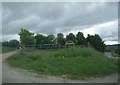
Situated on a steeply sloping, west-facing hillside to the south of of Auchorachan steading [and 50m N of the Nevie Burn], is a standing stone of prehistoric date. The stone stands about 1.7m in height and 1.3m in girth and is roughly triangular in shape with a packing of smaller stones around its base. [text from
RCAHMS webpage]
The 1874 OS map marked it as a circle but the name Book of 1869 records only one stone "said to be a Druidical remain"; in fact the steep slope makes this an unlikely site for a circle.
You may be viewing yesterday's version of this page. To see the most up to date information please register for a free account.
")
")
Do not use the above information on other web sites or publications without permission of the contributor.
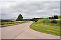
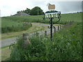
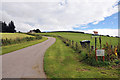
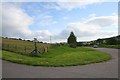
Nearby Images from Geograph Britain and Ireland:
©2010(licence)
©2009(licence)
©2010(licence)
©2006(licence)
©2009(licence)
The above images may not be of the site on this page, they are loaded from Geograph.
Please Submit an Image of this site or go out and take one for us!
Click here to see more info for this site
Nearby sites
Key: Red: member's photo, Blue: 3rd party photo, Yellow: other image, Green: no photo - please go there and take one, Grey: site destroyed
Download sites to:
KML (Google Earth)
GPX (GPS waypoints)
CSV (Garmin/Navman)
CSV (Excel)
To unlock full downloads you need to sign up as a Contributory Member. Otherwise downloads are limited to 50 sites.
Turn off the page maps and other distractions
Nearby sites listing. In the following links * = Image available
2.2km NW 326° Glenlivet Standing Stone* Standing Stone (Menhir) (NJ19732963)
2.7km WNW 297° Nethertown Stone Circle (NJ185291)
3.2km N 357° Tom Na Heron Class I Pictish Symbol Stone (NJ208310)
3.9km NW 320° Doune Of Dalmore* Stone Circle (NJ185308)
6.3km WSW 251° Balneilean Class I Pictish Symbol Stone (NJ149259)
8.6km NNW 339° Lower Lagmore* Stone Circle (NJ180359)
8.7km NNW 336° Upper Lagmore* Stone Circle (NJ176358)
9.0km NNW 342° Marionburgh* Stone Circle (NJ183364)
10.1km NNW 344° Inveravon* Class I Pictish Symbol Stone (NJ1828737599)
10.1km NNW 344° Inveravon (1)* Class I Pictish Symbol Stone (NJ1828737599)
10.1km NNW 344° Inveravon (4)* Class I Pictish Symbol Stone (NJ1828737599)
10.1km NNW 344° Inveravon (3)* Class I Pictish Symbol Stone (NJ1828737599)
10.1km NNW 344° Inveravon (2)* Class I Pictish Symbol Stone (NJ1828737599)
10.5km NW 307° Advie* Class I Pictish Symbol Stone (NJ12653426)
10.9km NNW 342° Pitchroy* Stone Circle (NJ17823826)
12.3km NNW 343° Mains of Kirdells* Round Cairn (NJ175396)
14.7km NE 45° Nether Cluny* Stone Circle (NJ315381)
14.9km NNW 341° Leakin* Round Cairn (NJ164420)
15.2km N 350° Knockando 1* Class I Pictish Symbol Stone (NJ186428)
15.2km N 350° Knockando 2* Class I Pictish Symbol Stone (NJ186428)
15.2km W 263° Congash* Class I Pictish Symbol Stone (NJ058262)
15.2km NNE 22° Hatton Circle (Moray)* Stone Circle (NJ270418)
15.4km N 352° Drum Divan* Stone Circle (NJ192431)
15.5km NNE 21° The Fairy Knowe* Misc. Earthwork (NJ267422)
15.5km W 274° Upper Port* Standing Stones (NJ054292)
View more nearby sites and additional images


 We would like to know more about this location. Please feel free to add a brief description and any relevant information in your own language.
 Wir möchten mehr über diese Stätte erfahren. Bitte zögern Sie nicht, eine kurze Beschreibung und relevante Informationen in Deutsch hinzuzufügen.
 Nous aimerions en savoir encore un peu sur les lieux. S'il vous plaît n'hesitez pas à ajouter une courte description et tous les renseignements pertinents dans votre propre langue.
 Quisieramos informarnos un poco más de las lugares. No dude en añadir una breve descripción y otros datos relevantes en su propio idioma.