<< Text Pages >> Carreg Gywir - Marker Stone in Wales
Submitted by Blaenavonphotos on Sunday, 28 July 2019 Page Views: 860
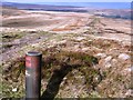
Multi-periodSite Name: Carreg GywirCountry: Wales
NOTE: This site is 1.2 km away from the location you searched for.
Type: Marker Stone
Map Ref: SO21191033
Latitude: 51.786056N Longitude: 3.143936W
Condition:
| 5 | Perfect |
| 4 | Almost Perfect |
| 3 | Reasonable but with some damage |
| 2 | Ruined but still recognisable as an ancient site |
| 1 | Pretty much destroyed, possibly visible as crop marks |
| 0 | No data. |
| -1 | Completely destroyed |
| 5 | Superb |
| 4 | Good |
| 3 | Ordinary |
| 2 | Not Good |
| 1 | Awful |
| 0 | No data. |
| 5 | Can be driven to, probably with disabled access |
| 4 | Short walk on a footpath |
| 3 | Requiring a bit more of a walk |
| 2 | A long walk |
| 1 | In the middle of nowhere, a nightmare to find |
| 0 | No data. |
| 5 | co-ordinates taken by GPS or official recorded co-ordinates |
| 4 | co-ordinates scaled from a detailed map |
| 3 | co-ordinates scaled from a bad map |
| 2 | co-ordinates of the nearest village |
| 1 | co-ordinates of the nearest town |
| 0 | no data |
Internal Links:
External Links:
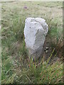
Marker Stone in Wales
This stone is detailed on the Coflein site but I can't access at the moment, from memory it's an old civil parish boundry marker possibly truncated.
You may be viewing yesterday's version of this page. To see the most up to date information please register for a free account.
")
")
Do not use the above information on other web sites or publications without permission of the contributor.
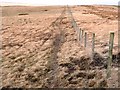
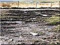
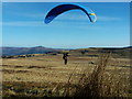
Nearby Images from Geograph Britain and Ireland:
©2015(licence)
©2008(licence)
©2008(licence)
©2006(licence)
©2008(licence)
The above images may not be of the site on this page, they are loaded from Geograph.
Please Submit an Image of this site or go out and take one for us!
Click here to see more info for this site
Nearby sites
Key: Red: member's photo, Blue: 3rd party photo, Yellow: other image, Green: no photo - please go there and take one, Grey: site destroyed
Download sites to:
KML (Google Earth)
GPX (GPS waypoints)
CSV (Garmin/Navman)
CSV (Excel)
To unlock full downloads you need to sign up as a Contributory Member. Otherwise downloads are limited to 50 sites.
Turn off the page maps and other distractions
Nearby sites listing. In the following links * = Image available
2.7km NE 36° Twyn-y-Dinas Hillfort (SO228125)
2.8km ENE 68° Carreg Maen-Taro* Standing Stone (Menhir) (SO23831134)
3.2km NNE 20° Craig y Gaer* Hillfort (SO223133)
3.4km NE 54° Gilwern Hill* Standing Stone (Menhir) (SO2395512301)
3.6km E 85° Careg Croes-Ifor Round Cairn (SO248106)
3.7km N 1° Llanelly Round Barrow(s) (SO213140)
3.7km NE 53° Carreg Gywir* Stone Row / Alignment (SO242125)
4.3km NNW 347° Mynydd Pen-cyrn Barrow Cemetery* Barrow Cemetery (SO20281449)
4.3km NNW 347° Mynydd Pen-Cyrn Stone Circle* Stone Circle (SO2029214494)
4.6km NE 47° Bedd y Gwr Hir* Standing Stone (Menhir) (SO246134)
4.9km ENE 78° Blorenge West Flank - Y Blorens* Not Known (by us) (SO260113)
5.0km N 351° Ogof Darren Cilau Cave Cave or Rock Shelter (SO20511530)
5.1km NNE 14° Gaer Settlement Ancient Village or Settlement (SO225153)
5.4km NNW 341° Cairn south of Eglwys Faen* Cairn (SO1948415430)
5.4km E 100° Mynydd Garn Fawr* Ancient Trackway (SO2655609300)
5.6km SW 234° Y Domen Fawr Cairn Cairn (SO16600717)
5.7km NNW 339° Eglwys Faen Cave Cave or Rock Shelter (SO19261566)
5.8km E 93° Carn y Defaid (S)* Cairn (SO27040997)
5.9km E 92° Carn y Defaid (N)* Cairn (SO27081004)
6.0km ENE 74° Blorenge Cairn* Round Cairn (SO270119)
6.2km NNW 341° Coed Pentwyn* Hillfort (SO193162)
6.4km ESE 114° Capel Newydd* Carving (SO27020763)
6.5km NW 322° Ty Aderyn cairn 2* Cairn (SO1724815473)
6.7km ESE 102° Carn-y-Big Fach Cist (SO27790885)
6.8km NNE 16° Cwrt-y-Gollen* Standing Stone (Menhir) (SO2324116860)
View more nearby sites and additional images


 We would like to know more about this location. Please feel free to add a brief description and any relevant information in your own language.
 Wir möchten mehr über diese Stätte erfahren. Bitte zögern Sie nicht, eine kurze Beschreibung und relevante Informationen in Deutsch hinzuzufügen.
 Nous aimerions en savoir encore un peu sur les lieux. S'il vous plaît n'hesitez pas à ajouter une courte description et tous les renseignements pertinents dans votre propre langue.
 Quisieramos informarnos un poco más de las lugares. No dude en añadir una breve descripción y otros datos relevantes en su propio idioma.