<< Our Photo Pages >> Drumend - Standing Stone (Menhir) in Scotland in Perth and Kinross
Submitted by BigSweetie on Sunday, 14 December 2003 Page Views: 6717
Neolithic and Bronze AgeSite Name: DrumendCountry: Scotland County: Perth and Kinross Type: Standing Stone (Menhir)
Nearest Town: Blairgowrie Nearest Village: Rattray
Map Ref: NO20184582 Landranger Map Number: 53
Latitude: 56.597459N Longitude: 3.301566W
Condition:
| 5 | Perfect |
| 4 | Almost Perfect |
| 3 | Reasonable but with some damage |
| 2 | Ruined but still recognisable as an ancient site |
| 1 | Pretty much destroyed, possibly visible as crop marks |
| 0 | No data. |
| -1 | Completely destroyed |
| 5 | Superb |
| 4 | Good |
| 3 | Ordinary |
| 2 | Not Good |
| 1 | Awful |
| 0 | No data. |
| 5 | Can be driven to, probably with disabled access |
| 4 | Short walk on a footpath |
| 3 | Requiring a bit more of a walk |
| 2 | A long walk |
| 1 | In the middle of nowhere, a nightmare to find |
| 0 | No data. |
| 5 | co-ordinates taken by GPS or official recorded co-ordinates |
| 4 | co-ordinates scaled from a detailed map |
| 3 | co-ordinates scaled from a bad map |
| 2 | co-ordinates of the nearest village |
| 1 | co-ordinates of the nearest town |
| 0 | no data |
Internal Links:
External Links:
I have visited· I would like to visit
SolarMegalith would like to visit

From the centre of Perth, head E across the river, and join the A93 heading N. You will drive through Guildtown, pass the famous Meikleour beech hedge, and the cursus called the Cleaven Dyke before reaching Blairgowrie. Continue on the road that you are on, and it will take you into the centre of town. You will see a triangular grassy area on your right as you approach some traffic lights. Go into the left lane, which will take you left over the River Ericht. The road climbs, and you will pass on your left a turn-off for Glenshee and Braemar. Instead, stay on the road that you are on (now the A926) and leave Blairgowrie to the E.
Drumend is approximately 2.0km from the bridge over the Ericht. It is in a field on the left, close to the left-hand (W) boundary, about 150m up the field, but can be quite difficult to see from the road. This is a fast and narrow road, with few places to park. I would suggest either parking on the edge of Blairgowrie and walking the 1.0km or so to the stone, or looking for a farm drive that you can pull into without blocking.
Dimensions:
stone - 1.6m tall
Notes:
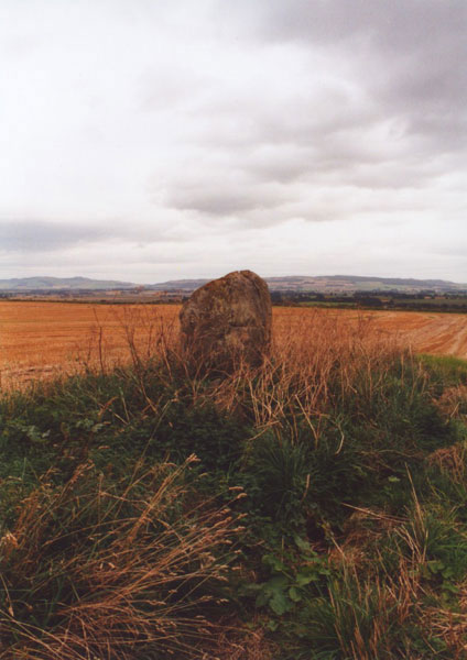
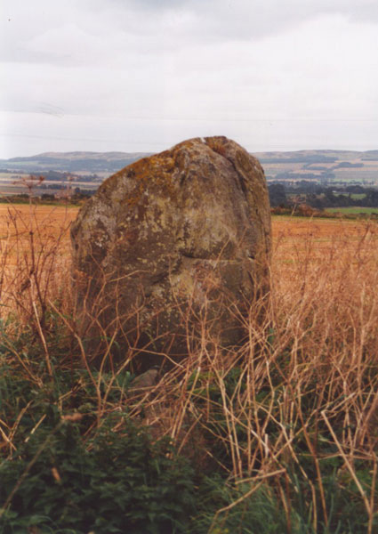
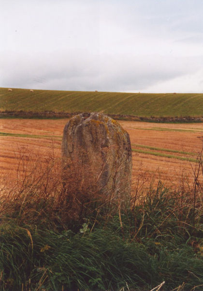
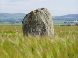
This single standing stone sits on a slight mound towards the NW corner of a field off the A926. Standing 1.6m tall, it swells slightly around its middle, where it is wider than at it's base or top. Around its base is piled field clearance, and it has obviously been scraped by farm machinery at some point. Although a largely unremarkable stone, it's a nice site, with a good view to the south, over Strathmore, towards the King's Seat and the distant Sidlaws.
References (books):
Coles, F R (1909) 'Report on stone circles surveyed in Perthshire (South-East District), with measured plans and drawings; obtained under the Gunning Fellow- ship' Proc Soc Antiq Scot, 43, 1908-9, p113
NSA (1845) The new statistical account of Scotland by the ministers of the respective parishes under the superintendence of a committee of the society for the benefit of the sons and daughters of the clergy 15v, Edinburgh, Vol.10, p241
OSA (1791-9) The statistical account of Scotland, drawn up from the communications of the ministers of the different parishes Sir John Sinclair (ed.), Edinburgh, Vol.4, p150
RCAHMS (1990) RCAHMS - North-east Perth: an archaeological landscape Edinburgh, p23, No.70
Tranter, N (1971) The Queen's Scotland - The Heartland London, p41
References (websites):
Stone Circles in Angus and Perthshire
CANMORE
The Modern Antiquarian
You may be viewing yesterday's version of this page. To see the most up to date information please register for a free account.


Do not use the above information on other web sites or publications without permission of the contributor.
Click here to see more info for this site
Nearby sites
Key: Red: member's photo, Blue: 3rd party photo, Yellow: other image, Green: no photo - please go there and take one, Grey: site destroyed
Download sites to:
KML (Google Earth)
GPX (GPS waypoints)
CSV (Garmin/Navman)
CSV (Excel)
To unlock full downloads you need to sign up as a Contributory Member. Otherwise downloads are limited to 50 sites.
Turn off the page maps and other distractions
Nearby sites listing. In the following links * = Image available
28m SE 134° Drumend* Holy Well or Sacred Spring (NO202458)
1.1km SSW 202° Rattray Cursus Cursus (NO19744479)
1.7km NNW 346° Broadmoss Standing Stones (NO198475)
2.2km SSW 200° The Welton Stone Circle (NO1937243766)
2.8km NW 321° Craighall Mill* Stone Circle (NO18444805)
2.9km N 349° Broad Moss Stone Circle (NO197487)
3.0km NW 325° Craighall* Standing Stone (Menhir) (NO185483)
3.1km NW 319° Glenballoch Farm* Stone Circle (NO182482)
4.2km NNW 331° Woodside (Bridge of Cally) Standing Stone (Menhir) (NO18224951)
4.4km W 279° Milton of Drumlochy Round Barrow(s) (NO15834662)
4.6km NNW 338° Horse Stone, Hill of Drimmie* Standing Stone (Menhir) (NO18535007)
4.6km NNW 337° Woodside, Hill of Drimmie* Stone Circle (NO1848750054)
4.6km WSW 244° Ardblair* Stone Circle (NO1598943883)
5.1km NE 53° Alyth* Class II Pictish Symbol Stone (NO24324878)
5.4km N 353° Heatheryhaugh (Bendochy) Rock Art (NO1963951153)
5.6km N 351° Tullymurdoch* Stone Circle (NO194514)
5.7km N 352° Parkneuk* Stone Circle (NO195515)
5.9km ESE 114° Bankhead of Kinloch Barrow Cemetery (NO2551443333)
6.2km ENE 59° Pitcrocknie* Standing Stone (Menhir) (NO2554648860)
6.2km W 260° Kinloch Cairn* Cairn (NO14074485)
6.5km WSW 243° Aikenhead Farm (Blairgowrie) Rock Art (NO143430)
6.6km SW 215° Cleaven Dyke* Cursus (NO16334049)
6.6km SSW 206° Caputh Cursus Cursus (NO17153998)
6.6km ESE 115° Arthurstone Standing Stone (Menhir) (NO261429)
6.7km SW 221° Caputh Cursus Cursus (NO15664088)
View more nearby sites and additional images


 We would like to know more about this location. Please feel free to add a brief description and any relevant information in your own language.
 Wir möchten mehr über diese Stätte erfahren. Bitte zögern Sie nicht, eine kurze Beschreibung und relevante Informationen in Deutsch hinzuzufügen.
 Nous aimerions en savoir encore un peu sur les lieux. S'il vous plaît n'hesitez pas à ajouter une courte description et tous les renseignements pertinents dans votre propre langue.
 Quisieramos informarnos un poco más de las lugares. No dude en añadir una breve descripción y otros datos relevantes en su propio idioma.