


<< Our Photo Pages >> Glenlivet Standing Stone - Standing Stone (Menhir) in Scotland in Moray
Submitted by PeteCrane5 on Tuesday, 26 September 2023 Page Views: 557
Date UncertainSite Name: Glenlivet Standing StoneCountry: Scotland County: Moray Type: Standing Stone (Menhir)
Nearest Village: Tomnavoulin
Map Ref: NJ19732963
Latitude: 57.350069N Longitude: 3.33557W
Condition:
| 5 | Perfect |
| 4 | Almost Perfect |
| 3 | Reasonable but with some damage |
| 2 | Ruined but still recognisable as an ancient site |
| 1 | Pretty much destroyed, possibly visible as crop marks |
| 0 | No data. |
| -1 | Completely destroyed |
| 5 | Superb |
| 4 | Good |
| 3 | Ordinary |
| 2 | Not Good |
| 1 | Awful |
| 0 | No data. |
| 5 | Can be driven to, probably with disabled access |
| 4 | Short walk on a footpath |
| 3 | Requiring a bit more of a walk |
| 2 | A long walk |
| 1 | In the middle of nowhere, a nightmare to find |
| 0 | No data. |
| 5 | co-ordinates taken by GPS or official recorded co-ordinates |
| 4 | co-ordinates scaled from a detailed map |
| 3 | co-ordinates scaled from a bad map |
| 2 | co-ordinates of the nearest village |
| 1 | co-ordinates of the nearest town |
| 0 | no data |
Internal Links:
External Links:
I have visited· I would like to visit
PeteCrane5 has visited here
")
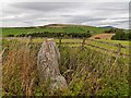
A single standing stone within a small fence .... sadly the fenced area was overgrown with nettles when I visited. The stone is shown on the Ordnance Survey 1869 six inch map and current 1:25 and 1:50,000 maps but does not appear to be listed on Canmore.
You may be viewing yesterday's version of this page. To see the most up to date information please register for a free account.
Do not use the above information on other web sites or publications without permission of the contributor.
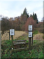
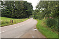
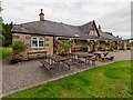
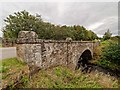
Nearby Images from Geograph Britain and Ireland:
©2018(licence)
©2018(licence)
©2010(licence)
©2018(licence)
©2018(licence)
The above images may not be of the site on this page, they are loaded from Geograph.
Please Submit an Image of this site or go out and take one for us!
Click here to see more info for this site
Nearby sites
Key: Red: member's photo, Blue: 3rd party photo, Yellow: other image, Green: no photo - please go there and take one, Grey: site destroyed
Download sites to:
KML (Google Earth)
GPX (GPS waypoints)
CSV (Garmin/Navman)
CSV (Excel)
To unlock full downloads you need to sign up as a Contributory Member. Otherwise downloads are limited to 50 sites.
Turn off the page maps and other distractions
Nearby sites listing. In the following links * = Image available
1.3km WSW 246° Nethertown Stone Circle (NJ185291)
1.7km NW 312° Doune Of Dalmore* Stone Circle (NJ185308)
1.7km NE 37° Tom Na Heron Class I Pictish Symbol Stone (NJ208310)
2.1km WNW 291° Chapelton Cairn* Cairn (NJ17783044)
2.2km SE 146° Auchorachan* Standing Stone (Menhir) (NJ20932780)
4.3km NNW 348° Craigroy* Barrow Cemetery (NJ18883387)
6.1km SW 231° Balneilean Class I Pictish Symbol Stone (NJ149259)
6.5km NNW 343° Lower Lagmore* Stone Circle (NJ180359)
6.5km NNW 340° Upper Lagmore* Stone Circle (NJ176358)
6.9km NNW 347° Marionburgh* Stone Circle (NJ183364)
8.1km NNW 349° Inveravon (1)* Class I Pictish Symbol Stone (NJ1828737599)
8.1km NNW 349° Inveravon (2)* Class I Pictish Symbol Stone (NJ1828737599)
8.1km NNW 349° Inveravon (3)* Class I Pictish Symbol Stone (NJ1828737599)
8.1km NNW 349° Inveravon (4)* Class I Pictish Symbol Stone (NJ1828737599)
8.1km NNW 349° Inveravon (5)* Class I Pictish Symbol Stone (NJ1828737599)
8.4km WNW 302° Advie* Class I Pictish Symbol Stone (NJ12653426)
8.8km NNW 346° Pitchroy* Stone Circle (NJ17823826)
9.3km W 281° Balnallan Cairn* Cairn (NJ1062031600)
9.4km W 281° Tom An Uird Wood* Cairn (NJ1055031600)
10.2km NNW 346° Mains of Kirdells* Round Cairn (NJ175396)
12.7km W 271° Lag na Dothaig* Natural Stone / Erratic / Other Natural Feature (NJ07043014)
12.8km NNW 344° Leakin* Round Cairn (NJ164420)
13.1km WNW 283° Torran Ban* Hillfort (NJ06953286)
13.2km N 354° Knockando 1* Class I Pictish Symbol Stone (NJ186428)
13.2km N 354° Knockando 2* Class I Pictish Symbol Stone (NJ186428)
View more nearby sites and additional images


 We would like to know more about this location. Please feel free to add a brief description and any relevant information in your own language.
 Wir möchten mehr über diese Stätte erfahren. Bitte zögern Sie nicht, eine kurze Beschreibung und relevante Informationen in Deutsch hinzuzufügen.
 Nous aimerions en savoir encore un peu sur les lieux. S'il vous plaît n'hesitez pas à ajouter une courte description et tous les renseignements pertinents dans votre propre langue.
 Quisieramos informarnos un poco más de las lugares. No dude en añadir una breve descripción y otros datos relevantes en su propio idioma.