<< Text Pages >> Wern Frank Wood Cairn - Cairn in Wales in Powys
Submitted by coldrum on Wednesday, 17 June 2009 Page Views: 4550
Neolithic and Bronze AgeSite Name: Wern Frank Wood CairnCountry: Wales
NOTE: This site is 0.7 km away from the location you searched for.
County: Powys Type: Cairn
Nearest Town: Talgarth
Map Ref: SO194332
Latitude: 51.991379N Longitude: 3.175232W
Condition:
| 5 | Perfect |
| 4 | Almost Perfect |
| 3 | Reasonable but with some damage |
| 2 | Ruined but still recognisable as an ancient site |
| 1 | Pretty much destroyed, possibly visible as crop marks |
| 0 | No data. |
| -1 | Completely destroyed |
| 5 | Superb |
| 4 | Good |
| 3 | Ordinary |
| 2 | Not Good |
| 1 | Awful |
| 0 | No data. |
| 5 | Can be driven to, probably with disabled access |
| 4 | Short walk on a footpath |
| 3 | Requiring a bit more of a walk |
| 2 | A long walk |
| 1 | In the middle of nowhere, a nightmare to find |
| 0 | No data. |
| 5 | co-ordinates taken by GPS or official recorded co-ordinates |
| 4 | co-ordinates scaled from a detailed map |
| 3 | co-ordinates scaled from a bad map |
| 2 | co-ordinates of the nearest village |
| 1 | co-ordinates of the nearest town |
| 0 | no data |
Be the first person to rate this site - see the 'Contribute!' box in the right hand menu.
Internal Links:
External Links:
Cairn in Powys
Possible Bronze age round cairn with the remains of a cist in the center. 5.4m in diameter and 0.5m high.
Coflein entry:
https://www.coflein.gov.uk/en/site/306043
You may be viewing yesterday's version of this page. To see the most up to date information please register for a free account.
Do not use the above information on other web sites or publications without permission of the contributor.
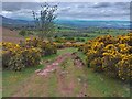
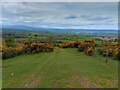
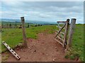
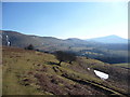
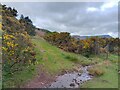
Nearby Images from Geograph Britain and Ireland:
©2023(licence)
©2023(licence)
©2023(licence)
©2010(licence)
©2023(licence)
The above images may not be of the site on this page, they are loaded from Geograph.
Please Submit an Image of this site or go out and take one for us!
Click here to see more info for this site
Nearby sites
Key: Red: member's photo, Blue: 3rd party photo, Yellow: other image, Green: no photo - please go there and take one, Grey: site destroyed
Download sites to:
KML (Google Earth)
GPX (GPS waypoints)
CSV (Garmin/Navman)
CSV (Excel)
To unlock full downloads you need to sign up as a Contributory Member. Otherwise downloads are limited to 50 sites.
Turn off the page maps and other distractions
Nearby sites listing. In the following links * = Image available
2.3km NW 318° Ffostil South Chambered Long Barrow* Chambered Tomb (SO179349)
2.3km NW 319° Ffostil North Chambered Long Barrow* Chambered Tomb (SO17913495)
2.7km SSW 199° Bwlch Bach a'r Grib cairns* Cairn (SO18503070)
3.4km SSW 205° Castell Dinas* Hillfort (SO179301)
3.5km NW 314° Croes-llechau (Bronllys) Long Barrow (SO169357)
3.9km SSW 195° Cwm Fforest Modern Stone Circle etc (SO1833029440)
3.9km W 260° Talgarth Hillfort (SO155326)
4.0km S 176° Pen Trumau Ring Cairn (SO196292)
4.2km E 96° Blaenbwch* Standing Stone (Menhir) (SO23633271)
4.3km SSW 195° Ty-Isaf* Chambered Tomb (SO18182906)
4.6km WSW 248° Penywyrlod* Chambered Tomb (SO15053156)
4.8km NNW 336° Gweryfed Park* Hillfort (SO17503759)
5.0km NNW 345° Little Lodge* Chambered Tomb (SO18223806)
5.1km ESE 109° Darren Esgob* Stone Circle (SO242315)
5.3km NNW 345° Coed-y-Polyn Cairn (SO18083832)
5.3km NW 320° Pipton* Chambered Tomb (SO16043729)
5.6km NNW 331° Bronllys 2* Round Barrow(s) (SO16783811)
5.6km NW 325° Spread Eagle Cursus Cursus (SO16283784)
5.7km NW 325° Spread Eagle Cursus Cursus (SO16203795)
5.8km SSW 213° Mynydd Troed* Chambered Tomb (SO16142842)
6.1km NE 47° Pen Y Beacon* Stone Circle (SO23933735)
6.4km SSW 211° Cockit Hill* Promontory Fort / Cliff Castle (SO16032774)
6.4km NE 43° Maes-Coch Chambered Cairn (SO239378)
6.4km SSE 149° Maen Llwyd (Powys)* Standing Stone (Menhir) (SO22602762)
6.4km ESE 108° Capel-y-ffin Standing Stone (Menhir) (SO2550031118)
View more nearby sites and additional images


 We would like to know more about this location. Please feel free to add a brief description and any relevant information in your own language.
 Wir möchten mehr über diese Stätte erfahren. Bitte zögern Sie nicht, eine kurze Beschreibung und relevante Informationen in Deutsch hinzuzufügen.
 Nous aimerions en savoir encore un peu sur les lieux. S'il vous plaît n'hesitez pas à ajouter une courte description et tous les renseignements pertinents dans votre propre langue.
 Quisieramos informarnos un poco más de las lugares. No dude en añadir una breve descripción y otros datos relevantes en su propio idioma.