<< Our Photo Pages >> Blackbury Camp - Hillfort in England in Devon
Submitted by AngieLake on Tuesday, 04 July 2006 Page Views: 22939
Iron Age and Later PrehistorySite Name: Blackbury Camp Alternative Name: Blackbury CastleCountry: England
NOTE: This site is 4.17 km away from the location you searched for.
County: Devon Type: Hillfort
Nearest Town: Seaton Nearest Village: Southleigh Parish
Map Ref: SY187924
Latitude: 50.725512N Longitude: 3.153185W
Condition:
| 5 | Perfect |
| 4 | Almost Perfect |
| 3 | Reasonable but with some damage |
| 2 | Ruined but still recognisable as an ancient site |
| 1 | Pretty much destroyed, possibly visible as crop marks |
| 0 | No data. |
| -1 | Completely destroyed |
| 5 | Superb |
| 4 | Good |
| 3 | Ordinary |
| 2 | Not Good |
| 1 | Awful |
| 0 | No data. |
| 5 | Can be driven to, probably with disabled access |
| 4 | Short walk on a footpath |
| 3 | Requiring a bit more of a walk |
| 2 | A long walk |
| 1 | In the middle of nowhere, a nightmare to find |
| 0 | No data. |
| 5 | co-ordinates taken by GPS or official recorded co-ordinates |
| 4 | co-ordinates scaled from a detailed map |
| 3 | co-ordinates scaled from a bad map |
| 2 | co-ordinates of the nearest village |
| 1 | co-ordinates of the nearest town |
| 0 | no data |
Internal Links:
External Links:
I have visited· I would like to visit
Hodur visited on 16th Nov 2018 - their rating: Cond: 3 Amb: 4 Access: 5 A beautiful site that we visited at a perfect time. Misty, very few people. It was a wonderful experience meditating here.
ajmp3003 visited on 1st Jul 2017 - their rating: Cond: 4 Amb: 4 Access: 5 Very nice site, pleasantly situated in the woods
graemefield visited on 14th Feb 2012 - their rating: Cond: 4 Amb: 5 Access: 5
ForestDaughter visited on 22nd Sep 2008 - their rating: Cond: 5 Amb: 5 Access: 5
Chrus visited on 1st Jan 0003 - their rating: Cond: 4 Amb: 5 Access: 4
AngieLake have visited here
Average ratings for this site from all visit loggers: Condition: 4 Ambience: 4.6 Access: 4.8

In Prehistoric Hillforts in Devon, (Devon Books, official publisher to Devon County Council) author Aileen Fox describes this ancient oval-shaped hillfort as 'important' and with 'an unusual entrance'. The excavation in 1952-54 by the Devon Archaeological Society showed that the main gate had been an imposing structure (see English Heritage noticeboard photograph to be posted.)
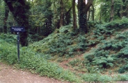
It is easily accessible and popular with walkers. A car park right next to its eastern (not original) 'gateway' is level with the interior. I visited with our local dowsing group on Summer Solstice 2006. Inside is very cool and peaceful, with a cathedral-like canopy of tall trees. The enclosing banks are still well-defined, and at the southern entrance you are still able to see the unusual layout of defensive banks. The land falls away down the slope of the hill here.
To quote Aileen Fox: "The oval enclosure of about 2 hectares now in open woodland straddles a 180m steep-sided Greensand ridge capped with clay and flints. It was defended by a substantial rampart and ditch, with one entrance facing the southern slopes; other gaps are recent. A triangular earthwork was added screening the gate - the so-called barbican entrance; it contained a central embanked passageway with a compartment on either side, probably used as stock pens.
Excavation showed that the main gate had been an imposing structure. [refers to fig.5] The rounded rampart ends projected forward and were built up with flint nodules, retained by a timber palisade. Deep post-holes indicated the gate, probably with a bridge to link the ramparts. There was a second timber gateway at the entrance to the barbican. In the interior, the post-holes of a rectilinear hut were uncovered with a cooking pit nearby. Iron slag from the local limonite ores, whetstones and spindle whorls were found along with more than 1,200 sling stones. The pottery included decorated Glastonbury ware and some earlier plain Iron Age wares indicating that the fort was in use from the early 3rd century BC onwards."
(If her scale drawing is correct the site is approximately 250m x 125m).
Signposted from A3052 Sidford-Colyford road and from the B3174, according to the book, published in 1996.
You may be viewing yesterday's version of this page. To see the most up to date information please register for a free account.


Do not use the above information on other web sites or publications without permission of the contributor.
Click here to see more info for this site
Nearby sites
Key: Red: member's photo, Blue: 3rd party photo, Yellow: other image, Green: no photo - please go there and take one, Grey: site destroyed
Download sites to:
KML (Google Earth)
GPX (GPS waypoints)
CSV (Garmin/Navman)
CSV (Excel)
To unlock full downloads you need to sign up as a Contributory Member. Otherwise downloads are limited to 50 sites.
Turn off the page maps and other distractions
Nearby sites listing. In the following links * = Image available
1.7km WNW 300° Broad Down Stone Circle (SY172933)
2.1km NW 318° Broad Down* Barrow Cemetery (SY173940)
4.1km NW 319° Farway Castle Henge (SY1606395499)
4.8km E 96° Seaton Down Camp* Hillfort (SY23449185)
4.8km NW 317° Ring-in-the-Mire* Misc. Earthwork (SY1548695932)
5.6km NW 312° Farway & Gittisham Hill Cemetery* Barrow Cemetery (SY146962)
5.9km WSW 258° Sidbury Castle* Hillfort (SY129913)
5.9km SW 228° Salcombe Hill Standing Stone* Standing Stone (Menhir) (SY142885)
6.1km ENE 73° Colyton Church Cross* Ancient Cross (SY24599409)
7.6km E 96° Hawksdown Camp Hillfort (SY26299143)
8.0km SW 230° Sidmouth Museum* Museum (SY125874)
9.1km WSW 239° Seven Stones (Devon)* Stone Circle (SY10758787)
9.6km E 79° Musbury Castle* Hillfort (SY282941)
10.6km SW 231° High Peak* Ancient Village or Settlement (SY103859)
10.9km NNE 20° Stockland Great Castle* Hillfort (ST22620262)
11.6km E 86° Shapwick Hill Bowl Barrows Barrow Cemetery (SY303930)
11.7km N 354° Dumpdon Great Camp* Hillfort (ST176040)
12.0km NNE 20° Stockland Little Castle Hillfort (ST22980362)
12.5km ENE 59° Axminster Castle* Hillfort (SY296986)
13.0km NW 325° Hembury Fort* Hillfort (ST113031)
13.1km W 266° Aylesbeare Common tumulus* Round Barrow(s) (SY056916)
14.1km NE 41° Membury Castle Hillfort (ST282028)
14.3km NNW 336° Row Barrow (Devon)* Round Barrow(s) (ST13180561)
14.5km WSW 249° Tor Barrow (Colaton Raleigh Common) Round Barrow(s) (SY05088737)
15.4km E 90° Leper's Well (Lyme Regis)* Holy Well or Sacred Spring (SY3411292224)
View more nearby sites and additional images


 We would like to know more about this location. Please feel free to add a brief description and any relevant information in your own language.
 Wir möchten mehr über diese Stätte erfahren. Bitte zögern Sie nicht, eine kurze Beschreibung und relevante Informationen in Deutsch hinzuzufügen.
 Nous aimerions en savoir encore un peu sur les lieux. S'il vous plaît n'hesitez pas à ajouter une courte description et tous les renseignements pertinents dans votre propre langue.
 Quisieramos informarnos un poco más de las lugares. No dude en añadir una breve descripción y otros datos relevantes en su propio idioma.