 with our Megalithic Portal iPhone app")


<< Text Pages >> Coed y Gaer - Hillfort in Wales in Powys
Submitted by vicky on Monday, 23 September 2002 Page Views: 5796
Iron Age and Later PrehistorySite Name: Coed y GaerCountry: Wales County: Powys Type: Hillfort
Nearest Town: Brecon Nearest Village: Felindre
Map Ref: SO176240 Landranger Map Number: 161
Latitude: 51.908417N Longitude: 3.199232W
Condition:
| 5 | Perfect |
| 4 | Almost Perfect |
| 3 | Reasonable but with some damage |
| 2 | Ruined but still recognisable as an ancient site |
| 1 | Pretty much destroyed, possibly visible as crop marks |
| 0 | No data. |
| -1 | Completely destroyed |
| 5 | Superb |
| 4 | Good |
| 3 | Ordinary |
| 2 | Not Good |
| 1 | Awful |
| 0 | No data. |
| 5 | Can be driven to, probably with disabled access |
| 4 | Short walk on a footpath |
| 3 | Requiring a bit more of a walk |
| 2 | A long walk |
| 1 | In the middle of nowhere, a nightmare to find |
| 0 | No data. |
| 5 | co-ordinates taken by GPS or official recorded co-ordinates |
| 4 | co-ordinates scaled from a detailed map |
| 3 | co-ordinates scaled from a bad map |
| 2 | co-ordinates of the nearest village |
| 1 | co-ordinates of the nearest town |
| 0 | no data |
Internal Links:
External Links:
Hillfort in Powys
Have you visited this site? Please add a comment below.
You may be viewing yesterday's version of this page. To see the most up to date information please register for a free account.
Do not use the above information on other web sites or publications without permission of the contributor.
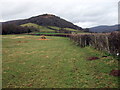
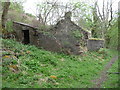
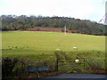
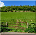
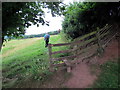
Nearby Images from Geograph Britain and Ireland:
©2009(licence)
©2013(licence)
©2009(licence)
©2018(licence)
©2016(licence)
The above images may not be of the site on this page, they are loaded from Geograph.
Please Submit an Image of this site or go out and take one for us!
Click here to see more info for this site
Nearby sites
Key: Red: member's photo, Blue: 3rd party photo, Yellow: other image, Green: no photo - please go there and take one, Grey: site destroyed
Download sites to:
KML (Google Earth)
GPX (GPS waypoints)
CSV (Garmin/Navman)
CSV (Excel)
To unlock full downloads you need to sign up as a Contributory Member. Otherwise downloads are limited to 50 sites.
Turn off the page maps and other distractions
Nearby sites listing. In the following links * = Image available
348m N 358° Coed y Gaer Cairn Cairn (SO1759324348)
476m ESE 109° Llanfihangel Cwmdu* Ancient Cross (SO18052384)
1.0km W 263° Cwmdu Stone Circle (SO166239)
1.7km W 276° Cefn Moel Stone Row / Alignment (SO15932421)
2.0km W 261° Cefn Moel Round Barrow(s) (SO156237)
2.1km SSE 168° Tretower* Standing Stone (Menhir) (SO180219)
2.3km NNW 334° Mynydd Llangorse 1 Ring Cairn (SO166261)
2.3km NNW 334° Mynydd Llangorse 2 Ring Cairn (SO166261)
2.4km SSW 195° Celtic Head, Middle Gaer Carving (SO16962172)
2.5km WSW 242° Bwlch Ring Cairn* Ring Cairn (SO154229)
2.7km ESE 106° Pen Gloch Y Pibwr* Cairn (SO2020123205)
3.1km E 83° Pen Alltmawr Cairns* Cairn (SO2069024330)
3.3km SW 230° Bwlch Standing Stone* Standing Stone (Menhir) (SO15052195)
3.3km S 183° Myarth Camp Hillfort (SO174207)
4.1km NNW 336° Cockit Hill* Promontory Fort / Cliff Castle (SO16032774)
4.1km SE 132° Craig Llwyn* Ancient Village or Settlement (SO206212)
4.1km SSW 208° Llwyn-Y-Fedwen* Standing Stone (Menhir) (SO15622039)
4.2km S 170° Penmyarth* Standing Stone (Menhir) (SO18291986)
4.4km ESE 111° Pen Cerrig-calch* Cairn (SO21702236)
4.7km NNW 341° Mynydd Troed* Chambered Tomb (SO16142842)
5.0km W 273° Allt-Yr-Yscrin* Cairn (SO12612435)
5.0km SSW 209° Castle Farm Stone* Standing Stone (Menhir) (SO1507319635)
5.1km N 6° Ty-Isaf* Chambered Tomb (SO18182906)
5.2km W 278° Allt yr Esgair* Hillfort (SO124248)
5.2km W 278° Allt yr Esgair 2 Hillfort (SO124248)
View more nearby sites and additional images


 We would like to know more about this location. Please feel free to add a brief description and any relevant information in your own language.
 Wir möchten mehr über diese Stätte erfahren. Bitte zögern Sie nicht, eine kurze Beschreibung und relevante Informationen in Deutsch hinzuzufügen.
 Nous aimerions en savoir encore un peu sur les lieux. S'il vous plaît n'hesitez pas à ajouter une courte description et tous les renseignements pertinents dans votre propre langue.
 Quisieramos informarnos un poco más de las lugares. No dude en añadir una breve descripción y otros datos relevantes en su propio idioma.