 with our Megalithic Portal iPhone app")


<< Text Pages >> Celtic Head, Middle Gaer - Carving in Wales in Powys
Submitted by coin on Thursday, 16 August 2018 Page Views: 1547
Multi-periodSite Name: Celtic Head, Middle Gaer Alternative Name: Middle Gaer Head, Middle GaerCountry: Wales
NOTE: This site is 0.7 km away from the location you searched for.
County: Powys Type: Carving
Nearest Town: Crickhowell Nearest Village: Tretower
Map Ref: SO16962172
Latitude: 51.887828N Longitude: 3.207983W
Condition:
| 5 | Perfect |
| 4 | Almost Perfect |
| 3 | Reasonable but with some damage |
| 2 | Ruined but still recognisable as an ancient site |
| 1 | Pretty much destroyed, possibly visible as crop marks |
| 0 | No data. |
| -1 | Completely destroyed |
| 5 | Superb |
| 4 | Good |
| 3 | Ordinary |
| 2 | Not Good |
| 1 | Awful |
| 0 | No data. |
| 5 | Can be driven to, probably with disabled access |
| 4 | Short walk on a footpath |
| 3 | Requiring a bit more of a walk |
| 2 | A long walk |
| 1 | In the middle of nowhere, a nightmare to find |
| 0 | No data. |
| 5 | co-ordinates taken by GPS or official recorded co-ordinates |
| 4 | co-ordinates scaled from a detailed map |
| 3 | co-ordinates scaled from a bad map |
| 2 | co-ordinates of the nearest village |
| 1 | co-ordinates of the nearest town |
| 0 | no data |
Internal Links:
External Links:
Carving in Powys
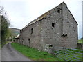
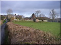
Small but impressive probable Iron Age sculpture of a figure incorporated into the rear wall of Middle Gaer Farm (facing the road). For more information see CPAT.
You may be viewing yesterday's version of this page. To see the most up to date information please register for a free account.
Do not use the above information on other web sites or publications without permission of the contributor.
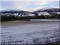
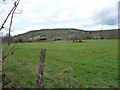
Nearby Images from Geograph Britain and Ireland:
©2012(licence)
©2009(licence)
©2012(licence)
©2007(licence)
©2012(licence)
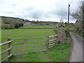
The above images may not be of the site on this page, they are loaded from Geograph.
Please Submit an Image of this site or go out and take one for us!
Click here to see more info for this site
Nearby sites
Key: Red: member's photo, Blue: 3rd party photo, Yellow: other image, Green: no photo - please go there and take one, Grey: site destroyed
Download sites to:
KML (Google Earth)
GPX (GPS waypoints)
CSV (Garmin/Navman)
CSV (Excel)
To unlock full downloads you need to sign up as a Contributory Member. Otherwise downloads are limited to 50 sites.
Turn off the page maps and other distractions
Nearby sites listing. In the following links * = Image available
1.1km E 79° Tretower* Standing Stone (Menhir) (SO180219)
1.1km SSE 156° Myarth Camp Hillfort (SO174207)
1.9km SW 224° Llwyn-Y-Fedwen* Standing Stone (Menhir) (SO15622039)
1.9km W 276° Bwlch Standing Stone* Standing Stone (Menhir) (SO15052195)
2.0km NW 306° Bwlch Ring Cairn* Ring Cairn (SO154229)
2.2km N 350° Cwmdu Stone Circle (SO166239)
2.3km SE 144° Penmyarth* Standing Stone (Menhir) (SO18291986)
2.4km NNE 15° Coed y Gaer Hillfort (SO176240)
2.4km NNE 26° Llanfihangel Cwmdu* Ancient Cross (SO18052384)
2.4km NW 325° Cefn Moel Round Barrow(s) (SO156237)
2.7km NNW 337° Cefn Moel Stone Row / Alignment (SO15932421)
2.7km NNE 13° Coed y Gaer Cairn Cairn (SO1759324348)
2.8km SW 221° Castle Farm Stone* Standing Stone (Menhir) (SO1507319635)
3.6km ENE 64° Pen Gloch Y Pibwr* Cairn (SO2020123205)
3.7km E 97° Craig Llwyn* Ancient Village or Settlement (SO206212)
4.2km SE 141° Ffawyddog Gaer Hillfort (SO196184)
4.4km S 187° Carreg Waen Llech* Standing Stone (Menhir) (SO1638717378)
4.4km N 354° Mynydd Llangorse 1 Ring Cairn (SO166261)
4.4km N 354° Mynydd Llangorse 2 Ring Cairn (SO166261)
4.4km WSW 249° The Llanddetty Stone Ancient Cross (SO12802023)
4.5km NE 54° Pen Alltmawr Cairns* Cairn (SO2069024330)
4.8km E 81° Pen Cerrig-calch* Cairn (SO21702236)
4.8km SE 130° Llan-Wysg Well* Holy Well or Sacred Spring (SO2060318584)
4.8km ESE 120° Gwernvale* Chambered Tomb (SO2111119217)
5.1km WNW 300° Allt-Yr-Yscrin* Cairn (SO12612435)
View more nearby sites and additional images


 We would like to know more about this location. Please feel free to add a brief description and any relevant information in your own language.
 Wir möchten mehr über diese Stätte erfahren. Bitte zögern Sie nicht, eine kurze Beschreibung und relevante Informationen in Deutsch hinzuzufügen.
 Nous aimerions en savoir encore un peu sur les lieux. S'il vous plaît n'hesitez pas à ajouter une courte description et tous les renseignements pertinents dans votre propre langue.
 Quisieramos informarnos un poco más de las lugares. No dude en añadir una breve descripción y otros datos relevantes en su propio idioma.