<< Text Pages >> Dunbrae Broch - Broch or Nuraghe in Scotland in Caithness
Submitted by SolarMegalith on Thursday, 11 November 2010 Page Views: 3235
Iron Age and Later PrehistorySite Name: Dunbrae Broch Alternative Name: Ballentink 2Country: Scotland County: Caithness Type: Broch or Nuraghe
Nearest Town: Wick Nearest Village: Dunbeath
Map Ref: ND15323098
Latitude: 58.259320N Longitude: 3.44477W
Condition:
| 5 | Perfect |
| 4 | Almost Perfect |
| 3 | Reasonable but with some damage |
| 2 | Ruined but still recognisable as an ancient site |
| 1 | Pretty much destroyed, possibly visible as crop marks |
| 0 | No data. |
| -1 | Completely destroyed |
| 5 | Superb |
| 4 | Good |
| 3 | Ordinary |
| 2 | Not Good |
| 1 | Awful |
| 0 | No data. |
| 5 | Can be driven to, probably with disabled access |
| 4 | Short walk on a footpath |
| 3 | Requiring a bit more of a walk |
| 2 | A long walk |
| 1 | In the middle of nowhere, a nightmare to find |
| 0 | No data. |
| 5 | co-ordinates taken by GPS or official recorded co-ordinates |
| 4 | co-ordinates scaled from a detailed map |
| 3 | co-ordinates scaled from a bad map |
| 2 | co-ordinates of the nearest village |
| 1 | co-ordinates of the nearest town |
| 0 | no data |
Internal Links:
External Links:
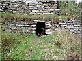
Broch in Caithness.
Remains of a broch which currently appears as a grassy mound with little remains of stone walls. The mound is 20 metres in diameter and just over 1.5 metres high and is located west from the Rhemullen bridge.
You may be viewing yesterday's version of this page. To see the most up to date information please register for a free account.
Do not use the above information on other web sites or publications without permission of the contributor.
Nearby Images from Geograph Britain and Ireland:
©2007(licence)
©2007(licence)
©2007(licence)
©2010(licence)
©2008(licence)
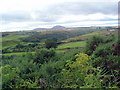
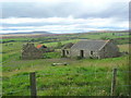
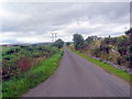
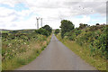
The above images may not be of the site on this page, they are loaded from Geograph.
Please Submit an Image of this site or go out and take one for us!
Click here to see more info for this site
Nearby sites
Key: Red: member's photo, Blue: 3rd party photo, Yellow: other image, Green: no photo - please go there and take one, Grey: site destroyed
Download sites to:
KML (Google Earth)
GPX (GPS waypoints)
CSV (Garmin/Navman)
CSV (Excel)
To unlock full downloads you need to sign up as a Contributory Member. Otherwise downloads are limited to 50 sites.
Turn off the page maps and other distractions
Nearby sites listing. In the following links * = Image available
440m NW 326° Bridge of Rhemullen Broch or Nuraghe (ND15083135)
606m SSE 162° Dunbeath* Broch or Nuraghe (ND155304)
778m SSE 150° Ballachly Carved Stones* Early Christian Sculptured Stone (ND157303)
1.3km NNE 31° Achnagoul* Standing Stone (Menhir) (ND16023207)
1.7km NW 308° Cairn Liath* Chambered Cairn (ND14033205)
1.7km WSW 252° Achorn Broch or Nuraghe (ND13693050)
1.7km NW 309° Loedebest* Chambered Cairn (ND14003209)
1.7km NNE 22° Achnagoul circle Stone Circle (ND16013256)
2.3km E 87° Knockinnon* Broch or Nuraghe (ND17643105)
2.3km WNW 303° Loedebest West* Chambered Cairn (ND13383229)
2.8km NE 55° Latheronwheel Mains Broch or Nuraghe (ND17623251)
3.1km NW 313° Cnoc Na Maranaich* Chambered Cairn (ND131331)
3.2km ENE 76° Latheronwheel Chambered Cairn Chambered Cairn (ND18443168)
3.3km N 4° Houstry* Standing Stone (Menhir) (ND156343)
3.5km WSW 258° Bad Nan Glac Ancient Village or Settlement (ND119303)
3.7km NE 40° Smerral Broch or Nuraghe (ND17803379)
4.0km NE 55° Latheronwheel Stone Circle (ND186332)
4.2km N 358° Tiantulloch* Broch or Nuraghe (ND15243522)
4.4km SW 235° Burg Ruadh Broch or Nuraghe (ND11602852)
4.8km SW 215° Upper Borgue Broch Broch or Nuraghe (ND12432708)
5.0km NNE 33° Guidebest* Stone Circle (ND181351)
5.1km SSW 211° Upper Borgue Standing Stone* Standing Stone (Menhir) (ND12632665)
5.2km ENE 61° Latheron 2* Class I Pictish Symbol Stone (ND19903343)
5.2km SSW 207° The Two Dogs* Standing Stone (Menhir) (ND1281026389)
5.4km ENE 58° Latheron Standing Stone* Standing Stone (Menhir) (ND19923374)
View more nearby sites and additional images


 We would like to know more about this location. Please feel free to add a brief description and any relevant information in your own language.
 Wir möchten mehr über diese Stätte erfahren. Bitte zögern Sie nicht, eine kurze Beschreibung und relevante Informationen in Deutsch hinzuzufügen.
 Nous aimerions en savoir encore un peu sur les lieux. S'il vous plaît n'hesitez pas à ajouter une courte description et tous les renseignements pertinents dans votre propre langue.
 Quisieramos informarnos un poco más de las lugares. No dude en añadir una breve descripción y otros datos relevantes en su propio idioma.