


<< Our Photo Pages >> Whitrow Beck - Stone Circle in England in Cumbria
Submitted by LivingRocks on Saturday, 06 August 2005 Page Views: 8539
Neolithic and Bronze AgeSite Name: Whitrow BeckCountry: England County: Cumbria Type: Stone Circle
Nearest Town: Millom Nearest Village: Waberthwaite
Map Ref: SD13429387
Latitude: 54.333019N Longitude: 3.332985W
Condition:
| 5 | Perfect |
| 4 | Almost Perfect |
| 3 | Reasonable but with some damage |
| 2 | Ruined but still recognisable as an ancient site |
| 1 | Pretty much destroyed, possibly visible as crop marks |
| 0 | No data. |
| -1 | Completely destroyed |
| 5 | Superb |
| 4 | Good |
| 3 | Ordinary |
| 2 | Not Good |
| 1 | Awful |
| 0 | No data. |
| 5 | Can be driven to, probably with disabled access |
| 4 | Short walk on a footpath |
| 3 | Requiring a bit more of a walk |
| 2 | A long walk |
| 1 | In the middle of nowhere, a nightmare to find |
| 0 | No data. |
| 5 | co-ordinates taken by GPS or official recorded co-ordinates |
| 4 | co-ordinates scaled from a detailed map |
| 3 | co-ordinates scaled from a bad map |
| 2 | co-ordinates of the nearest village |
| 1 | co-ordinates of the nearest town |
| 0 | no data |
Internal Links:
External Links:
I have visited· I would like to visit
Mikestavros would like to visit
")
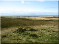
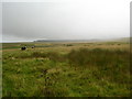
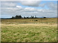
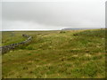
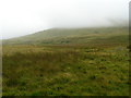
The circle is sited next to the well preserved remains of a Romano British Enclosure into the walls of which some of the stones on the Western side have been incorporated. The circle although quite ruinous is easily recognized, although a number of the stones are hidden by tall grasses.
The extensive site, of which the circle is a part, bears evidence of long term occupation, containing not only the circle and enclosure but four substantial cairnfields, several stone banks, an ancient trackway, hut circles, and the remains of a medieval field system.
For more information see Pastscape Monument No. 37533.
You may be viewing yesterday's version of this page. To see the most up to date information please register for a free account.
")
")
")
Do not use the above information on other web sites or publications without permission of the contributor.
Nearby Images from Geograph Britain and Ireland:
©2015(licence)
©2007(licence)
©2015(licence)
©2007(licence)
©2007(licence)
The above images may not be of the site on this page, they are loaded from Geograph.
Please Submit an Image of this site or go out and take one for us!
Click here to see more info for this site
Nearby sites
Key: Red: member's photo, Blue: 3rd party photo, Yellow: other image, Green: no photo - please go there and take one, Grey: site destroyed
Download sites to:
KML (Google Earth)
GPX (GPS waypoints)
CSV (Garmin/Navman)
CSV (Excel)
To unlock full downloads you need to sign up as a Contributory Member. Otherwise downloads are limited to 50 sites.
Turn off the page maps and other distractions
Nearby sites listing. In the following links * = Image available
1.9km N 352° Barnscar Settlement, Birkby Fell* Ancient Village or Settlement (SD132958)
3.3km SSE 146° Buckbarrow Crag, Hare Raise, Burn Moor and Whitfell Cairn (SD152911)
3.6km WNW 289° Waberthwaite Cross* Ancient Cross (SD10039510)
4.0km NW 311° St Michaels Church, Muncaster Castle* Ancient Cross (SD10399656)
4.1km NNE 32° Devoke Water and Water Crag* Ring Cairn (SD1563397273)
4.8km S 180° Bootle Fell Cairns* Cairn (SD1331989116)
4.8km S 177° Bootle Fell Round Cairn 1* Round Cairn (SD1354789043)
4.8km S 180° Bootle Fell Round Cairn 4* Round Cairn (SD1333389018)
5.0km WNW 293° Roman Bath House, Ravenglass, Cumbria* Ancient Village or Settlement (SD0882795927)
5.1km S 180° Bootle Fell Round Cairn 2/3* Round Cairn (SD1336388790)
5.2km ENE 64° Brown Rigg Round Cairn* Round Cairn (SD1812396059)
5.5km W 281° Glannoventa* Ancient Village or Settlement (SD0895)
5.5km ENE 63° Wormkragg Stiner Stone Row / Alignment (SD184963)
5.7km SE 125° Beckstones and Logan Beck Bridge* Ancient Village or Settlement (SD18069051)
5.9km ESE 111° Frith Hall* Ancient Village or Settlement (SD189916)
6.3km SE 129° Thwaites Fell* Standing Stone (Menhir) (SD1824089813)
6.8km SE 146° Swinside* Stone Circle (SD17168817)
7.8km E 99° Tarn Hill Cairn* Ring Cairn (SD211925)
7.8km NW 326° Irton Cross* Ancient Cross (NY0916000455)
8.0km NE 35° St Catherine's Well (Boot)* Holy Well or Sacred Spring (NY18150030)
8.0km NE 46° Low Birker Tarn Cairn* Cairn (SD1928099379)
8.0km WNW 290° Drigg sand dunes* Ancient Mine, Quarry or other Industry (SD059968)
8.1km N 353° Irton Pike Ring Cairn Ring Cairn (NY1261601907)
8.4km S 178° Black Combe* Cairn (SD135855)
8.5km SSW 194° Hall Foss Stone Circle (SD112857)
View more nearby sites and additional images


 We would like to know more about this location. Please feel free to add a brief description and any relevant information in your own language.
 Wir möchten mehr über diese Stätte erfahren. Bitte zögern Sie nicht, eine kurze Beschreibung und relevante Informationen in Deutsch hinzuzufügen.
 Nous aimerions en savoir encore un peu sur les lieux. S'il vous plaît n'hesitez pas à ajouter une courte description et tous les renseignements pertinents dans votre propre langue.
 Quisieramos informarnos un poco más de las lugares. No dude en añadir una breve descripción y otros datos relevantes en su propio idioma.