


<< Image Pages >> Barnscar Settlement, Birkby Fell - Ancient Village or Settlement in England in Cumbria
Submitted by durhamnature on Tuesday, 30 October 2012 Page Views: 6056
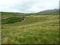
Multi-periodSite Name: Barnscar Settlement, Birkby Fell Alternative Name: Birkby FellCountry: England County: Cumbria Type: Ancient Village or Settlement
Map Ref: SD132958
Latitude: 54.350322N Longitude: 3.33693W
Condition:
| 5 | Perfect |
| 4 | Almost Perfect |
| 3 | Reasonable but with some damage |
| 2 | Ruined but still recognisable as an ancient site |
| 1 | Pretty much destroyed, possibly visible as crop marks |
| 0 | No data. |
| -1 | Completely destroyed |
| 5 | Superb |
| 4 | Good |
| 3 | Ordinary |
| 2 | Not Good |
| 1 | Awful |
| 0 | No data. |
| 5 | Can be driven to, probably with disabled access |
| 4 | Short walk on a footpath |
| 3 | Requiring a bit more of a walk |
| 2 | A long walk |
| 1 | In the middle of nowhere, a nightmare to find |
| 0 | No data. |
| 5 | co-ordinates taken by GPS or official recorded co-ordinates |
| 4 | co-ordinates scaled from a detailed map |
| 3 | co-ordinates scaled from a bad map |
| 2 | co-ordinates of the nearest village |
| 1 | co-ordinates of the nearest town |
| 0 | no data |
Be the first person to rate this site - see the 'Contribute!' box in the right hand menu.
Internal Links:
External Links:
")
You may be viewing yesterday's version of this page. To see the most up to date information please register for a free account.
Do not use the above information on other web sites or publications without permission of the contributor.
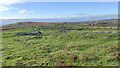
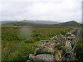
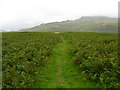
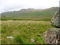
Nearby Images from Geograph Britain and Ireland:
©2023(licence)
©2007(licence)
©2007(licence)
©2007(licence)
©2007(licence)
The above images may not be of the site on this page, they are loaded from Geograph.
Please Submit an Image of this site or go out and take one for us!
Click here to see more info for this site
Nearby sites
Key: Red: member's photo, Blue: 3rd party photo, Yellow: other image, Green: no photo - please go there and take one, Grey: site destroyed
Download sites to:
KML (Google Earth)
GPX (GPS waypoints)
CSV (Garmin/Navman)
CSV (Excel)
To unlock full downloads you need to sign up as a Contributory Member. Otherwise downloads are limited to 50 sites.
Turn off the page maps and other distractions
Nearby sites listing. In the following links * = Image available
1.9km S 172° Whitrow Beck* Stone Circle (SD13429387)
2.8km ENE 58° Devoke Water and Water Crag* Ring Cairn (SD1563397273)
2.9km WNW 284° St Michaels Church, Muncaster Castle* Ancient Cross (SD10399656)
3.2km WSW 256° Waberthwaite Cross* Ancient Cross (SD10039510)
4.4km W 271° Roman Bath House, Ravenglass, Cumbria* Ancient Village or Settlement (SD0882795927)
4.9km E 86° Brown Rigg Round Cairn* Round Cairn (SD1812396059)
5.1km SSE 156° Buckbarrow Crag, Hare Raise, Burn Moor and Whitfell Cairn (SD152911)
5.2km E 83° Wormkragg Stiner Stone Row / Alignment (SD184963)
5.2km W 260° Glannoventa* Ancient Village or Settlement (SD0895)
6.1km N 353° Irton Pike Ring Cairn Ring Cairn (NY1261601907)
6.2km NW 318° Irton Cross* Ancient Cross (NY0916000455)
6.7km NE 47° St Catherine's Well (Boot)* Holy Well or Sacred Spring (NY18150030)
6.7km S 178° Bootle Fell Cairns* Cairn (SD1331989116)
6.8km S 176° Bootle Fell Round Cairn 1* Round Cairn (SD1354789043)
6.8km S 178° Bootle Fell Round Cairn 4* Round Cairn (SD1333389018)
7.0km S 178° Bootle Fell Round Cairn 2/3* Round Cairn (SD1336388790)
7.1km SE 125° Frith Hall* Ancient Village or Settlement (SD189916)
7.2km SE 136° Beckstones and Logan Beck Bridge* Ancient Village or Settlement (SD18069051)
7.3km W 277° Drigg sand dunes* Ancient Mine, Quarry or other Industry (SD059968)
7.5km NE 35° Boot cairn circle* Cairn (NY17630189)
7.7km NNE 30° White Moss SW* Stone Circle (NY17250239)
7.7km NNE 31° Brat's Hill* Stone Circle (NY17370234)
7.8km NNE 31° White Moss NE* Stone Circle (NY17300241)
7.8km SE 139° Thwaites Fell* Standing Stone (Menhir) (SD1824089813)
8.0km NNE 29° Low Longrigg SW* Stone Circle (NY172027)
View more nearby sites and additional images


 We would like to know more about this location. Please feel free to add a brief description and any relevant information in your own language.
 Wir möchten mehr über diese Stätte erfahren. Bitte zögern Sie nicht, eine kurze Beschreibung und relevante Informationen in Deutsch hinzuzufügen.
 Nous aimerions en savoir encore un peu sur les lieux. S'il vous plaît n'hesitez pas à ajouter une courte description et tous les renseignements pertinents dans votre propre langue.
 Quisieramos informarnos un poco más de las lugares. No dude en añadir una breve descripción y otros datos relevantes en su propio idioma.