

<< Our Photo Pages >> Tormain Hill - Rock Art in Scotland in Midlothian
Submitted by vicky on Sunday, 22 December 2002 Page Views: 10750
Rock ArtSite Name: Tormain Hill Alternative Name: Bonnington MainsCountry: Scotland County: Midlothian Type: Rock Art
Nearest Town: Ratho Nearest Village: Tormain Hill
Map Ref: NT12906967 Landranger Map Number: 65
Latitude: 55.912214N Longitude: 3.394981W
Condition:
| 5 | Perfect |
| 4 | Almost Perfect |
| 3 | Reasonable but with some damage |
| 2 | Ruined but still recognisable as an ancient site |
| 1 | Pretty much destroyed, possibly visible as crop marks |
| 0 | No data. |
| -1 | Completely destroyed |
| 5 | Superb |
| 4 | Good |
| 3 | Ordinary |
| 2 | Not Good |
| 1 | Awful |
| 0 | No data. |
| 5 | Can be driven to, probably with disabled access |
| 4 | Short walk on a footpath |
| 3 | Requiring a bit more of a walk |
| 2 | A long walk |
| 1 | In the middle of nowhere, a nightmare to find |
| 0 | No data. |
| 5 | co-ordinates taken by GPS or official recorded co-ordinates |
| 4 | co-ordinates scaled from a detailed map |
| 3 | co-ordinates scaled from a bad map |
| 2 | co-ordinates of the nearest village |
| 1 | co-ordinates of the nearest town |
| 0 | no data |
Be the first person to rate this site - see the 'Contribute!' box in the right hand menu.
Internal Links:
External Links:
I have visited· I would like to visit
schwagmyre has visited here
")
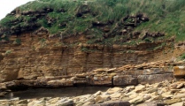
These cup and ring marked rocks, centred around NT 1290 6967, are recorded as Canmore ID 50365, a 1969 entry describing them as "several cup-and-ring markings have been found on outcropping rock surface on the highest point of Tormain Hill. They occur on eight outcrops in one area measuring c.15 yds by 7yds. The markings include plain cups, cups with rings, concentric circles and gutters." Later entries from 1985 and 2014 include a publication account and field visit, the latter having detailed descriptions of each of the panels.
This standing stone is also featured on The Ancient Stones: A Guide to Standing Stones and Stone Circles in the South of Scotland - see their entry for Inscribed Stones, Tormain Hill, Ratho, which includes a description, directions for finding this stone together with nearby parking, folklore and fieldnotes.
You may be viewing yesterday's version of this page. To see the most up to date information please register for a free account.
")
")
")
")
")
")
")
")
")
")
")
Do not use the above information on other web sites or publications without permission of the contributor.
Click here to see more info for this site
Nearby sites
Key: Red: member's photo, Blue: 3rd party photo, Yellow: other image, Green: no photo - please go there and take one, Grey: site destroyed
Download sites to:
KML (Google Earth)
GPX (GPS waypoints)
CSV (Garmin/Navman)
CSV (Excel)
To unlock full downloads you need to sign up as a Contributory Member. Otherwise downloads are limited to 50 sites.
Turn off the page maps and other distractions
Nearby sites listing. In the following links * = Image available
180m WNW 288° Witches' Stone (Ratho)* Rock Art (NT12736973)
1.4km N 10° Witchis Stane* Standing Stone (Menhir) (NT13177104)
2.7km ESE 117° Newhouse Standing Stone Standing Stone (Menhir) (NT15296838)
2.8km SSE 167° Dalmahoy Hill Hillfort (NT135669)
3.0km N 354° Lochend menhir* Standing Stone (Menhir) (NT12667263)
3.0km NNW 348° Huly Hill Cairn* Round Cairn (NT1234272610)
3.0km NNW 348° Huly Hill Standing Stones* Standing Stones (NT1234272610)
3.1km SSW 207° Kirknewton stone Sculptured Stone (NT11426693)
3.2km S 177° Kaimes Standing Stones (NT130665)
3.5km NE 47° Gogar Stone* Standing Stone (Menhir) (NT15487199)
5.0km N 9° Carlowrie (Kirkliston) Rock Art (NT138746)
5.1km NNE 22° Cat Stane (Kirkliston)* Standing Stone (Menhir) (NT1489374373)
5.8km ESE 109° St Mungo's Well (Edinburgh)* Holy Well or Sacred Spring (NT18346773)
6.8km NE 41° Cammo Stone* Standing Stone (Menhir) (NT1747774681)
6.9km NW 326° Winchburgh Enclosure* Misc. Earthwork (NT09097547)
7.3km ENE 66° Physic Well (Corstorphine)* Holy Well or Sacred Spring (NT19597252)
7.3km ENE 65° Lady Well* Holy Well or Sacred Spring (NT196726)
7.6km ESE 112° Clubbiedean Fort* Promontory Fort / Cliff Castle (NT19956671)
8.5km NNE 12° Crossall Hill (South Queensferry)* Ancient Cross (NT14907791)
8.7km N 358° Bell Stane (Queensferry) Standing Stone (Menhir) (NT12827840)
9.3km NNW 328° Justice Stone Standing Stone (Menhir) (NT08087759)
9.5km NE 38° Cramond Ancient Village or Settlement (NT18957706)
9.9km E 87° Craiglockart Hill Vitrified Fort Hillfort (NT22827006)
10.5km NNW 332° Abercorn* Sculptured Stone (NT08147910)
10.7km ENE 67° Succoth Place Double Cist Burial Cist (NT22897362)
View more nearby sites and additional images


 We would like to know more about this location. Please feel free to add a brief description and any relevant information in your own language.
 Wir möchten mehr über diese Stätte erfahren. Bitte zögern Sie nicht, eine kurze Beschreibung und relevante Informationen in Deutsch hinzuzufügen.
 Nous aimerions en savoir encore un peu sur les lieux. S'il vous plaît n'hesitez pas à ajouter une courte description et tous les renseignements pertinents dans votre propre langue.
 Quisieramos informarnos un poco más de las lugares. No dude en añadir una breve descripción y otros datos relevantes en su propio idioma.