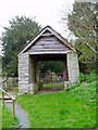
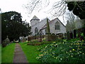
<< Our Photo Pages >> St Mathew's Church Well - Holy Well or Sacred Spring in Wales in Powys
Submitted by coldrum on Wednesday, 17 June 2009 Page Views: 3400
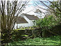
Springs and Holy WellsSite Name: St Mathew's Church WellCountry: Wales
NOTE: This site is 2.2 km away from the location you searched for.
County: Powys Type: Holy Well or Sacred Spring
Nearest Village: Felinfach
Map Ref: SO107355
Latitude: 52.010720N Longitude: 3.302501W
Condition:
| 5 | Perfect |
| 4 | Almost Perfect |
| 3 | Reasonable but with some damage |
| 2 | Ruined but still recognisable as an ancient site |
| 1 | Pretty much destroyed, possibly visible as crop marks |
| 0 | No data. |
| -1 | Completely destroyed |
| 5 | Superb |
| 4 | Good |
| 3 | Ordinary |
| 2 | Not Good |
| 1 | Awful |
| 0 | No data. |
| 5 | Can be driven to, probably with disabled access |
| 4 | Short walk on a footpath |
| 3 | Requiring a bit more of a walk |
| 2 | A long walk |
| 1 | In the middle of nowhere, a nightmare to find |
| 0 | No data. |
| 5 | co-ordinates taken by GPS or official recorded co-ordinates |
| 4 | co-ordinates scaled from a detailed map |
| 3 | co-ordinates scaled from a bad map |
| 2 | co-ordinates of the nearest village |
| 1 | co-ordinates of the nearest town |
| 0 | no data |
Be the first person to rate this site - see the 'Contribute!' box in the right hand menu.
Internal Links:
External Links:
I have visited· I would like to visit
AJHL visited on 18th Feb 2023 - their rating: Cond: 2 Amb: 2 Access: 4 A rather disappointing site, it’s been capped with concrete and a modern drain cover. The water trickles out in to an overgrown marshy area. The church is worth a visit though. Very interesting leper’s squint.
geoffstickland have visited here
")
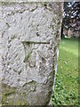
Depression 1.0m square and 0.5m deep, in St Mathew's churchyard.
Coflein entry:
Coflein ID 306027.
You may be viewing yesterday's version of this page. To see the most up to date information please register for a free account.
")
Do not use the above information on other web sites or publications without permission of the contributor.
Nearby Images from Geograph Britain and Ireland:
©2006(licence)
©2015(licence)
©2014(licence)
©2009(licence)
©2012(licence)
The above images may not be of the site on this page, they are loaded from Geograph.
Please Submit an Image of this site or go out and take one for us!
Click here to see more info for this site
Nearby sites
Key: Red: member's photo, Blue: 3rd party photo, Yellow: other image, Green: no photo - please go there and take one, Grey: site destroyed
Download sites to:
KML (Google Earth)
GPX (GPS waypoints)
CSV (Garmin/Navman)
CSV (Excel)
To unlock full downloads you need to sign up as a Contributory Member. Otherwise downloads are limited to 50 sites.
Turn off the page maps and other distractions
Nearby sites listing. In the following links * = Image available
806m S 186° Tre Durn Wood Fort Hillfort (SO106347)
2.8km SSE 166° Llanfilo Camp* Hillfort (SO113328)
2.8km S 173° Weston Camp* Hillfort (SO110327)
3.2km NE 40° Llyswen Camp Hillfort (SO128379)
3.3km NE 46° Bronllys 1 Round Barrow(s) (SO131377)
4.4km NNE 20° Llangoed Maen Hir* Standing Stone (Menhir) (SO123396)
4.4km NNE 24° Boughrood Tumulus* Round Barrow(s) (SO126395)
5.3km W 266° Twyn-y-Gaer (Llaneglwys)* Hillfort (SO054352)
5.6km ESE 120° Talgarth Hillfort (SO155326)
5.6km ENE 70° Pipton* Chambered Tomb (SO16043729)
5.9km SE 131° Penywyrlod* Chambered Tomb (SO15053156)
6.0km NNE 18° Neuadd-Glan-Gwy* Standing Stone (Menhir) (SO1263641167)
6.0km ENE 65° Spread Eagle Cursus Cursus (SO16203795)
6.0km ENE 66° Spread Eagle Cursus Cursus (SO16283784)
6.2km E 87° Croes-llechau (Bronllys) Long Barrow (SO169357)
6.6km ENE 66° Bronllys 2* Round Barrow(s) (SO16783811)
6.7km N 9° St Steffan Church* Holy Well or Sacred Spring (SO119421)
6.9km NNW 343° Camp (Powys)* Hillfort (SO088421)
6.9km SSW 201° Twyn-Llechfaen* Hillfort (SO081291)
7.0km SW 227° Bishop Gower's Well* Holy Well or Sacred Spring (SO0551330776)
7.1km ENE 72° Gweryfed Park* Hillfort (SO17503759)
7.2km E 94° Ffostil South Chambered Long Barrow* Chambered Tomb (SO179349)
7.2km E 93° Ffostil North Chambered Long Barrow* Chambered Tomb (SO17913495)
7.2km NW 320° Wanu Gunllwch Ring Cairn (SO061411)
7.9km ENE 68° Coed-y-Polyn Cairn (SO18083832)
View more nearby sites and additional images


 We would like to know more about this location. Please feel free to add a brief description and any relevant information in your own language.
 Wir möchten mehr über diese Stätte erfahren. Bitte zögern Sie nicht, eine kurze Beschreibung und relevante Informationen in Deutsch hinzuzufügen.
 Nous aimerions en savoir encore un peu sur les lieux. S'il vous plaît n'hesitez pas à ajouter une courte description et tous les renseignements pertinents dans votre propre langue.
 Quisieramos informarnos un poco más de las lugares. No dude en añadir una breve descripción y otros datos relevantes en su propio idioma.