

<< Our Photo Pages >> Grave of Diarmid - Stone Circle in Scotland in Perth and Kinross
Submitted by cosmic on Friday, 10 March 2023 Page Views: 10170
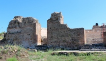
Neolithic and Bronze AgeSite Name: Grave of Diarmid Alternative Name: Spittal of GlensheeCountry: Scotland County: Perth and Kinross Type: Stone Circle
Nearest Village: Spittal of Glenshee
Map Ref: NO117701
Latitude: 56.813991N Longitude: 3.447978W
Condition:
| 5 | Perfect |
| 4 | Almost Perfect |
| 3 | Reasonable but with some damage |
| 2 | Ruined but still recognisable as an ancient site |
| 1 | Pretty much destroyed, possibly visible as crop marks |
| 0 | No data. |
| -1 | Completely destroyed |
| 5 | Superb |
| 4 | Good |
| 3 | Ordinary |
| 2 | Not Good |
| 1 | Awful |
| 0 | No data. |
| 5 | Can be driven to, probably with disabled access |
| 4 | Short walk on a footpath |
| 3 | Requiring a bit more of a walk |
| 2 | A long walk |
| 1 | In the middle of nowhere, a nightmare to find |
| 0 | No data. |
| 5 | co-ordinates taken by GPS or official recorded co-ordinates |
| 4 | co-ordinates scaled from a detailed map |
| 3 | co-ordinates scaled from a bad map |
| 2 | co-ordinates of the nearest village |
| 1 | co-ordinates of the nearest town |
| 0 | no data |
Internal Links:
External Links:
I have visited· I would like to visit
ivrig visited on 19th Mar 2024 - their rating: Cond: 4 Amb: 4 Access: 3 A 20-30 min walk along the Cateran Trail from Spittal of Glenshee, off the A93, signposted 'Kirkton of Glenisla'
bishop_pam visited on 10th Apr 2018 - their rating: Cond: 5 Amb: 4 Access: 3 From Spittal of Glenshee walk along the Cateran Trail, over one cattle grid, past one bothy. Just before the second cattle grid/bothy take the grass trail forking up to the left and steeply up. The grave is a mound with four stones at the top.
Average ratings for this site from all visit loggers: Condition: 4.5 Ambience: 4 Access: 3
")
You may be viewing yesterday's version of this page. To see the most up to date information please register for a free account.
")
")
")
")
")
")
")
")
")
")
")
")
")
")
Do not use the above information on other web sites or publications without permission of the contributor.
Click here to see more info for this site
Nearby sites
Key: Red: member's photo, Blue: 3rd party photo, Yellow: other image, Green: no photo - please go there and take one, Grey: site destroyed
Download sites to:
KML (Google Earth)
GPX (GPS waypoints)
CSV (Garmin/Navman)
CSV (Excel)
To unlock full downloads you need to sign up as a Contributory Member. Otherwise downloads are limited to 50 sites.
Turn off the page maps and other distractions
Nearby sites listing. In the following links * = Image available
780m W 264° Spittal of Glenshee Modern Stone Circle* Modern Stone Circle etc (NO10927004)
836m W 275° Spittal of Glenshee Standing Stone* Standing Stone (Menhir) (NO1086770194)
3.1km N 7° Gleann Beag Stone Circle (NO12127318)
3.3km NNE 17° Cleann Beag Cairn* Cairn (NO12737327)
3.7km SE 145° Broughdearg* Stone Circle (NO1374567047)
5.8km SW 226° Faire na Paitig* Stone Circle (NO07456620)
7.3km SW 217° Slimestone* Standing Stone (Menhir) (NO0722364367)
7.7km S 174° Glenkilrie Stone Circle (NO123624)
9.1km SW 220° Croft House Stone* Standing Stone (Menhir) (NO057633)
9.1km SW 215° Giant's Grave, Enochdhu* Standing Stone (Menhir) (NO06296279)
9.1km SW 217° Enochdhu* Standing Stone (Menhir) (NO060630)
9.2km SW 220° Kindrogan Standing Stones (NO056632)
9.2km SW 230° Witch's Stone, Straloch Standing Stone (Menhir) (NO04516431)
10.1km SSE 158° The Borland Stone* Standing Stone (Menhir) (NO1536160677)
10.1km SW 230° Straloch* Standing Stone (Menhir) (NO038637)
10.9km SSW 198° Kirkmichael Stone Circle (NO08085985)
13.6km S 189° Balnabroich* Standing Stones (NO0917556752)
15.0km SSW 200° Pitcarmick Burn Standing Stone (Menhir) (NO06165610)
16.6km SSE 155° Drumderg 1 (Tullymurdoch) Rock Art (NO18525497)
17.9km SSE 162° Rannagulzion Standing Stone (Menhir) (NO1753)
18.2km S 178° Cally Standing Stones (NO118519)
18.2km SW 223° Black Spout Wood Homestead Ancient Village or Settlement (NN990570)
18.8km SSE 153° Alyth Burn Hut Circles Ancient Village or Settlement (NO199531)
20.0km SE 140° Kilry* Standing Stone (Menhir) (NO24325449)
20.1km WSW 237° Balnakeilly* Standing Stone (Menhir) (NN94655944)
View more nearby sites and additional images


 We would like to know more about this location. Please feel free to add a brief description and any relevant information in your own language.
 Wir möchten mehr über diese Stätte erfahren. Bitte zögern Sie nicht, eine kurze Beschreibung und relevante Informationen in Deutsch hinzuzufügen.
 Nous aimerions en savoir encore un peu sur les lieux. S'il vous plaît n'hesitez pas à ajouter une courte description et tous les renseignements pertinents dans votre propre langue.
 Quisieramos informarnos un poco más de las lugares. No dude en añadir una breve descripción y otros datos relevantes en su propio idioma.