<< Text Pages >> Aelwyd Uchaf (Cottage) Barrows - Round Barrow(s) in Wales in Denbighshire
Submitted by coldrum on Wednesday, 27 January 2010 Page Views: 4691
Neolithic and Bronze AgeSite Name: Aelwyd Uchaf (Cottage) BarrowsCountry: Wales County: Denbighshire Type: Round Barrow(s)
Map Ref: SJ0758577185
Latitude: 53.283552N Longitude: 3.387616W
Condition:
| 5 | Perfect |
| 4 | Almost Perfect |
| 3 | Reasonable but with some damage |
| 2 | Ruined but still recognisable as an ancient site |
| 1 | Pretty much destroyed, possibly visible as crop marks |
| 0 | No data. |
| -1 | Completely destroyed |
| 5 | Superb |
| 4 | Good |
| 3 | Ordinary |
| 2 | Not Good |
| 1 | Awful |
| 0 | No data. |
| 5 | Can be driven to, probably with disabled access |
| 4 | Short walk on a footpath |
| 3 | Requiring a bit more of a walk |
| 2 | A long walk |
| 1 | In the middle of nowhere, a nightmare to find |
| 0 | No data. |
| 5 | co-ordinates taken by GPS or official recorded co-ordinates |
| 4 | co-ordinates scaled from a detailed map |
| 3 | co-ordinates scaled from a bad map |
| 2 | co-ordinates of the nearest village |
| 1 | co-ordinates of the nearest town |
| 0 | no data |
Internal Links:
External Links:
Damaged Bronze Age Barrows in Denbighshire (Sir Ddinbych)
A group of three barrows (NPRN 306657 306658 & 306659).
306657 is an irregular oval mound, possibly a natural feature, 39m by 32m and 1.5m to 2.7m high." 306658 has been ploughed down, surviving as a low mound 13m in diameter and 0.7m high. Excavation in 1955 revealed a central in-urned cremation, two secondary cremations and a small bone pommel. A socketed iron axehead, thought to be Iron Age, was recovered from the surface soil." 306659 has been ploughed out and survives as a low mound 20m in diameter and 0.7m high. Excavation in 1956 demonstrated the presence of a central cremation, with urn fragments, within a pseudo-cist, as well as a possible secondary cremation." Source: Coflein.
You may be viewing yesterday's version of this page. To see the most up to date information please register for a free account.
Do not use the above information on other web sites or publications without permission of the contributor.
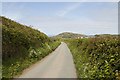
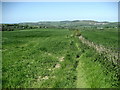
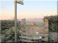
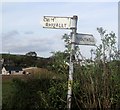
Nearby Images from Geograph Britain and Ireland:
©2019(licence)
©2009(licence)
©2010(licence)
©2017(licence)
©2019(licence)
The above images may not be of the site on this page, they are loaded from Geograph.
Please Submit an Image of this site or go out and take one for us!
Click here to see more info for this site
Nearby sites
Key: Red: member's photo, Blue: 3rd party photo, Yellow: other image, Green: no photo - please go there and take one, Grey: site destroyed
Download sites to:
KML (Google Earth)
GPX (GPS waypoints)
CSV (Garmin/Navman)
CSV (Excel)
To unlock full downloads you need to sign up as a Contributory Member. Otherwise downloads are limited to 50 sites.
Turn off the page maps and other distractions
Nearby sites listing. In the following links * = Image available
567m S 173° Llyn-Y-Gorseddau 3 Round Barrow(s) (SJ07647662)
622m S 170° Llyn-Y-Gorseddau 2 Round Barrow(s) (SJ07687657)
670m NW 306° Marion Bach 1 Round Barrow(s) (SJ07057759)
678m S 173° Llyn-Y-Gorseddau 1 Round Barrow(s) (SJ07657651)
737m NNW 328° Marion Bach 2 Round Barrow(s) (SJ07217782)
770m N 350° Marian Ffrith Hillfort (SJ0746877947)
1.7km NE 51° Cae Bryn Round Barrow(s) (SJ08917821)
1.8km NW 315° Moel Hiraddug* Hillfort (SJ063785)
2.0km ESE 121° Criafol* Round Barrow(s) (SJ09317611)
2.3km ESE 113° Pany Y Dulath Round Barrow(s) (SJ09677624)
2.5km NNE 21° Hen Dy Round Barrow(s) (SJ08547950)
2.6km E 99° Hendre Bach Round Barrow(s) (SJ10137671)
2.8km NW 314° Dyserth Church* Ancient Cross (SJ056792)
3.1km NNE 19° Gop Caves* Cave or Rock Shelter (SJ08648009)
3.1km SSE 158° Moel Maen Efa* Barrow Cemetery (SJ087743)
3.2km NNE 19° Gop-y-Goleuni* Cairn (SJ08668015)
3.2km NNW 335° Graig Fawr (Dyserth)* Standing Stone (Menhir) (SJ06288013)
3.2km NNE 23° Gop Wood Mound* Cairn (SJ08928012)
3.3km N 7° Gop Farm Bone Cave Cave or Rock Shelter (SJ08028041)
3.5km WNW 297° Ffynnon Fair (Rhuddlan)* Holy Well or Sacred Spring (SJ045788)
3.7km NNE 30° Bryn-Y-Odyn* Round Barrow(s) (SJ0952380376)
3.7km ESE 109° Traveller's Inn* Round Barrow(s) (SJ111759)
3.8km N 3° Ty-Uchaf* Round Barrow(s) (SJ07868095)
4.2km NE 41° Axton Barrows Round Barrow(s) (SJ104803)
4.2km SSE 162° Penuchaf Cairn (SJ08837315)
View more nearby sites and additional images


 We would like to know more about this location. Please feel free to add a brief description and any relevant information in your own language.
 Wir möchten mehr über diese Stätte erfahren. Bitte zögern Sie nicht, eine kurze Beschreibung und relevante Informationen in Deutsch hinzuzufügen.
 Nous aimerions en savoir encore un peu sur les lieux. S'il vous plaît n'hesitez pas à ajouter une courte description et tous les renseignements pertinents dans votre propre langue.
 Quisieramos informarnos un poco más de las lugares. No dude en añadir una breve descripción y otros datos relevantes en su propio idioma.