<< Our Photo Pages >> Giant's Grave, Enochdhu - Standing Stone (Menhir) in Scotland in Perth and Kinross
Submitted by BigSweetie on Thursday, 25 March 2004 Page Views: 9728
Neolithic and Bronze AgeSite Name: Giant's Grave, EnochdhuCountry: Scotland County: Perth and Kinross Type: Standing Stone (Menhir)
Nearest Town: Pitlochry Nearest Village: Enochdhu
Map Ref: NO06296279 Landranger Map Number: 43
Latitude: 56.747286N Longitude: 3.533877W
Condition:
| 5 | Perfect |
| 4 | Almost Perfect |
| 3 | Reasonable but with some damage |
| 2 | Ruined but still recognisable as an ancient site |
| 1 | Pretty much destroyed, possibly visible as crop marks |
| 0 | No data. |
| -1 | Completely destroyed |
| 5 | Superb |
| 4 | Good |
| 3 | Ordinary |
| 2 | Not Good |
| 1 | Awful |
| 0 | No data. |
| 5 | Can be driven to, probably with disabled access |
| 4 | Short walk on a footpath |
| 3 | Requiring a bit more of a walk |
| 2 | A long walk |
| 1 | In the middle of nowhere, a nightmare to find |
| 0 | No data. |
| 5 | co-ordinates taken by GPS or official recorded co-ordinates |
| 4 | co-ordinates scaled from a detailed map |
| 3 | co-ordinates scaled from a bad map |
| 2 | co-ordinates of the nearest village |
| 1 | co-ordinates of the nearest town |
| 0 | no data |
Internal Links:
External Links:
I have visited· I would like to visit
Klingon has visited here
")
Have you visited this site? Please add a comment below.
You may be viewing yesterday's version of this page. To see the most up to date information please register for a free account.
")
Do not use the above information on other web sites or publications without permission of the contributor.
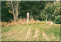
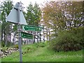
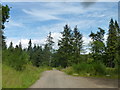
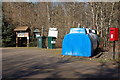
Nearby Images from Geograph Britain and Ireland:
©2008(licence)
©2008(licence)
©2014(licence)
©2012(licence)
©2018(licence)
The above images may not be of the site on this page, they are loaded from Geograph.
Please Submit an Image of this site or go out and take one for us!
Click here to see more info for this site
Nearby sites
Key: Red: member's photo, Blue: 3rd party photo, Yellow: other image, Green: no photo - please go there and take one, Grey: site destroyed
Download sites to:
KML (Google Earth)
GPX (GPS waypoints)
CSV (Garmin/Navman)
CSV (Excel)
To unlock full downloads you need to sign up as a Contributory Member. Otherwise downloads are limited to 50 sites.
Turn off the page maps and other distractions
Nearby sites listing. In the following links * = Image available
357m NW 305° Enochdhu* Standing Stone (Menhir) (NO060630)
778m NW 310° Croft House Stone* Standing Stone (Menhir) (NO057633)
800m WNW 299° Kindrogan Standing Stones (NO056632)
1.8km NNE 29° Slimestone* Standing Stone (Menhir) (NO0722364367)
2.3km NW 309° Witch's Stone, Straloch Standing Stone (Menhir) (NO04516431)
2.6km WNW 289° Straloch* Standing Stone (Menhir) (NO038637)
3.4km SSE 147° Kirkmichael Stone Circle (NO08085985)
3.6km NNE 17° Faire na Paitig* Stone Circle (NO07456620)
6.0km E 92° Glenkilrie Stone Circle (NO123624)
6.7km SSE 153° Balnabroich* Standing Stones (NO0917556752)
6.7km S 180° Pitcarmick Burn Standing Stone (Menhir) (NO06165610)
8.6km ENE 59° Broughdearg* Stone Circle (NO1374567047)
8.6km NNE 31° Spittal of Glenshee Modern Stone Circle* Modern Stone Circle etc (NO10927004)
8.7km NNE 30° Spittal of Glenshee Standing Stone* Standing Stone (Menhir) (NO1086770194)
9.1km NE 35° Grave of Diarmid* Stone Circle (NO117701)
9.3km ESE 102° The Borland Stone* Standing Stone (Menhir) (NO1536160677)
9.3km SW 230° Black Spout Wood Homestead Ancient Village or Settlement (NN990570)
11.9km NNE 28° Gleann Beag Stone Circle (NO12127318)
12.1km WSW 253° Balnakeilly* Standing Stone (Menhir) (NN94655944)
12.2km SSE 152° Cally Standing Stones (NO118519)
12.3km NNE 30° Cleann Beag Cairn* Cairn (NO12737327)
12.5km WSW 253° Dane's Stone* Standing Stone (Menhir) (NN9425559414)
12.7km WSW 250° Cnoc Dubh Stone Circle (NN94245871)
12.7km SW 222° Tigh Na Ruaich* Stone Circle (NN97625346)
12.9km WSW 242° Dunfallandy Cairn* Cairn (NN94745700)
View more nearby sites and additional images


 We would like to know more about this location. Please feel free to add a brief description and any relevant information in your own language.
 Wir möchten mehr über diese Stätte erfahren. Bitte zögern Sie nicht, eine kurze Beschreibung und relevante Informationen in Deutsch hinzuzufügen.
 Nous aimerions en savoir encore un peu sur les lieux. S'il vous plaît n'hesitez pas à ajouter une courte description et tous les renseignements pertinents dans votre propre langue.
 Quisieramos informarnos un poco más de las lugares. No dude en añadir una breve descripción y otros datos relevantes en su propio idioma.