


<< Text Pages >> Carwood Farm - Ancient Village or Settlement in Scotland in North Lanarkshire
Submitted by Andy B on Wednesday, 14 May 2008 Page Views: 5524
Multi-periodSite Name: Carwood FarmCountry: Scotland
NOTE: This site is 1.2 km away from the location you searched for.
County: North Lanarkshire Type: Ancient Village or Settlement
Nearest Town: Biggar
Map Ref: NT039401
Latitude: 55.644908N Longitude: 3.528471W
Condition:
| 5 | Perfect |
| 4 | Almost Perfect |
| 3 | Reasonable but with some damage |
| 2 | Ruined but still recognisable as an ancient site |
| 1 | Pretty much destroyed, possibly visible as crop marks |
| 0 | No data. |
| -1 | Completely destroyed |
| 5 | Superb |
| 4 | Good |
| 3 | Ordinary |
| 2 | Not Good |
| 1 | Awful |
| 0 | No data. |
| 5 | Can be driven to, probably with disabled access |
| 4 | Short walk on a footpath |
| 3 | Requiring a bit more of a walk |
| 2 | A long walk |
| 1 | In the middle of nowhere, a nightmare to find |
| 0 | No data. |
| 5 | co-ordinates taken by GPS or official recorded co-ordinates |
| 4 | co-ordinates scaled from a detailed map |
| 3 | co-ordinates scaled from a bad map |
| 2 | co-ordinates of the nearest village |
| 1 | co-ordinates of the nearest town |
| 0 | no data |
Internal Links:
External Links:
Ancient Settlement in North Lanarkshire. Biggar Archaeology Group have discovered the location of an ancient 5000-6000-year-old settlement site in a ploughed field at Carwood Farm near the town. After only two days walking ploughed fields to look for evidence of the past, an annual Spring event for the group, the ancient site was located.
Tam Ward, group leader, explained: “Last year we found a few flints at this location, and this time the first thing we noticed on the ground were carbonised hazel nut shells and bits of pottery.
“Straight away, we knew this meant the Early Stone Age when the first people to settle on the land built houses, used pottery and farmed the landscape. Such sites are rare in Britain.”
Farmer Colin Wight readily gave permission to dig the site before sowing began on the field and the search was on to find out exactly what lay below the soil.
Tam added: “After two gruelling weekends, we opened a huge trench and found lots of pottery, bits of stone axes and several pits cut into the ground.
“These all contained charcoal which will be analysed and dated to give us a picture of what the landscape would have been like and an accurate date for the site.
“One pit was stuffed with pottery from at least two pots.”
This was discovered by Elliot Veitch, a young archaeologist from Biggar Museums.
The eight-year-old said: “I love archaeology, but never thought I'd find something as old as this. The pottery is older than the pyramids!”
The site is covered over once more but the group will be out searching more fields.
Source: Hamilton Advertiser.
You may be viewing yesterday's version of this page. To see the most up to date information please register for a free account.
Do not use the above information on other web sites or publications without permission of the contributor.
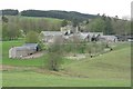
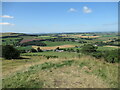
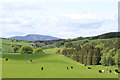
Nearby Images from Geograph Britain and Ireland:
©2019(licence)

©2006(licence)
©2021(licence)

©2006(licence)
©2015(licence)
The above images may not be of the site on this page, they are loaded from Geograph.
Please Submit an Image of this site or go out and take one for us!
Click here to see more info for this site
Nearby sites
Key: Red: member's photo, Blue: 3rd party photo, Yellow: other image, Green: no photo - please go there and take one, Grey: site destroyed
Download sites to:
KML (Google Earth)
GPX (GPS waypoints)
CSV (Garmin/Navman)
CSV (Excel)
To unlock full downloads you need to sign up as a Contributory Member. Otherwise downloads are limited to 50 sites.
Turn off the page maps and other distractions
Nearby sites listing. In the following links * = Image available
2.3km S 176° Moat Park Heritage Centre Museum (NT040378)
4.2km SSW 211° Biggar Cursus Cursus (NT01663657)
5.5km N 358° Tod Holes (Weston) Sculptured Stone (NT03844560)
5.5km NE 44° Howburn Farm Ancient Village or Settlement (NT078440)
5.7km N 350° Weston henge* Henge (NT03004578)
5.9km SE 140° Cleuch Hill* Cairn (NT07573546)
6.3km WSW 245° Boatbridge Quarry Cist (NS981376)
6.4km SSE 157° Mitchelhill Rings Hillfort (NT06283417)
6.5km SE 136° Parkgatestone Hill Ancient Village or Settlement (NT08293529)
7.2km SSW 192° Culterpark Hill* Hillfort (NT02213305)
7.5km S 190° Snaip Hill* Hillfort (NT02463269)
7.6km ENE 58° Netherurd Mains (Kirkurd) Ancient Cross (NT10414403)
7.9km S 181° Nisbet* Hillfort (NT03543216)
8.0km SE 144° Mill Rings Misc. Earthwork (NT08493357)
8.1km SSE 147° Knowe Kniffling* Hillfort (NT08163323)
8.4km WSW 245° Fallburn at Tinto Hillfort (NS96193674)
8.5km ESE 123° Helm End Hillfort (NT10983532)
8.7km SE 129° Whitslade Hill Burnt Mound Artificial Mound (NT10603447)
9.2km NE 52° Shaw Hill (Kirkurd) Misc. Earthwork (NT11334564)
9.3km N 353° Burngrange Cairn (NT029494)
9.5km ENE 62° Harestanes (Kirkurd)* Stone Circle (NT12404432)
9.7km ESE 117° Dreva Craig* Standing Stone (Menhir) (NT12453545)
9.7km SE 127° Piper's Stone Standing Stone (Menhir) (NT11533400)
9.8km NNE 26° Dunsyre cup and ring marked stone* Rock Art (NT084488)
9.9km SE 130° Rachan Hill Henge (NT11423363)
View more nearby sites and additional images


 We would like to know more about this location. Please feel free to add a brief description and any relevant information in your own language.
 Wir möchten mehr über diese Stätte erfahren. Bitte zögern Sie nicht, eine kurze Beschreibung und relevante Informationen in Deutsch hinzuzufügen.
 Nous aimerions en savoir encore un peu sur les lieux. S'il vous plaît n'hesitez pas à ajouter une courte description et tous les renseignements pertinents dans votre propre langue.
 Quisieramos informarnos un poco más de las lugares. No dude en añadir una breve descripción y otros datos relevantes en su propio idioma.