<< Text Pages >> Burngrange - Cairn in Scotland in North Lanarkshire
Submitted by vicky on Sunday, 21 July 2002 Page Views: 8233
Neolithic and Bronze AgeSite Name: BurngrangeCountry: Scotland County: North Lanarkshire Type: Cairn
Map Ref: NT029494 Landranger Map Number: 72
Latitude: 55.728240N Longitude: 3.54765W
Condition:
| 5 | Perfect |
| 4 | Almost Perfect |
| 3 | Reasonable but with some damage |
| 2 | Ruined but still recognisable as an ancient site |
| 1 | Pretty much destroyed, possibly visible as crop marks |
| 0 | No data. |
| -1 | Completely destroyed |
| 5 | Superb |
| 4 | Good |
| 3 | Ordinary |
| 2 | Not Good |
| 1 | Awful |
| 0 | No data. |
| 5 | Can be driven to, probably with disabled access |
| 4 | Short walk on a footpath |
| 3 | Requiring a bit more of a walk |
| 2 | A long walk |
| 1 | In the middle of nowhere, a nightmare to find |
| 0 | No data. |
| 5 | co-ordinates taken by GPS or official recorded co-ordinates |
| 4 | co-ordinates scaled from a detailed map |
| 3 | co-ordinates scaled from a bad map |
| 2 | co-ordinates of the nearest village |
| 1 | co-ordinates of the nearest town |
| 0 | no data |
Be the first person to rate this site - see the 'Contribute!' box in the right hand menu.
Internal Links:
External Links:
Cairn in Lanarkshire
Have you visited this site? Please add a comment below.
You may be viewing yesterday's version of this page. To see the most up to date information please register for a free account.
Do not use the above information on other web sites or publications without permission of the contributor.
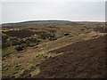
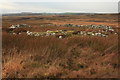
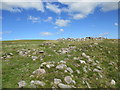
Nearby Images from Geograph Britain and Ireland:
©2006(licence)

©2011(licence)
©2009(licence)
©2020(licence)

©2006(licence)
The above images may not be of the site on this page, they are loaded from Geograph.
Please Submit an Image of this site or go out and take one for us!
Click here to see more info for this site
Nearby sites
Key: Red: member's photo, Blue: 3rd party photo, Yellow: other image, Green: no photo - please go there and take one, Grey: site destroyed
Download sites to:
KML (Google Earth)
GPX (GPS waypoints)
CSV (Garmin/Navman)
CSV (Excel)
To unlock full downloads you need to sign up as a Contributory Member. Otherwise downloads are limited to 50 sites.
Turn off the page maps and other distractions
Nearby sites listing. In the following links * = Image available
2.9km WNW 298° Wester Yard Houses Souterrain* Souterrain (Fogou, Earth House) (NT004508)
3.6km S 177° Weston henge* Henge (NT03004578)
3.9km SSE 165° Tod Holes (Weston) Sculptured Stone (NT03844560)
5.5km E 95° Dunsyre cup and ring marked stone* Rock Art (NT084488)
7.3km SE 137° Howburn Farm Ancient Village or Settlement (NT078440)
9.2km ESE 113° Shaw Hill (Kirkurd) Misc. Earthwork (NT11334564)
9.2km SE 124° Netherurd Mains (Kirkurd) Ancient Cross (NT10414403)
9.3km S 173° Carwood Farm Ancient Village or Settlement (NT039401)
10.7km ESE 117° Harestanes (Kirkurd)* Stone Circle (NT12404432)
11.3km N 4° Cromwell's Stone (West Calder) Natural Stone / Erratic / Other Natural Feature (NT03986068)
11.6km S 173° Moat Park Heritage Centre Museum (NT040378)
12.5km ESE 105° Henderland Hill* Hillfort (NT14964597)
12.7km SSW 201° Boatbridge Quarry Cist (NS981376)
12.9km S 184° Biggar Cursus Cursus (NT01663657)
14.3km SSW 207° Fallburn at Tinto Hillfort (NS96193674)
14.7km SSE 160° Cleuch Hill* Cairn (NT07573546)
15.1km SSE 158° Parkgatestone Hill Ancient Village or Settlement (NT08293529)
15.6km SSE 166° Mitchelhill Rings Hillfort (NT06283417)
16.2km SSE 149° Helm End Hillfort (NT10983532)
16.3km S 181° Culterpark Hill* Hillfort (NT02213305)
16.4km WSW 248° St Patrick's Well (Lanark) Holy Well or Sacred Spring (NS8744443652)
16.7km S 180° Snaip Hill* Hillfort (NT02463269)
16.8km SSE 159° Mill Rings Misc. Earthwork (NT08493357)
16.8km SSE 151° Whitslade Hill Burnt Mound Artificial Mound (NT10603447)
16.9km SE 144° Dreva Craig* Standing Stone (Menhir) (NT12453545)
View more nearby sites and additional images


 We would like to know more about this location. Please feel free to add a brief description and any relevant information in your own language.
 Wir möchten mehr über diese Stätte erfahren. Bitte zögern Sie nicht, eine kurze Beschreibung und relevante Informationen in Deutsch hinzuzufügen.
 Nous aimerions en savoir encore un peu sur les lieux. S'il vous plaît n'hesitez pas à ajouter une courte description et tous les renseignements pertinents dans votre propre langue.
 Quisieramos informarnos un poco más de las lugares. No dude en añadir una breve descripción y otros datos relevantes en su propio idioma.