<< Our Photo Pages >> Llanharan Beacons - Cairn in Wales in Mid Glamorgan
Submitted by sem on Friday, 27 December 2013 Page Views: 3664
Neolithic and Bronze AgeSite Name: Llanharan Beacons Alternative Name: The BeaconsCountry: Wales
NOTE: This site is 1.951 km away from the location you searched for.
County: Mid Glamorgan Type: Cairn
Nearest Town: Llantrisant Nearest Village: Ynysmaerdy
Map Ref: ST0170783980
Latitude: 51.546124N Longitude: 3.418882W
Condition:
| 5 | Perfect |
| 4 | Almost Perfect |
| 3 | Reasonable but with some damage |
| 2 | Ruined but still recognisable as an ancient site |
| 1 | Pretty much destroyed, possibly visible as crop marks |
| 0 | No data. |
| -1 | Completely destroyed |
| 5 | Superb |
| 4 | Good |
| 3 | Ordinary |
| 2 | Not Good |
| 1 | Awful |
| 0 | No data. |
| 5 | Can be driven to, probably with disabled access |
| 4 | Short walk on a footpath |
| 3 | Requiring a bit more of a walk |
| 2 | A long walk |
| 1 | In the middle of nowhere, a nightmare to find |
| 0 | No data. |
| 5 | co-ordinates taken by GPS or official recorded co-ordinates |
| 4 | co-ordinates scaled from a detailed map |
| 3 | co-ordinates scaled from a bad map |
| 2 | co-ordinates of the nearest village |
| 1 | co-ordinates of the nearest town |
| 0 | no data |
Internal Links:
External Links:
I have visited· I would like to visit
sem has visited here
")
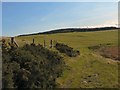
Quote GGAT (PRNs 600m and 601m) Pair of mounds on Mynydd Garthmaelwg, at the edge of the escarpment which forms the southern edge of the Coalfield. They are both far larger than is normally found, but it seems probable that their present height may be the result of augmentation during period of use as post- medieval beacon platforms. To me, like many cairns in South Wales, they seem to be paired in order to represent the Brecon Beacons. Could it be that this is also the origin of the name.
Now set in Forestry Commission land they are heavily overgrown and only their size gives them away.
You may be viewing yesterday's version of this page. To see the most up to date information please register for a free account.
")
Do not use the above information on other web sites or publications without permission of the contributor.
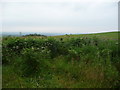
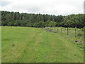
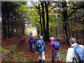
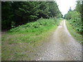
Nearby Images from Geograph Britain and Ireland:
©2011(licence)
©2011(licence)
©2015(licence)
©2011(licence)
©2008(licence)
The above images may not be of the site on this page, they are loaded from Geograph.
Please Submit an Image of this site or go out and take one for us!
Click here to see more info for this site
Nearby sites
Key: Red: member's photo, Blue: 3rd party photo, Yellow: other image, Green: no photo - please go there and take one, Grey: site destroyed
Download sites to:
KML (Google Earth)
GPX (GPS waypoints)
CSV (Garmin/Navman)
CSV (Excel)
To unlock full downloads you need to sign up as a Contributory Member. Otherwise downloads are limited to 50 sites.
Turn off the page maps and other distractions
Nearby sites listing. In the following links * = Image available
665m NW 311° Mynydd Meiros Cairn* Cairn (ST0121084423)
4.5km WNW 281° Mynydd y Gaer* Hillfort (SS97358495)
4.7km NE 46° Tarren Deusant* Holy Well or Sacred Spring (ST05208721)
5.8km S 189° Mynydd Y Fforest Enclosure* Misc. Earthwork (ST007783)
6.3km ESE 106° Cae'rarfau* Chambered Tomb (ST0772582144)
6.6km WNW 285° Mynnydd y Gaer* Cairn (SS95378584)
7.3km SW 232° Craig Tan-Y-Tan Hillfort (SS95867958)
7.3km WSW 243° Ogof-Y-Pebyll* Cave or Rock Shelter (SS95108075)
7.3km NW 326° Mynydd Maes-Teg Cairn (SS97699014)
7.7km NNW 337° Carn-Y-Celyn* Cairn (SS98779114)
7.9km NW 315° Mynydd Maendy Cairn (SS96168964)
8.2km ESE 111° Craig-y-Parc Ancient Village or Settlement (ST09298084)
8.2km WSW 250° Coed-Y-Gaer Hillfort (SS93918138)
8.5km SSW 210° Penllyn Wells* Holy Well or Sacred Spring (SS973767)
8.6km E 92° Garth Hill* Round Barrow(s) (ST103835)
8.6km SW 223° St Canna's Church (Llangan)* Ancient Cross (SS957778)
8.8km N 349° Mynydd Brith-Weunydd Cairn (ST00279263)
8.8km WSW 240° Ebissar Stone* Ancient Cross (SS93997971)
8.8km WSW 240° St Crallog (Coychurch)* Ancient Cross (SS93997970)
8.9km NE 44° Coed-Pen-Maen Common* Ring Cairn (ST07989031)
8.9km NE 46° Carreg Siglio* Modern Stone Circle etc (ST082901)
8.9km ESE 104° Ffynnoncattwg* Holy Well or Sacred Spring (ST10348165)
9.1km W 259° Pant-Y-Pyllau Ancient Village or Settlement (SS92728243)
9.2km S 182° Stalling Down Tumulus Round Barrow(s) (ST012748)
9.2km WSW 256° Coity* Chambered Cairn (SS92698193)
View more nearby sites and additional images


 We would like to know more about this location. Please feel free to add a brief description and any relevant information in your own language.
 Wir möchten mehr über diese Stätte erfahren. Bitte zögern Sie nicht, eine kurze Beschreibung und relevante Informationen in Deutsch hinzuzufügen.
 Nous aimerions en savoir encore un peu sur les lieux. S'il vous plaît n'hesitez pas à ajouter une courte description et tous les renseignements pertinents dans votre propre langue.
 Quisieramos informarnos un poco más de las lugares. No dude en añadir una breve descripción y otros datos relevantes en su propio idioma.