 with our Megalithic Portal iPhone app")


<< Text Pages >> Tan-y-graig - Stone Row / Alignment in Wales in Denbighshire
Submitted by Anne T on Friday, 06 May 2016 Page Views: 1585
Neolithic and Bronze AgeSite Name: Tan-y-graigCountry: Wales
NOTE: This site is 0.2 km away from the location you searched for.
County: Denbighshire Type: Stone Row / Alignment
Nearest Town: Abergele Nearest Village: Cefn
Map Ref: SJ01137199
Latitude: 53.235705N Longitude: 3.482786W
Condition:
| 5 | Perfect |
| 4 | Almost Perfect |
| 3 | Reasonable but with some damage |
| 2 | Ruined but still recognisable as an ancient site |
| 1 | Pretty much destroyed, possibly visible as crop marks |
| 0 | No data. |
| -1 | Completely destroyed |
| 5 | Superb |
| 4 | Good |
| 3 | Ordinary |
| 2 | Not Good |
| 1 | Awful |
| 0 | No data. |
| 5 | Can be driven to, probably with disabled access |
| 4 | Short walk on a footpath |
| 3 | Requiring a bit more of a walk |
| 2 | A long walk |
| 1 | In the middle of nowhere, a nightmare to find |
| 0 | No data. |
| 5 | co-ordinates taken by GPS or official recorded co-ordinates |
| 4 | co-ordinates scaled from a detailed map |
| 3 | co-ordinates scaled from a bad map |
| 2 | co-ordinates of the nearest village |
| 1 | co-ordinates of the nearest town |
| 0 | no data |
Be the first person to rate this site - see the 'Contribute!' box in the right hand menu.
Internal Links:
External Links:
The site was reported as badly damaged in December 1998, having been cut by a lane. A single boulder was reported in a field. A fourth stone was found in a field, but this seemed to have been relocated due to the change in colour at one end (cleaner, less weathered) indicating it had been unearthed.
Archwilio records this as a Neolithic Stone Row PRN 102134 made up of four large stones and two small ones, 4.7 metres long. "One stone is a boulder, the others set on edge at right angles."
This site is at an altitude of 121 metres and is to the west of Pant Farm, currently against the eastern side of a small wooded area.
Note: Have you visited this site? Are you able to add any further information? Do you have a photograph you can contribute?
You may be viewing yesterday's version of this page. To see the most up to date information please register for a free account.
Do not use the above information on other web sites or publications without permission of the contributor.
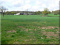
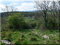
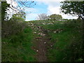
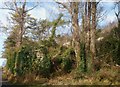
Nearby Images from Geograph Britain and Ireland:

©2025(licence)
©2008(licence)
©2008(licence)
©2008(licence)
©2009(licence)
The above images may not be of the site on this page, they are loaded from Geograph.
Please Submit an Image of this site or go out and take one for us!
Click here to see more info for this site
Nearby sites
Key: Red: member's photo, Blue: 3rd party photo, Yellow: other image, Green: no photo - please go there and take one, Grey: site destroyed
Download sites to:
KML (Google Earth)
GPX (GPS waypoints)
CSV (Garmin/Navman)
CSV (Excel)
To unlock full downloads you need to sign up as a Contributory Member. Otherwise downloads are limited to 50 sites.
![]()
Turn off the page maps and other distractions
Nearby sites listing. In the following links * = Image available
623m NW 318° Tyddyn Bleiddyn* Chambered Cairn (SJ00727246)
822m SSW 195° Bontnewydd Cave* Cave or Rock Shelter (SJ009712)
894m SW 218° Nant-Y-Graig Cave or Rock Shelter (SJ00567130)
1.9km SE 141° Cefn-Yr-Ogof Cave or Rock Shelter (SJ023705)
2.0km ESE 116° Ffynnon Fair (Trefnant)* Holy Well or Sacred Spring (SJ02927107)
3.5km SE 143° Plas Heaton Cave Cave or Rock Shelter (SJ03206911)
3.6km NE 55° Ysgol Glan Clwyd Modern Circle* Modern Stone Circle etc (SJ0412074000)
3.8km W 266° Mynydd-y-Gaer* Hillfort (SH973718)
5.0km NW 325° Terfyn Well Holy Well or Sacred Spring (SH98317613)
5.1km NW 315° St George's Well (Denbighshire) Holy Well or Sacred Spring (SH97657567)
5.7km NW 309° Dinorben Hillfort (SH968757)
7.2km E 86° St Beuno's Well (Tremeirchion)* Holy Well or Sacred Spring (SJ083723)
7.3km E 85° Cae Gwyn* Cave or Rock Shelter (SJ0843972501)
7.4km E 85° Ffynnon Beuno (Caves)* Cave or Rock Shelter (SJ0849972500)
7.6km NNE 25° Ffynnon Fair (Rhuddlan)* Holy Well or Sacred Spring (SJ045788)
7.8km E 80° Penuchaf Cairn (SJ08837315)
7.9km ENE 72° Moel Maen Efa* Barrow Cemetery (SJ087743)
7.9km NE 54° Llyn-Y-Gorseddau 1 Round Barrow(s) (SJ07657651)
8.0km NE 53° Llyn-Y-Gorseddau 3 Round Barrow(s) (SJ07647662)
8.0km NE 54° Llyn-Y-Gorseddau 2 Round Barrow(s) (SJ07687657)
8.1km NE 45° Marion Bach 1 Round Barrow(s) (SJ07057759)
8.3km NE 50° Aelwyd Uchaf (Cottage) Barrows Round Barrow(s) (SJ0758577185)
8.3km NE 37° Moel Hiraddug* Hillfort (SJ063785)
8.4km NE 45° Marion Bach 2 Round Barrow(s) (SJ07217782)
8.4km E 86° Cefn Du Ancient Village or Settlement (SJ0956272450)
View more nearby sites and additional images


 We would like to know more about this location. Please feel free to add a brief description and any relevant information in your own language.
 Wir möchten mehr über diese Stätte erfahren. Bitte zögern Sie nicht, eine kurze Beschreibung und relevante Informationen in Deutsch hinzuzufügen.
 Nous aimerions en savoir encore un peu sur les lieux. S'il vous plaît n'hesitez pas à ajouter une courte description et tous les renseignements pertinents dans votre propre langue.
 Quisieramos informarnos un poco más de las lugares. No dude en añadir una breve descripción y otros datos relevantes en su propio idioma.