<< Text Pages >> Stalling Down Tumulus - Round Barrow(s) in Wales in Mid Glamorgan
Submitted by coldrum on Sunday, 15 July 2007 Page Views: 3818
Neolithic and Bronze AgeSite Name: Stalling Down TumulusCountry: Wales County: Mid Glamorgan Type: Round Barrow(s)
Nearest Village: Aberthin
Map Ref: ST012748
Latitude: 51.463519N Longitude: 3.423616W
Condition:
| 5 | Perfect |
| 4 | Almost Perfect |
| 3 | Reasonable but with some damage |
| 2 | Ruined but still recognisable as an ancient site |
| 1 | Pretty much destroyed, possibly visible as crop marks |
| 0 | No data. |
| -1 | Completely destroyed |
| 5 | Superb |
| 4 | Good |
| 3 | Ordinary |
| 2 | Not Good |
| 1 | Awful |
| 0 | No data. |
| 5 | Can be driven to, probably with disabled access |
| 4 | Short walk on a footpath |
| 3 | Requiring a bit more of a walk |
| 2 | A long walk |
| 1 | In the middle of nowhere, a nightmare to find |
| 0 | No data. |
| 5 | co-ordinates taken by GPS or official recorded co-ordinates |
| 4 | co-ordinates scaled from a detailed map |
| 3 | co-ordinates scaled from a bad map |
| 2 | co-ordinates of the nearest village |
| 1 | co-ordinates of the nearest town |
| 0 | no data |
Be the first person to rate this site - see the 'Contribute!' box in the right hand menu.
Internal Links:
External Links:
Round Barrow(s) in Mid Glamorgan
Tumulus.
You may be viewing yesterday's version of this page. To see the most up to date information please register for a free account.
Do not use the above information on other web sites or publications without permission of the contributor.
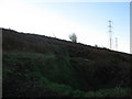
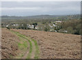
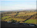
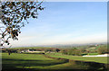
Nearby Images from Geograph Britain and Ireland:
©2008(licence)
©2007(licence)
©2008(licence)

©2006(licence)
©2006(licence)
The above images may not be of the site on this page, they are loaded from Geograph.
Please Submit an Image of this site or go out and take one for us!
Click here to see more info for this site
Nearby sites
Key: Red: member's photo, Blue: 3rd party photo, Yellow: other image, Green: no photo - please go there and take one, Grey: site destroyed
Download sites to:
KML (Google Earth)
GPX (GPS waypoints)
CSV (Garmin/Navman)
CSV (Excel)
To unlock full downloads you need to sign up as a Contributory Member. Otherwise downloads are limited to 50 sites.
Turn off the page maps and other distractions
Nearby sites listing. In the following links * = Image available
982m ESE 113° Llanquian Wood Fort Hillfort (ST021744)
2.8km SSE 151° Coed Hills Rural Art Space Modern Stone Circle etc (ST025723)
3.1km SSE 154° Cross Inn Well Holy Well or Sacred Spring (ST025720)
3.4km W 275° Corrwg Mounds (E) Cairn (SS97857515)
3.5km N 351° Mynydd Y Fforest Enclosure* Misc. Earthwork (ST007783)
3.7km W 275° Corrwg Mounds (W) Cairn (SS97477518)
4.2km SW 226° St Anne's Well (Llanmihangel)* Holy Well or Sacred Spring (SS98117190)
4.2km SW 225° Llanmihangel Early Christian Sculptured Stone (SS98137187)
4.3km WNW 295° Penllyn Wells* Holy Well or Sacred Spring (SS973767)
5.2km ENE 77° Ffynnon Deilo* Holy Well or Sacred Spring (ST0633975904)
6.3km WNW 298° St Canna's Church (Llangan)* Ancient Cross (SS957778)
6.7km E 97° Redland Farm Standing Stone (Menhir) (ST07817382)
6.8km SE 135° Castle Ditches Fort* Hillfort (ST059699)
6.9km E 95° Cottrell Park Standing Stone* Standing Stone (Menhir) (ST0804574124)
6.9km SE 143° Pen Onn Farmstead Ancient Village or Settlement (ST053692)
7.0km E 97° Coed-Y-Cwm* Chambered Cairn (ST08117378)
7.2km NW 311° Craig Tan-Y-Tan Hillfort (SS95867958)
7.6km SW 216° St Illtud's Cross* Early Christian Sculptured Stone (SS96626872)
7.7km E 89° St Nicholas' Well (Glamorgan)* Holy Well or Sacred Spring (ST08937484)
8.1km E 100° Tinkinswood* Chambered Cairn (ST09217330)
8.2km E 100° Tinkinswood standing stones* Standing Stones (ST09247327)
8.2km E 100° Tinkinswood avenue* Stone Row / Alignment (ST09267323)
8.2km E 99° Tinkinswood outliers* Rock Outcrop (ST09337334)
8.2km E 99° Tinkinswood quarry* Ancient Mine, Quarry or other Industry (ST09337331)
8.2km E 100° Tinkinswood 2* Burial Chamber or Dolmen (ST09337327)
View more nearby sites and additional images


 We would like to know more about this location. Please feel free to add a brief description and any relevant information in your own language.
 Wir möchten mehr über diese Stätte erfahren. Bitte zögern Sie nicht, eine kurze Beschreibung und relevante Informationen in Deutsch hinzuzufügen.
 Nous aimerions en savoir encore un peu sur les lieux. S'il vous plaît n'hesitez pas à ajouter une courte description et tous les renseignements pertinents dans votre propre langue.
 Quisieramos informarnos un poco más de las lugares. No dude en añadir una breve descripción y otros datos relevantes en su propio idioma.