


<< Text Pages >> Caen Burn 2 - Broch or Nuraghe in Scotland in Sutherland
Submitted by SolarMegalith on Tuesday, 01 November 2011 Page Views: 2295
Iron Age and Later PrehistorySite Name: Caen Burn 2Country: Scotland
NOTE: This site is 0.9 km away from the location you searched for.
County: Sutherland Type: Broch or Nuraghe
Nearest Town: Kildonan
Map Ref: ND0118
Latitude: 58.139799N Longitude: 3.683169W
Condition:
| 5 | Perfect |
| 4 | Almost Perfect |
| 3 | Reasonable but with some damage |
| 2 | Ruined but still recognisable as an ancient site |
| 1 | Pretty much destroyed, possibly visible as crop marks |
| 0 | No data. |
| -1 | Completely destroyed |
| 5 | Superb |
| 4 | Good |
| 3 | Ordinary |
| 2 | Not Good |
| 1 | Awful |
| 0 | No data. |
| 5 | Can be driven to, probably with disabled access |
| 4 | Short walk on a footpath |
| 3 | Requiring a bit more of a walk |
| 2 | A long walk |
| 1 | In the middle of nowhere, a nightmare to find |
| 0 | No data. |
| 5 | co-ordinates taken by GPS or official recorded co-ordinates |
| 4 | co-ordinates scaled from a detailed map |
| 3 | co-ordinates scaled from a bad map |
| 2 | co-ordinates of the nearest village |
| 1 | co-ordinates of the nearest town |
| 0 | no data |
Internal Links:
External Links:
Broch in Sutherland
Possible site of a broch.
MacKie E.W. 2007. The Roundhouses, Brochs and Wheelhouses of Atlantic Scotland c. 700 BC – AD 500. Part 2 (I). Oxford: Archaeopress
You may be viewing yesterday's version of this page. To see the most up to date information please register for a free account.
Do not use the above information on other web sites or publications without permission of the contributor.
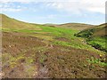
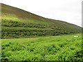
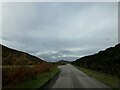
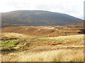
Nearby Images from Geograph Britain and Ireland:
©2010(licence)
©2011(licence)
©2023(licence)
©2009(licence)
©2021(licence)
The above images may not be of the site on this page, they are loaded from Geograph.
Please Submit an Image of this site or go out and take one for us!
Click here to see more info for this site
Nearby sites
Key: Red: member's photo, Blue: 3rd party photo, Yellow: other image, Green: no photo - please go there and take one, Grey: site destroyed
Download sites to:
KML (Google Earth)
GPX (GPS waypoints)
CSV (Garmin/Navman)
CSV (Excel)
To unlock full downloads you need to sign up as a Contributory Member. Otherwise downloads are limited to 50 sites.
Turn off the page maps and other distractions
Nearby sites listing. In the following links * = Image available
779m SE 139° Caen Burn 1 Broch or Nuraghe (ND015174)
1.8km WNW 299° Kilphedir* Broch or Nuraghe (NC99431891)
2.7km W 272° Eldrable Broch or Nuraghe (NC98331816)
2.8km SSE 147° St John the Baptist's Well (Helmsdale)* Holy Well or Sacred Spring (ND025156)
4.2km S 172° Dun Phail Broch or Nuraghe (ND01481387)
4.6km W 281° Kildonan NE* Multiple Stone Rows / Avenue (NC96541898)
5.3km S 189° Portgower Broch or Nuraghe (ND00081279)
5.5km W 274° Kildonan SW* Multiple Stone Rows / Avenue (NC9550918564)
6.1km W 271° Gailiable Broch or Nuraghe (NC94871823)
6.2km E 81° Ousdale Burn* Broch or Nuraghe (ND07131881)
6.5km W 277° Balvalaich* Broch or Nuraghe (NC94521898)
6.7km NE 36° Langwell Hut Circle Ancient Village or Settlement (ND05052335)
6.9km NE 40° Langwell Water Souterrain (Fogou, Earth House) (ND05602322)
7.0km NNE 21° Langwell Water Enclosure Ancient Village or Settlement (ND03712445)
7.2km NE 43° Langwell Water Earth House Souterrain (Fogou, Earth House) (ND06032313)
7.3km NNE 18° Langwell Earth House Souterrain (Fogou, Earth House) (ND03442484)
7.5km WSW 246° Clach Mhic Mhios* Standing Stone (Menhir) (NC9404515083)
8.1km W 274° Kilearnan Hill* Broch or Nuraghe (NC92931882)
8.2km N 354° Wagmore Rigg* Ancient Village or Settlement (ND00292614)
8.4km NE 42° Strathy Burn Souterrain (Fogou, Earth House) (ND06742409)
8.4km NE 55° Langwell Water Hut Circle Ancient Village or Settlement (ND08002266)
8.9km W 274° Kilearnan Broch* Broch or Nuraghe (NC92161887)
8.9km SW 228° Carn Bran* Broch or Nuraghe (NC94201219)
9.1km SW 233° Glen Loth* Standing Stones (NC936127)
9.2km ENE 61° Berriedale Chambered Cairn (ND09152223)
View more nearby sites and additional images


 We would like to know more about this location. Please feel free to add a brief description and any relevant information in your own language.
 Wir möchten mehr über diese Stätte erfahren. Bitte zögern Sie nicht, eine kurze Beschreibung und relevante Informationen in Deutsch hinzuzufügen.
 Nous aimerions en savoir encore un peu sur les lieux. S'il vous plaît n'hesitez pas à ajouter une courte description et tous les renseignements pertinents dans votre propre langue.
 Quisieramos informarnos un poco más de las lugares. No dude en añadir una breve descripción y otros datos relevantes en su propio idioma.