 with our Megalithic Portal iPhone app")


<< Our Photo Pages >> Sack Stone - Standing Stone (Menhir) in Scotland in Perth and Kinross
Submitted by hinejc001 on Thursday, 25 March 2004 Page Views: 6125
Neolithic and Bronze AgeSite Name: Sack StoneCountry: Scotland
NOTE: This site is 3.0 km away from the location you searched for.
County: Perth and Kinross Type: Standing Stone (Menhir)
Nearest Town: Perth Nearest Village: Bankfoot
Map Ref: NN9925535973 Landranger Map Number: 52
Latitude: 56.504999N Longitude: 3.638385W
Condition:
| 5 | Perfect |
| 4 | Almost Perfect |
| 3 | Reasonable but with some damage |
| 2 | Ruined but still recognisable as an ancient site |
| 1 | Pretty much destroyed, possibly visible as crop marks |
| 0 | No data. |
| -1 | Completely destroyed |
| 5 | Superb |
| 4 | Good |
| 3 | Ordinary |
| 2 | Not Good |
| 1 | Awful |
| 0 | No data. |
| 5 | Can be driven to, probably with disabled access |
| 4 | Short walk on a footpath |
| 3 | Requiring a bit more of a walk |
| 2 | A long walk |
| 1 | In the middle of nowhere, a nightmare to find |
| 0 | No data. |
| 5 | co-ordinates taken by GPS or official recorded co-ordinates |
| 4 | co-ordinates scaled from a detailed map |
| 3 | co-ordinates scaled from a bad map |
| 2 | co-ordinates of the nearest village |
| 1 | co-ordinates of the nearest town |
| 0 | no data |
Internal Links:
External Links:
")
Page originally by BigSweetie
You may be viewing yesterday's version of this page. To see the most up to date information please register for a free account.
")
Do not use the above information on other web sites or publications without permission of the contributor.
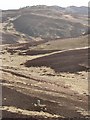
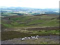
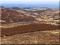
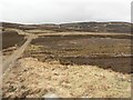
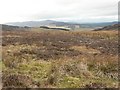
Nearby Images from Geograph Britain and Ireland:
©2007(licence)
©2011(licence)
©2015(licence)
©2007(licence)
©2007(licence)
The above images may not be of the site on this page, they are loaded from Geograph.
Please Submit an Image of this site or go out and take one for us!
Click here to see more info for this site
Nearby sites
Key: Red: member's photo, Blue: 3rd party photo, Yellow: other image, Green: no photo - please go there and take one, Grey: site destroyed
Download sites to:
KML (Google Earth)
GPX (GPS waypoints)
CSV (Garmin/Navman)
CSV (Excel)
To unlock full downloads you need to sign up as a Contributory Member. Otherwise downloads are limited to 50 sites.
Turn off the page maps and other distractions
Nearby sites listing. In the following links * = Image available
2.1km E 82° Tullybeagles* Stone Circle (NO013362)
3.7km NE 52° Craig Obney Vitrified Fort (NO02243822)
3.8km NW 308° Airlich (Cup and Ring Marks)* Rock Art (NN963384)
4.3km NW 308° Airlich Stone Circle* Stone Circle (NN9590838678)
4.4km NW 313° Meikle Findowie* Standing Stone (Menhir) (NN961391)
5.2km ENE 71° Witch's Stone* Standing Stone (Menhir) (NO042375)
5.5km WNW 298° Little Findowie* Standing Stone (Menhir) (NN94483865)
5.8km NNW 338° Ballinloan* Rock Art (NN97244141)
6.1km ENE 66° Staredam Standing Stones* Standing Stones (NO049383)
6.1km ENE 70° Muirheadston Stone Circle (NO05053790)
6.2km SSW 197° Kor Stone* Standing Stone (Menhir) (NN97333004)
6.5km ESE 102° Pitsundry* Stone Circle (NO0558834454)
7.2km NNE 12° King's Seat Hillfort (NO00934303)
7.3km NE 44° Newtyle* Standing Stones (NO0449241062)
7.3km NNE 24° Dunkeld Cathedral Sculptured Stone* Early Christian Sculptured Stone (NO024426)
7.3km NNE 16° Dunkeld Park* Standing Stone (Menhir) (NO0142642993)
7.5km ESE 120° Cowford Standing Stone (Menhir) (NO05633205)
7.9km NNW 332° Salachill* Rock Art (NN95714300)
7.9km SSE 151° Lynedoch Cottage (1) Standing Stone (Menhir) (NO02962898)
8.2km SSE 147° Lynedoch Cottage (2) Standing Stone (Menhir) (NO03582902)
8.6km SSE 147° Lynedoch Cottage (3) Standing Stone (Menhir) (NO03792870)
8.6km ENE 64° Murthly Castle Standing Stone (Menhir) (NO07053956)
8.6km WNW 283° Innercochill* Rock Art (NN909381)
8.8km ESE 108° Loak Stone* Standing Stone (Menhir) (NO07573305)
9.0km ESE 108° Loak Court Hill Round Barrow(s) (NO07733301)
View more nearby sites and additional images


 We would like to know more about this location. Please feel free to add a brief description and any relevant information in your own language.
 Wir möchten mehr über diese Stätte erfahren. Bitte zögern Sie nicht, eine kurze Beschreibung und relevante Informationen in Deutsch hinzuzufügen.
 Nous aimerions en savoir encore un peu sur les lieux. S'il vous plaît n'hesitez pas à ajouter une courte description et tous les renseignements pertinents dans votre propre langue.
 Quisieramos informarnos un poco más de las lugares. No dude en añadir una breve descripción y otros datos relevantes en su propio idioma.