

<< Text Pages >> Llanmihangel - Early Christian Sculptured Stone in Wales in South Glamorgan
Submitted by coldrum on Thursday, 07 January 2010 Page Views: 2894
Early Medieval (Dark Age)Site Name: LlanmihangelCountry: Wales
NOTE: This site is 0.9 km away from the location you searched for.
County: South Glamorgan Type: Early Christian Sculptured Stone
Map Ref: SS98137187
Latitude: 51.436637N Longitude: 3.466949W
Condition:
| 5 | Perfect |
| 4 | Almost Perfect |
| 3 | Reasonable but with some damage |
| 2 | Ruined but still recognisable as an ancient site |
| 1 | Pretty much destroyed, possibly visible as crop marks |
| 0 | No data. |
| -1 | Completely destroyed |
| 5 | Superb |
| 4 | Good |
| 3 | Ordinary |
| 2 | Not Good |
| 1 | Awful |
| 0 | No data. |
| 5 | Can be driven to, probably with disabled access |
| 4 | Short walk on a footpath |
| 3 | Requiring a bit more of a walk |
| 2 | A long walk |
| 1 | In the middle of nowhere, a nightmare to find |
| 0 | No data. |
| 5 | co-ordinates taken by GPS or official recorded co-ordinates |
| 4 | co-ordinates scaled from a detailed map |
| 3 | co-ordinates scaled from a bad map |
| 2 | co-ordinates of the nearest village |
| 1 | co-ordinates of the nearest town |
| 0 | no data |
Be the first person to rate this site - see the 'Contribute!' box in the right hand menu.
Internal Links:
External Links:
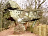
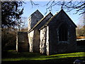
Early Christian Sculptured Stone in South Glamorgan
From Coflein:
"A monolithic cross-base, 1.2m by 0.6m, surmounted by a square socket stone."
https://www.coflein.gov.uk/en/site/307607
You may be viewing yesterday's version of this page. To see the most up to date information please register for a free account.
 (PID:196804)")
 (PID:185469)")
Do not use the above information on other web sites or publications without permission of the contributor.
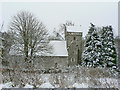
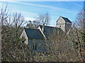
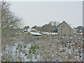
Nearby Images from Geograph Britain and Ireland:
©2016(licence)
©2009(licence)
©2009(licence)
©2009(licence)
©2011(licence)
The above images may not be of the site on this page, they are loaded from Geograph.
Please Submit an Image of this site or go out and take one for us!
Click here to see more info for this site
Nearby sites
Key: Red: member's photo, Blue: 3rd party photo, Yellow: other image, Green: no photo - please go there and take one, Grey: site destroyed
Download sites to:
KML (Google Earth)
GPX (GPS waypoints)
CSV (Garmin/Navman)
CSV (Excel)
To unlock full downloads you need to sign up as a Contributory Member. Otherwise downloads are limited to 50 sites.
Turn off the page maps and other distractions
Nearby sites listing. In the following links * = Image available
36m NW 325° St Anne's Well (Llanmihangel)* Holy Well or Sacred Spring (SS98117190)
3.3km N 354° Corrwg Mounds (E) Cairn (SS97857515)
3.4km NNW 348° Corrwg Mounds (W) Cairn (SS97477518)
3.5km SSW 204° St Illtud's Cross* Early Christian Sculptured Stone (SS96626872)
4.2km NE 45° Stalling Down Tumulus Round Barrow(s) (ST012748)
4.4km E 87° Cross Inn Well Holy Well or Sacred Spring (ST025720)
4.4km E 83° Coed Hills Rural Art Space Modern Stone Circle etc (ST025723)
4.7km ENE 56° Llanquian Wood Fort Hillfort (ST021744)
4.9km N 349° Penllyn Wells* Holy Well or Sacred Spring (SS973767)
4.9km SSW 204° Castle Ditches (Glamorgan)* Hillfort (SS960674)
6.4km NNW 337° St Canna's Church (Llangan)* Ancient Cross (SS957778)
6.9km NNE 21° Mynydd Y Fforest Enclosure* Misc. Earthwork (ST007783)
7.2km WSW 248° Nash Point Barrows* Round Barrow(s) (SS91376926)
7.3km WSW 252° New Mill Farm Enclosure* Ancient Village or Settlement (SS91156978)
7.4km WSW 240° Cae'r-Eglwys Long Cairn* Long Barrow (SS91666825)
7.4km WSW 242° Nash Point* Promontory Fort / Cliff Castle (SS915685)
7.6km ESE 109° Pen Onn Farmstead Ancient Village or Settlement (ST053692)
8.0km ESE 103° Castle Ditches Fort* Hillfort (ST059699)
8.0km NNW 342° Craig Tan-Y-Tan Hillfort (SS95867958)
8.4km W 268° Cwm Bach Hillfort Hillfort (SS89727175)
8.8km NNW 331° St Crallog (Coychurch)* Ancient Cross (SS93997970)
8.9km NNW 331° Ebissar Stone* Ancient Cross (SS93997971)
9.1km ENE 63° Ffynnon Deilo* Holy Well or Sacred Spring (ST0633975904)
9.4km NNW 340° Ogof-Y-Pebyll* Cave or Rock Shelter (SS95108075)
9.4km W 274° Dunraven* Hillfort (SS887728)
View more nearby sites and additional images


 We would like to know more about this location. Please feel free to add a brief description and any relevant information in your own language.
 Wir möchten mehr über diese Stätte erfahren. Bitte zögern Sie nicht, eine kurze Beschreibung und relevante Informationen in Deutsch hinzuzufügen.
 Nous aimerions en savoir encore un peu sur les lieux. S'il vous plaît n'hesitez pas à ajouter une courte description et tous les renseignements pertinents dans votre propre langue.
 Quisieramos informarnos un poco más de las lugares. No dude en añadir una breve descripción y otros datos relevantes en su propio idioma.