Featured: Ark of Secrets - Neolithic spirit alive in the Middle Ages

Ark of Secrets - Neolithic spirit alive in the Middle Ages

Random Image


Carschenna

The Henge Monuments of the British Isles: Myth and Archaeology

The Henge Monuments of the British Isles: Myth and Archaeology

Who's Online

There are currently, 308 guests and 0 members online.

You are a guest. To join in, please register for free by clicking here

Sponsors

<< Our Photo Pages >> Brenig 44 - Timber Circle in Wales in Denbighshire

Submitted by TimPrevett on Wednesday, 06 April 2011  Page Views: 17849

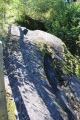
Neolithic and Bronze AgeSite Name: Brenig 44 Alternative Name: Brenig Ringcairn
Country: Wales County: Denbighshire Type: Timber Circle
Nearest Town: Cerrigydrudion  Nearest Village: Pentre-llyn-cymmer
Map Ref: SH98345720  Landranger Map Number: 116
Latitude: 53.102279N  Longitude: 3.519866W
Condition:
5Perfect
4Almost Perfect
3Reasonable but with some damage
2Ruined but still recognisable as an ancient site
1Pretty much destroyed, possibly visible as crop marks
0No data.
-1Completely destroyed
3 Ambience:
5Superb
4Good
3Ordinary
2Not Good
1Awful
0No data.
3 Access:
5Can be driven to, probably with disabled access
4Short walk on a footpath
3Requiring a bit more of a walk
2A long walk
1In the middle of nowhere, a nightmare to find
0No data.
4 Accuracy:
5co-ordinates taken by GPS or official recorded co-ordinates
4co-ordinates scaled from a detailed map
3co-ordinates scaled from a bad map
2co-ordinates of the nearest village
1co-ordinates of the nearest town
0no data
5

Internal Links:
External Links:

I have visited· I would like to visit

Marko visited on 24th Aug 2014 - their rating: Cond: 4 Amb: 4 Access: 4

w650marion TimPrevett have visited here

Brenig 44
Brenig 44 submitted by TimPrevett : The ring cairn and timber circle (reconstructed) on the east shore of the flooded valley, now Llyn Brenig, looking south. (Vote or comment on this photo)
Timber Circle in Denbighshire. The ring of posts are not a fence but are in fact located in the timber circle's post holes. The area around the Llyn Brenig Reservoir is riddled with prehistoric sites, a large number of which can be accessed by following the archaeological trails from the main car park.

Excavations in the early 1970s revealed that the central area was surrounded by a ring of stones and a circle of stakes as with the nearby Boncyn Arian Ringcairn. Similar Sites are known in Cheshire at places such as Delamere and Church Lawton.

This ring cairn is recorded as Coflein NPRN 303462.

Note: RCAHMW Uplands Archaeology Initiative - forum and guided walk 13/14 May 2011
You may be viewing yesterday's version of this page. To see the most up to date information please register for a free account.


Brenig 44
Brenig 44 submitted by w650marion : Unusual bright and hot sunny day in February 2019, perfect for photographing interesting sites! (Vote or comment on this photo)

Brenig 44
Brenig 44 submitted by Bladup : Brenig 44 with Boncyn Arian behind. (Vote or comment on this photo)

Brenig 44
Brenig 44 submitted by TimPrevett : Looking south across Brenig 44, 19/08/22. Notice the cows in the field, far right. These frolicking bovines interrupted our planned complete circuit of the trail, but, nonetheless, I still visited two of the other cairns uphill. (Vote or comment on this photo)

Brenig 44
Brenig 44 submitted by TimPrevett : Evening mood, a sunny scene - a first for me on the Llyn Brenig Archaeological Trail. Brenig 44 ring cairn and timber circle, 19/08/22. (Vote or comment on this photo)

Brenig 44
Brenig 44 submitted by w650marion : information board for Brenig 44/Timber Circle/ring cairn

Brenig 44
Brenig 44 submitted by Postman : Boncyn Arian gets into the picture of it's more handsome cousin.

Brenig 44
Brenig 44 submitted by Postman : Llyn Brenig.

Brenig 44
Brenig 44 submitted by Postman : Spring equinox 2012

Brenig 44
Brenig 44 submitted by Postman : My first time, 11 tears ago.

Brenig 44
Brenig 44 submitted by Bladup : A snowy Brenig 44 from the hillside.

Brenig 44
Brenig 44 submitted by Bladup : Brenig 44 in the snow.

Brenig 44
Brenig 44 submitted by KenMiddleton : The same mound from the other side. Very easy to spot from the car park.

Brenig 44
Brenig 44 submitted by KenMiddleton : Notice the very neat mound right next to Brenig44.

Brenig 44
Brenig 44 submitted by KenMiddleton : Here we can see part of the main structure. Behind it we have a tumulus on the island and another one below the tree line in the centre of the picture.

Brenig 44
Brenig 44 submitted by KenMiddleton : The structure is very easy to find. It lies very close to the edge of the lake and near the car park.

Brenig 44
Brenig 44 submitted by Nick- : Medieval hut/house platform or remains. Part of the Llyn Brenig Archaeological trail. Taken in February 2002.

Brenig 44
Brenig 44 submitted by TimPrevett : The ring cairn is much bigger than many of the photos show; here the group are on the SW arc of the ring cairn & timber circle. The wind here was picking up droplets of water off the lake and impacting them onto our faces - quite uncomfortable! John's yellow mac is quite conspicuous, but it is pretty well impervious to wind and water, we were told. (1 comment)

Brenig 44
Brenig 44 submitted by TimPrevett : Looking down onto the Ring Cairn of Brenig 46, the reconstructed timber circle, and the barrow, Boncyn Arian just off to the right.

Brenig 44
Brenig 44 submitted by PaulM : See the Megalith Map for details (1 comment)

Do not use the above information on other web sites or publications without permission of the contributor.
Click here to see more info for this site

Nearby sites

Click here to view sites on an interactive OS map

Key: Red: member's photo, Blue: 3rd party photo, Yellow: other image, Green: no photo - please go there and take one, Grey: site destroyed

Download sites to:
KML (Google Earth)
GPX (GPS waypoints)
CSV (Garmin/Navman)
CSV (Excel)

To unlock full downloads you need to sign up as a Contributory Member. Otherwise downloads are limited to 50 sites.


Turn off the page maps and other distractions

Nearby sites listing. In the following links * = Image available
 72m NW 325° Boncyn Arian* Round Barrow(s) (SH98305726)
 376m SE 139° Brenig 46* Cairn (SH98585691)
 430m NNE 21° Brenig Mesolithic Camp Site Ancient Village or Settlement (SH985576)
 474m WSW 246° Brenig 41* Round Barrow(s) (SH97905702)
 566m W 260° Brenig 40* Round Barrow(s) (SH97785711)
 903m SE 134° Brenig 51* Cairn (SH98985656)
 957m SSE 150° Brenig 8* Round Barrow(s) (SH98805636)
 975m WSW 238° Brenig 42* Round Barrow(s) (SH975567)
 1.0km NNE 33° Brenig 47* Round Cairn (SH98925804)
 1.1km S 181° Brenig 14 Cairn (SH983561)
 1.4km ESE 123° Brenig 5. Ring Cairn (SH995564)
 1.5km SE 126° Maen Cleddau* Natural Stone / Erratic / Other Natural Feature (SH99515630)
 1.5km SE 126° Brenig 6* Cairn (SH99525631)
 1.8km NNE 32° Tir Mostyn Kerb Cairns Cairn (SH99345870)
 2.8km ENE 70° Twr-yr-Hill* Round Barrow(s) (SJ010581)
 2.9km NNW 327° Gorsedd Bran* Barrow Cemetery (SH968597)
 4.4km SE 138° Y Foel Frech Stone Circle (SJ012539)
 4.6km SSW 205° Hafod-y-llan Isaf Cairn Circle* Ring Cairn (SH963531)
 5.2km NW 310° Rhiwiau Barrow* Round Barrow(s) (SH94466063)
 5.2km S 177° Caer Ddunod* Hillfort (SH985520)
 5.5km ESE 118° Capel Hiraethog III* Stone Circle (SJ032545)
 5.6km SW 225° Cerrig y Drudion Stone Circle (SH943533)
 5.8km NW 309° Blaen y Cwm Barrow* Round Barrow(s) (SH93916091)
 5.9km ESE 116° Capel Hiraethog ring cairn* Ring Cairn (SJ036545)
 6.2km WSW 252° Nant Heilyn* Ring Cairn (SH92355543)
View more nearby sites and additional images

<< Castro de Viladonga

Abbeyquarter >>

Please add your thoughts on this site

Current Archaeology Book of the Year 2019!

Current Archaeology Book of the Year 2019!

Sponsors

Auto-Translation (Google)

Translate from English into:

"Brenig 44" | Login/Create an Account | 6 News and Comments
  
Go back to top of page    Comments are owned by the poster. We aren't responsible for their content.
The Brenig Archaeology Trail by Andy B on Monday, 05 October 2015
(User Info | Send a Message)
Prof. Howard M. R. Williams writes: Many of the sites are Bronze Age mortuary and ceremonial monuments and hence this is a rare instance where a scattered ‘cemetery’ of mounds across hillsides in North-East Wales has been the focus of heritage interpretation.

The trail takes in elements of a rich archaeological upland landscape explored by work done ahead of the construction of the Llyn Brenig reservoir in the 1970s. The fact that these parts of the landscape are not submerged is because plans for a second stage enlargement of Llyn Brenig were never completed.

More at
https://howardwilliamsblog.wordpress.com/2015/08/24/brenig-archaeology-trail-archaeodeath-in-the-landscape/
[ Reply to This ]

Re: Brenig 44 by Anonymous on Thursday, 19 June 2014
I have two photos of the Circle which were taken in the 70's, one of them shows my father, Robert Edwards, a stone mason, who rebuilt the circle whilst employed by the water board. I am unable to load them onto the site.
[ Reply to This ]

Mynydd Hiraethog Prehistoric, Burial and Ceremonial Landscapes by Andy B on Wednesday, 06 April 2011
(User Info | Send a Message)
The fine burial mounds which dominate many of the moorland ridges of Mynydd Hiraethog represent not only the principal visible elements in the landscape surviving from the prehistoric past, but have also achieved a significance beyond the mountain itself. The prehistoric burial and ceremonial monuments of Mynydd Hiraethog have been the focus of intensive study, particularly since the 1970s, when the construction of the Llyn Brenig reservoir provided one of the rare opportunities of recent times to examine a range of contemporary monument types within a single landscape.

More at
http://www.cpat.org.uk/projects/longer/histland/hiraeth/mhpreh.htm
[ Reply to This ]

RCAHMW Uplands Archaeology Initiative - forum and guided walk 13/14 May 2011 by Andy B on Wednesday, 06 April 2011
(User Info | Send a Message)
PAB writes: The Royal Commission for Ancient & Historic Monuments of Wales have announced details of two events in May which are likely to be of great interest to Portal members and visitors.

This year’s guided walk in the uplands will take place on Saturday 14 May 2011 in the Brenig valley. This area (as RCAHMW's release states) is part of the upland landscape of Mynydd Hiraethog/Denbigh Moors which has been extensively searched for the Royal Commission’s uplands archaeology project.

Brenig valley has been the focus of human activity for many thousands of years and which is well known for its Bronze Age burial and religious monuments. The walk will be a tour around the Brone Age burial sites, taking in sites of later periods and presenting the results of recent fieldwork. It will appeal to all those who enjoy upland scenery and are interested in looking at ancient sites and wish to know more about them.
http://www.rcahmw.gov.uk/HI/ENG/Announcements/?anno=14

The day before the walk, RCAHMW is inviting those with an interest in the archaeology of the uplands of Wales to join in their Uplands Archaeology Forum 2011 on Friday 13th May in Llanrwst. This will be an open event at which the findings from this year’s programme of uplands surveys across Wales will be presented.

PRESENTATIONS ON LAST YEAR’S FIELD PROJECTS

1. Radnorshire Small Commons Jenny Hall & Paul Sambrook (Trysor)
2. Arenig Fawr (Mer.) Richard Hayman (Hayman & Horton)
3. Central Glamorgan Uplands Jenny Hall & Paul Sambrook (Trysor)
4. Glaslyn (NE) (Plynlimon) Richard Hayman (Hayman & Horton)
5. Moel-siabod (Caerns.) Martin Railton (North Pennine Archaeology)
6. Penllyn (nr.Bala) Richard Hayman (Hayman & Horton)
7. West Glamorgan Uplands Jenny Hall & Paul Sambrook (Trysor)

Further details are available on the RCAHMW site.
http://www.rcahmw.gov.uk/HI/ENG/Announcements/?anno=13
[ Reply to This ]

Brenig 45 by Andy B on Wednesday, 06 April 2011
(User Info | Send a Message)
Grid Reference: SH98305726

A centrally disturbed round barrow, 16m in diameter & 1.8m high, set on a low, level promontory: excavation, 1973, showed that a central grave/pit, 1.4m by 0.8m, was surrounded by three roughly concentric stake-circles, c.3.5m to 9.0m in diameter, showing traces of hurdling, without these was a drystone wall, 11m overall diameter, with some orthostatic components, these last appeared to have predated the construction of a turf mound, which the completed wall revetted; a stake-circle, apparently hurdled, 14m in diameter, stood without the wall, & about all was a pallisade trench, 15m in diameter which appeared to have contained a clay capping applied to the mound: seven cremations were identified within this sequence, with two collared urns: two radio-carbon dates, centred on 1620BC & 1570BC, were produced.

Coflein:
http://www.coflein.gov.uk/en/site/303463/details/BONCYN+ARIAN%3BBRENIG+45/
[ Reply to This ]

Your Name: Anonymous [ Register Now ]
Subject:


Add your comment or contribution to this page. Spam or offensive posts are deleted immediately, don't even bother

<<< What is five plus one as a number? (Please type the answer to this question in the little box on the left)
You can also embed videos and other things. For Youtube please copy and paste the 'embed code'.
For Google Street View please include Street View in the text.
Create a web link like this: <a href="https://www.megalithic.co.uk">This is a link</a>  

Allowed HTML is:
<p> <b> <i> <a> <img> <em> <br> <strong> <blockquote> <tt> <li> <ol> <ul> <object> <param> <embed> <iframe>

We would like to know more about this location. Please feel free to add a brief description and any relevant information in your own language.
Wir möchten mehr über diese Stätte erfahren. Bitte zögern Sie nicht, eine kurze Beschreibung und relevante Informationen in Deutsch hinzuzufügen.
Nous aimerions en savoir encore un peu sur les lieux. S'il vous plaît n'hesitez pas à ajouter une courte description et tous les renseignements pertinents dans votre propre langue.
Quisieramos informarnos un poco más de las lugares. No dude en añadir una breve descripción y otros datos relevantes en su propio idioma.