<< Our Photo Pages >> Ballintomb - Class I Pictish Symbol Stone in Scotland in Highlands
Submitted by alligator on Wednesday, 25 February 2004 Page Views: 13764
Early Medieval (Dark Age)Site Name: Ballintomb Alternative Name: FinlarigCountry: Scotland County: Highlands Type: Class I Pictish Symbol Stone
Map Ref: NH995253 Landranger Map Number: 36
Latitude: 57.307174N Longitude: 3.66984W
Condition:
| 5 | Perfect |
| 4 | Almost Perfect |
| 3 | Reasonable but with some damage |
| 2 | Ruined but still recognisable as an ancient site |
| 1 | Pretty much destroyed, possibly visible as crop marks |
| 0 | No data. |
| -1 | Completely destroyed |
| 5 | Superb |
| 4 | Good |
| 3 | Ordinary |
| 2 | Not Good |
| 1 | Awful |
| 0 | No data. |
| 5 | Can be driven to, probably with disabled access |
| 4 | Short walk on a footpath |
| 3 | Requiring a bit more of a walk |
| 2 | A long walk |
| 1 | In the middle of nowhere, a nightmare to find |
| 0 | No data. |
| 5 | co-ordinates taken by GPS or official recorded co-ordinates |
| 4 | co-ordinates scaled from a detailed map |
| 3 | co-ordinates scaled from a bad map |
| 2 | co-ordinates of the nearest village |
| 1 | co-ordinates of the nearest town |
| 0 | no data |
Internal Links:
External Links:
")
Canmore site no. 139359.
You may be viewing yesterday's version of this page. To see the most up to date information please register for a free account.
Do not use the above information on other web sites or publications without permission of the contributor.
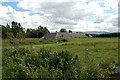
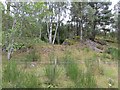
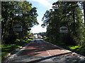
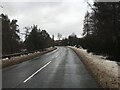
Nearby Images from Geograph Britain and Ireland:
©2006(licence)
©2014(licence)
©2015(licence)
©2022(licence)
©2010(licence)
The above images may not be of the site on this page, they are loaded from Geograph.
Please Submit an Image of this site or go out and take one for us!
Click here to see more info for this site
Nearby sites
Key: Red: member's photo, Blue: 3rd party photo, Yellow: other image, Green: no photo - please go there and take one, Grey: site destroyed
Download sites to:
KML (Google Earth)
GPX (GPS waypoints)
CSV (Garmin/Navman)
CSV (Excel)
To unlock full downloads you need to sign up as a Contributory Member. Otherwise downloads are limited to 50 sites.
Turn off the page maps and other distractions
Nearby sites listing. In the following links * = Image available
749m ESE 114° Dulnain Bridge* Natural Stone / Erratic / Other Natural Feature (NJ00182498)
1.3km E 86° Gaich Wood 1* Chambered Cairn (NJ00772535)
1.7km ENE 78° Gaich Wood Cairn 2* Cairn (NJ01182561)
1.7km ESE 111° Tom Nan Carragh* Standing Stones (NJ0110824642)
2.0km S 179° Curr Wood* Round Cairn (NH995233)
2.0km NE 40° Laggan Hill* Round Cairn (NJ0084926813)
2.2km S 186° Auchendean Hill Cairn* Chambered Cairn (NH99232312)
2.4km N 6° Beinn Mhor* Round Cairn (NH998277)
2.5km WSW 243° Clury* Round Cairn (NH972242)
3.2km ENE 76° Inverallan* Class I Pictish Symbol Stone (NJ026260)
3.5km N 0° Tom A' Chaistel* Hillfort (NH996288)
4.1km WSW 250° Easter Gallovie* Round Cairn (NH956240)
5.0km SW 223° Toum Cairn* Cairn (NH9601621757)
5.0km E 84° Inchbroke* Round Cairn (NJ045257)
5.0km SW 216° Tullochgorum Cairn* Stone Circle (NH96482130)
5.1km SSW 212° Tullochgorum Stones* Standing Stones (NH96702101)
6.3km E 80° Congash* Class I Pictish Symbol Stone (NJ058262)
7.1km NE 55° Upper Port* Standing Stones (NJ054292)
7.2km SW 228° Drumuillie* Round Cairn (NH940206)
8.5km SW 231° Deishar* Round Cairn (NH928201)
11.3km SSW 209° Lynchurn Class I Pictish Symbol Stone (NH93841551)
11.8km SSW 210° Pityoulish Standing Stone* Standing Stone (Menhir) (NH93251521)
12.2km SW 224° Avielochan* Chambered Tomb (NH908167)
13.1km SW 220° Grenish* Stone Circle (NH90781550)
13.1km SW 220° Loch nan Carraigean* Cairn (NH90781547)
View more nearby sites and additional images


 We would like to know more about this location. Please feel free to add a brief description and any relevant information in your own language.
 Wir möchten mehr über diese Stätte erfahren. Bitte zögern Sie nicht, eine kurze Beschreibung und relevante Informationen in Deutsch hinzuzufügen.
 Nous aimerions en savoir encore un peu sur les lieux. S'il vous plaît n'hesitez pas à ajouter une courte description et tous les renseignements pertinents dans votre propre langue.
 Quisieramos informarnos un poco más de las lugares. No dude en añadir una breve descripción y otros datos relevantes en su propio idioma.