


<< Our Photo Pages >> Rhiwiau Barrow - Round Barrow(s) in Wales in Conwy (Bwrdeistref Sirol)
Submitted by Anonymous on Tuesday, 18 April 2006 Page Views: 4374
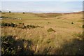
Neolithic and Bronze AgeSite Name: Rhiwiau BarrowCountry: Wales County: Conwy (Bwrdeistref Sirol) Type: Round Barrow(s)
Nearest Town: Denbigh Nearest Village: Llansannan
Map Ref: SH94466063
Latitude: 53.132345N Longitude: 3.578924W
Condition:
| 5 | Perfect |
| 4 | Almost Perfect |
| 3 | Reasonable but with some damage |
| 2 | Ruined but still recognisable as an ancient site |
| 1 | Pretty much destroyed, possibly visible as crop marks |
| 0 | No data. |
| -1 | Completely destroyed |
| 5 | Superb |
| 4 | Good |
| 3 | Ordinary |
| 2 | Not Good |
| 1 | Awful |
| 0 | No data. |
| 5 | Can be driven to, probably with disabled access |
| 4 | Short walk on a footpath |
| 3 | Requiring a bit more of a walk |
| 2 | A long walk |
| 1 | In the middle of nowhere, a nightmare to find |
| 0 | No data. |
| 5 | co-ordinates taken by GPS or official recorded co-ordinates |
| 4 | co-ordinates scaled from a detailed map |
| 3 | co-ordinates scaled from a bad map |
| 2 | co-ordinates of the nearest village |
| 1 | co-ordinates of the nearest town |
| 0 | no data |
Internal Links:
External Links:
")
You may be viewing yesterday's version of this page. To see the most up to date information please register for a free account.
")
")
Do not use the above information on other web sites or publications without permission of the contributor.
davidmorgan has found this location on Google Street View:
Nearby Images from Geograph Britain and Ireland:
©2005(licence)
©2005(licence)
©2005(licence)
©2014(licence)
©2014(licence)
The above images may not be of the site on this page, they are loaded from Geograph.
Please Submit an Image of this site or go out and take one for us!
Click here to see more info for this site
Nearby sites
Key: Red: member's photo, Blue: 3rd party photo, Yellow: other image, Green: no photo - please go there and take one, Grey: site destroyed
Download sites to:
KML (Google Earth)
GPX (GPS waypoints)
CSV (Garmin/Navman)
CSV (Excel)
To unlock full downloads you need to sign up as a Contributory Member. Otherwise downloads are limited to 50 sites.
Turn off the page maps and other distractions
Nearby sites listing. In the following links * = Image available
616m WNW 296° Blaen y Cwm Barrow* Round Barrow(s) (SH93916091)
2.5km ESE 110° Gorsedd Bran* Barrow Cemetery (SH968597)
3.0km WNW 300° Boncyn Crwn Barrow* Round Barrow(s) (SH9192062170)
3.1km WSW 253° Aled Isaf Reservoir Standing Stone* Standing Stone (Menhir) (SH915598)
3.2km NW 322° Cau Du Barrow* Round Barrow(s) (SH9256063160)
3.3km WSW 251° Llyn Aled Isaf Ancient Village or Settlement (SH91295959)
4.4km ESE 119° Maen Llwyd (Denbigh) Standing Stone (Menhir) (SH9828058371)
4.8km SE 135° Brenig 40* Round Barrow(s) (SH97785711)
5.0km SE 141° Brenig 42* Round Barrow(s) (SH975567)
5.0km SE 135° Brenig 41* Round Barrow(s) (SH97905702)
5.0km SE 126° Brenig Mesolithic Camp Site Ancient Village or Settlement (SH985576)
5.1km SE 130° Boncyn Arian* Round Barrow(s) (SH98305726)
5.1km ESE 119° Brenig 47* Round Cairn (SH98925804)
5.2km SE 130° Brenig 44* Timber Circle (SH98345720)
5.2km ESE 110° Tir Mostyn Kerb Cairns Cairn (SH99345870)
5.2km SE 127° Nant y Griafolen Hut Circle* Ancient Village or Settlement (SH98605739)
5.5km SE 131° Brenig 46* Cairn (SH98585691)
5.6km NW 306° Rhos Domen Barrow Cemetery (SH900640)
5.6km SSW 201° Nant Heilyn* Ring Cairn (SH92355543)
5.8km N 1° Plas Newydd Barrow* Round Barrow(s) (SH94716644)
5.9km SSW 207° Lon Bwlch y Garnedd Trackway* Ancient Trackway (SH9170055450)
5.9km SE 139° Brenig 14 Cairn (SH983561)
6.1km SE 131° Brenig 51* Cairn (SH98985656)
6.1km SE 133° Brenig 8* Round Barrow(s) (SH98805636)
6.2km SSW 207° Bwlch y Garnedd Cairn 1* Cairn (SH91475517)
View more nearby sites and additional images


 We would like to know more about this location. Please feel free to add a brief description and any relevant information in your own language.
 Wir möchten mehr über diese Stätte erfahren. Bitte zögern Sie nicht, eine kurze Beschreibung und relevante Informationen in Deutsch hinzuzufügen.
 Nous aimerions en savoir encore un peu sur les lieux. S'il vous plaît n'hesitez pas à ajouter une courte description et tous les renseignements pertinents dans votre propre langue.
 Quisieramos informarnos un poco más de las lugares. No dude en añadir una breve descripción y otros datos relevantes en su propio idioma.