

<< Text Pages >> Coed-Y-Gaer - Hillfort in Wales in South Glamorgan
Submitted by coldrum on Tuesday, 12 October 2010 Page Views: 3848
Iron Age and Later PrehistorySite Name: Coed-Y-GaerCountry: Wales County: South Glamorgan Type: Hillfort
Map Ref: SS93918138
Latitude: 51.521341N Longitude: 3.530497W
Condition:
| 5 | Perfect |
| 4 | Almost Perfect |
| 3 | Reasonable but with some damage |
| 2 | Ruined but still recognisable as an ancient site |
| 1 | Pretty much destroyed, possibly visible as crop marks |
| 0 | No data. |
| -1 | Completely destroyed |
| 5 | Superb |
| 4 | Good |
| 3 | Ordinary |
| 2 | Not Good |
| 1 | Awful |
| 0 | No data. |
| 5 | Can be driven to, probably with disabled access |
| 4 | Short walk on a footpath |
| 3 | Requiring a bit more of a walk |
| 2 | A long walk |
| 1 | In the middle of nowhere, a nightmare to find |
| 0 | No data. |
| 5 | co-ordinates taken by GPS or official recorded co-ordinates |
| 4 | co-ordinates scaled from a detailed map |
| 3 | co-ordinates scaled from a bad map |
| 2 | co-ordinates of the nearest village |
| 1 | co-ordinates of the nearest town |
| 0 | no data |
Be the first person to rate this site - see the 'Contribute!' box in the right hand menu.
Internal Links:
External Links:
Hillfort in South Glamorgan
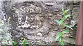
"On a small isolated hilltop bounded on the W by limestone cliffs, the enclosure measures 75m (N-S) by 55m (0.3ha). On the N,W and S it is defined by a mutilated bank of earth and stone best preserved on the N where it, and its external ditch, measures 7.5m wide overall and 0.6m high. The entrance was probably on the S."
Source: Coflein
You may be viewing yesterday's version of this page. To see the most up to date information please register for a free account.
Do not use the above information on other web sites or publications without permission of the contributor.
Nearby Images from Geograph Britain and Ireland:
©2007(licence)
©2016(licence)
©2018(licence)

©2018(licence)
©2018(licence)
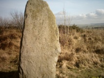
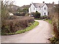
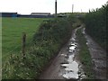
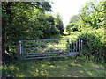
The above images may not be of the site on this page, they are loaded from Geograph.
Please Submit an Image of this site or go out and take one for us!
Click here to see more info for this site
Nearby sites
Key: Red: member's photo, Blue: 3rd party photo, Yellow: other image, Green: no photo - please go there and take one, Grey: site destroyed
Download sites to:
KML (Google Earth)
GPX (GPS waypoints)
CSV (Garmin/Navman)
CSV (Excel)
To unlock full downloads you need to sign up as a Contributory Member. Otherwise downloads are limited to 50 sites.
Turn off the page maps and other distractions
Nearby sites listing. In the following links * = Image available
1.3km WNW 293° Coity* Chambered Cairn (SS92698193)
1.3km ESE 117° Ogof-Y-Pebyll* Cave or Rock Shelter (SS95108075)
1.6km NW 310° Pant-Y-Pyllau Ancient Village or Settlement (SS92728243)
1.6km WSW 251° Simondston Cairn* Cairn (SS92378088)
1.7km S 176° Ebissar Stone* Ancient Cross (SS93997971)
1.7km S 176° St Crallog (Coychurch)* Ancient Cross (SS93997970)
1.7km W 263° Bronze Age cremation cemetery, Coity Link Road Marker Stone (SS922812)
2.5km W 265° Pond Cairn* Ring Cairn (SS914812)
2.6km NW 314° Cefn Hirgoed Misc. Earthwork (SS92068324)
2.6km SE 132° Craig Tan-Y-Tan Hillfort (SS95867958)
4.0km SSE 152° St Canna's Church (Llangan)* Ancient Cross (SS957778)
4.1km WSW 242° Bridgend Recreation Centre* Standing Stone (Menhir) (SS90217951)
4.7km NNE 17° Mynnydd y Gaer* Cairn (SS95378584)
5.0km NE 43° Mynydd y Gaer* Hillfort (SS97358495)
5.6km NNW 341° Bryn-Y-Wrach* Round Cairn (SS92188672)
5.6km NNW 341° Bryn y Wrach Round Barrow(s) (SS9218086729)
5.8km SE 143° Penllyn Wells* Holy Well or Sacred Spring (SS973767)
6.0km SW 235° Chapel Hill Camp Hillfort (SS88887806)
6.4km W 264° Cae'r-hen-Eglwys* Standing Stones (SS8753380886)
6.6km W 280° Cefn Cribbwr* Standing Stone (Menhir) (SS8738882634)
7.1km SSE 149° Corrwg Mounds (W) Cairn (SS97477518)
7.2km SW 231° Ogmore Cross Shaft* Early Christian Sculptured Stone (SS88177698)
7.4km SSE 147° Corrwg Mounds (E) Cairn (SS97857515)
7.4km ESE 113° Mynydd Y Fforest Enclosure* Misc. Earthwork (ST007783)
7.7km WSW 253° Tythegston* Chambered Tomb (SS86467925)
View more nearby sites and additional images


 We would like to know more about this location. Please feel free to add a brief description and any relevant information in your own language.
 Wir möchten mehr über diese Stätte erfahren. Bitte zögern Sie nicht, eine kurze Beschreibung und relevante Informationen in Deutsch hinzuzufügen.
 Nous aimerions en savoir encore un peu sur les lieux. S'il vous plaît n'hesitez pas à ajouter une courte description et tous les renseignements pertinents dans votre propre langue.
 Quisieramos informarnos un poco más de las lugares. No dude en añadir una breve descripción y otros datos relevantes en su propio idioma.