<< Text Pages >> Rhos Domen - Barrow Cemetery in Wales in Conwy
Submitted by vicky on Wednesday, 25 September 2002 Page Views: 4853
Neolithic and Bronze AgeSite Name: Rhos DomenCountry: Wales
NOTE: This site is 0.9 km away from the location you searched for.
County: Conwy Type: Barrow Cemetery
Nearest Town: Denbigh Nearest Village: Gwytherin
Map Ref: SH900640 Landranger Map Number: 116
Latitude: 53.161723N Longitude: 3.646715W
Condition:
| 5 | Perfect |
| 4 | Almost Perfect |
| 3 | Reasonable but with some damage |
| 2 | Ruined but still recognisable as an ancient site |
| 1 | Pretty much destroyed, possibly visible as crop marks |
| 0 | No data. |
| -1 | Completely destroyed |
| 5 | Superb |
| 4 | Good |
| 3 | Ordinary |
| 2 | Not Good |
| 1 | Awful |
| 0 | No data. |
| 5 | Can be driven to, probably with disabled access |
| 4 | Short walk on a footpath |
| 3 | Requiring a bit more of a walk |
| 2 | A long walk |
| 1 | In the middle of nowhere, a nightmare to find |
| 0 | No data. |
| 5 | co-ordinates taken by GPS or official recorded co-ordinates |
| 4 | co-ordinates scaled from a detailed map |
| 3 | co-ordinates scaled from a bad map |
| 2 | co-ordinates of the nearest village |
| 1 | co-ordinates of the nearest town |
| 0 | no data |
Internal Links:
External Links:
Barrow Cemetery in Conwy
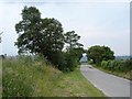
Four barrows lie on either side of the B5384 road.
Have you visited this site? Please add a comment below.
You may be viewing yesterday's version of this page. To see the most up to date information please register for a free account.
Do not use the above information on other web sites or publications without permission of the contributor.
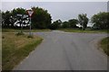
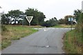
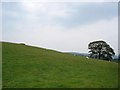
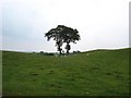
Nearby Images from Geograph Britain and Ireland:
©2015(licence)
©2006(licence)
©2006(licence)
©2006(licence)
©2006(licence)
The above images may not be of the site on this page, they are loaded from Geograph.
Please Submit an Image of this site or go out and take one for us!
Click here to see more info for this site
Nearby sites
Key: Red: member's photo, Blue: 3rd party photo, Yellow: other image, Green: no photo - please go there and take one, Grey: site destroyed
Download sites to:
KML (Google Earth)
GPX (GPS waypoints)
CSV (Garmin/Navman)
CSV (Excel)
To unlock full downloads you need to sign up as a Contributory Member. Otherwise downloads are limited to 50 sites.
Turn off the page maps and other distractions
Nearby sites listing. In the following links * = Image available
2.6km SE 132° Boncyn Crwn Barrow* Round Barrow(s) (SH9192062170)
2.7km ESE 107° Cau Du Barrow* Round Barrow(s) (SH9256063160)
3.4km SW 221° Gwytherin Churchyard* Stone Row / Alignment (SH87676147)
4.3km NW 323° St Digain (Llangernyw)* Ancient Cross (SH8749567455)
4.5km SSE 159° Aled Isaf Reservoir Standing Stone* Standing Stone (Menhir) (SH915598)
4.6km SSE 162° Llyn Aled Isaf Ancient Village or Settlement (SH91295959)
5.0km SE 127° Blaen y Cwm Barrow* Round Barrow(s) (SH93916091)
5.2km NW 325° Ffynnon Digain* Holy Well or Sacred Spring (SH87146833)
5.3km ENE 61° Plas Newydd Barrow* Round Barrow(s) (SH94716644)
5.6km SE 126° Rhiwiau Barrow* Round Barrow(s) (SH94466063)
8.0km ESE 121° Gorsedd Bran* Barrow Cemetery (SH968597)
8.6km S 185° Pen Yr Orsedd Ring Cairn* Ring Cairn (SH8901055460)
8.7km SSE 167° Lon Bwlch y Garnedd Trackway* Ancient Trackway (SH9170055450)
8.8km S 189° Moel Rhiwlug Cairn 1* Cairn (SH88445538)
8.9km SSE 163° Nant Heilyn* Ring Cairn (SH92355543)
8.9km S 169° Bwlch y Garnedd Cairn 1* Cairn (SH91475517)
9.0km S 190° Moel Rhiwlug Cairn 2* Cairn (SH88295515)
9.1km S 174° Bwlch y Garnedd Round Cairn* Round Cairn (SH90755494)
9.2km S 188° Moel Rhiwlug Recumbent* Natural Stone / Erratic / Other Natural Feature (SH8855954892)
9.3km SW 216° Maen Pebyll* Long Barrow (SH844566)
9.4km W 267° Ffynnon Ddoged (Llanddoged)* Holy Well or Sacred Spring (SH806638)
9.4km SSW 211° Bryn-Cyplau Cairn Circle East Ring Cairn (SH8489756103)
9.4km SSW 212° Bryn-Cyplau Cairn Circle West Ring Cairn (SH8486156102)
9.4km S 187° Bryniau Duon Cairn on Hiraethog Trail* Cairn (SH8855054670)
9.5km S 175° Bwlch y Garnedd Cairn 3 Cairn (SH90695450)
View more nearby sites and additional images


 We would like to know more about this location. Please feel free to add a brief description and any relevant information in your own language.
 Wir möchten mehr über diese Stätte erfahren. Bitte zögern Sie nicht, eine kurze Beschreibung und relevante Informationen in Deutsch hinzuzufügen.
 Nous aimerions en savoir encore un peu sur les lieux. S'il vous plaît n'hesitez pas à ajouter une courte description et tous les renseignements pertinents dans votre propre langue.
 Quisieramos informarnos un poco más de las lugares. No dude en añadir una breve descripción y otros datos relevantes en su propio idioma.