<< Text Pages >> Parkmill Cross (Alloa) - Ancient Cross in Scotland in Clackmannanshire
Submitted by Anne T on Thursday, 26 July 2018 Page Views: 1775
Early Medieval (Dark Age)Site Name: Parkmill Cross (Alloa) Alternative Name: Stone Cross (Clackmannan)Country: Scotland County: Clackmannanshire Type: Ancient Cross
Nearest Town: Alloa / Clackmannan
Map Ref: NS9013392661
Latitude: 56.114019N Longitude: 3.768441W
Condition:
| 5 | Perfect |
| 4 | Almost Perfect |
| 3 | Reasonable but with some damage |
| 2 | Ruined but still recognisable as an ancient site |
| 1 | Pretty much destroyed, possibly visible as crop marks |
| 0 | No data. |
| -1 | Completely destroyed |
| 5 | Superb |
| 4 | Good |
| 3 | Ordinary |
| 2 | Not Good |
| 1 | Awful |
| 0 | No data. |
| 5 | Can be driven to, probably with disabled access |
| 4 | Short walk on a footpath |
| 3 | Requiring a bit more of a walk |
| 2 | A long walk |
| 1 | In the middle of nowhere, a nightmare to find |
| 0 | No data. |
| 5 | co-ordinates taken by GPS or official recorded co-ordinates |
| 4 | co-ordinates scaled from a detailed map |
| 3 | co-ordinates scaled from a bad map |
| 2 | co-ordinates of the nearest village |
| 1 | co-ordinates of the nearest town |
| 0 | no data |
Internal Links:
External Links:
I have visited· I would like to visit
maureenspencer visited on 29th Sep 2020 - their rating: Cond: 2 Access: 4 This cross remains is at the grid ref. in the log site . It is in a field just off the roundabout leading into Alloa from Clackmannan. No where really to park but there is a opening so you can view it
Anne T couldn't find on 14th Jul 2018 - their rating: Cond: -1 Parkmill Cross, Alloa: Could not find this – the grid reference seemed to be somewhere in a breaker’s yard. Parking in the nearby housing estate just to the south west of this location, we followed the footpath sign to the footpath which ran west-east along the bottom of the field this cross base is supposed to be in, the tall fence and padlocked gates prevented entry. Andrew tried to gain access from the car breakers yard to the north-west, but said it looks as if their site has been extended to cover where this cross might have been.
Average ratings for this site from all visit loggers: Condition: 0.5
This old cross is recorded as Canmore 48304, which tells us that the slab is set up on a knoll 200 yards south of the main road between Alloa and Clackmannan. "It is packed round the base with fairly large stones, and stands with its broad face E-W. A cross of Celtic form is incised on both sides, It stands 8' high and measures 2'7 1/2" x 9" at base. When the site was examined in 1829, many human bones were found close to the stone, and at about 9' N of its base was a stone cist which contained human bones, and was covered with a flagstone, at each end of which was incised a small cross of simple form. Long before 1829 the cross stood on the inside of a hedge-row and was situated about 160 paces from the old road between Alloa and Clackmannan, and a few paces W of it was an old parish road. The Statistical Account (OSA 1791) notes that old people used to speak of the figure of a man on horseback which they had seen on it."
The last report made was in 1950, when Canmore said "the cross is as described. The incised crosses on either face can still be seen, although they are much weather worn." An additional desk based assessment was made in 2004, in advance of construction works associated with the Kincardine Railway.
We tried to find this cross, armed with our GPS and images. There is now a housing estate to the south west of the field in which this cross lies, with a footpath leading west-east across the bottom of the field. The high fences and padlocked gates prevented entry. We tried to gain access to the site from the Auto Dismantlers to the west, but it looks as if they may have extended their site to cover where the Parkmill Cross stood.
Any information about the current location of this cross would be very gratefully received.
Note: Does anyone have any information about where this cross is currently located? Do you have any photographs, illustrations or drawings to add?
You may be viewing yesterday's version of this page. To see the most up to date information please register for a free account.
Do not use the above information on other web sites or publications without permission of the contributor.
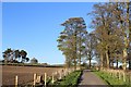
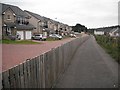
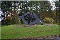
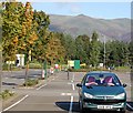
Nearby Images from Geograph Britain and Ireland:
©2014(licence)
©2010(licence)

©2019(licence)
©2014(licence)
©2008(licence)
The above images may not be of the site on this page, they are loaded from Geograph.
Please Submit an Image of this site or go out and take one for us!
Click here to see more info for this site
Nearby sites
Key: Red: member's photo, Blue: 3rd party photo, Yellow: other image, Green: no photo - please go there and take one, Grey: site destroyed
Download sites to:
KML (Google Earth)
GPX (GPS waypoints)
CSV (Garmin/Navman)
CSV (Excel)
To unlock full downloads you need to sign up as a Contributory Member. Otherwise downloads are limited to 50 sites.
Turn off the page maps and other distractions
Nearby sites listing. In the following links * = Image available
469m E 96° Hawk Hill (Alloa) Stone Circle (NS906926)
1.0km W 277° Hawk Hill Cairn (Alloa) Cairn (NS89119282)
1.2km SE 127° Mercat Cross (Clackmannan)* Ancient Cross (NS9111091889)
1.2km SE 127° Stone of Mannan* Standing Stone (Menhir) (NS91119188)
1.4km SE 134° Lady Well (Clackmannan) Holy Well or Sacred Spring (NS91129166)
2.0km ESE 108° Hawk Hill Stone Circle (NS920920)
2.5km ENE 71° Grassmainston Well (Clackmannan) Holy Well or Sacred Spring (NS9247893403)
4.8km NNW 342° St Serf's Well (Alva) Holy Well or Sacred Spring (NS88819723)
4.8km NE 48° Balhearty Standing Stone (Menhir) (NS9378295816)
4.8km WNW 302° Priest's Well (Tullibody) Holy Well or Sacred Spring (NS8606995324)
4.9km WNW 302° The Maiden Stone (Tullibody)* Sculptured Stone (NS86039533)
4.9km N 10° Lady's Well (Tillicoultry) Holy Well or Sacred Spring (NS91119749)
4.9km WNW 294° Haer Stane* Standing Stone (Menhir) (NS85659475)
5.0km SE 127° Tulliallan Castle Sculptured Stone (NS94058952)
5.0km NNE 27° Cunninghar Stone Circle (NS92569708)
5.1km NNW 340° Dwarf's Tomb (Alva) Burial Chamber or Dolmen (NS88489754)
5.3km WNW 301° Lady's Well (Tullibody) Holy Well or Sacred Spring (NS85639548)
5.4km NNE 23° Tillicoultry House Carving (Tillicoultry) Rock Art (NS92409752)
5.4km NNW 342° Ladies Well (Alva) Holy Well or Sacred Spring (NS88579788)
5.6km SE 142° Greenfield Park, Alloa Stone Row / Alignment (NS935882)
5.9km SSE 148° Market Cross (Kincardine)* Ancient Cross (NS9312087515)
6.0km SW 223° Castleton 1* Rock Art (NS85878840)
6.1km SW 223° Castleton 2* Rock Art (NS85818831)
6.4km SW 224° Castleton 7a* Rock Art (NS8552188188)
6.4km SW 218° Castleton 8* Rock Art (NS86028771)
View more nearby sites and additional images


 We would like to know more about this location. Please feel free to add a brief description and any relevant information in your own language.
 Wir möchten mehr über diese Stätte erfahren. Bitte zögern Sie nicht, eine kurze Beschreibung und relevante Informationen in Deutsch hinzuzufügen.
 Nous aimerions en savoir encore un peu sur les lieux. S'il vous plaît n'hesitez pas à ajouter une courte description et tous les renseignements pertinents dans votre propre langue.
 Quisieramos informarnos un poco más de las lugares. No dude en añadir una breve descripción y otros datos relevantes en su propio idioma.