<< Our Photo Pages >> Innercochill - Rock Art in Scotland in Perth and Kinross
Submitted by tiompan on Saturday, 20 May 2006 Page Views: 6260
Rock ArtSite Name: InnercochillCountry: Scotland
NOTE: This site is 2.9 km away from the location you searched for.
County: Perth and Kinross Type: Rock Art
Map Ref: NN909381
Latitude: 56.522235N Longitude: 3.774949W
Condition:
| 5 | Perfect |
| 4 | Almost Perfect |
| 3 | Reasonable but with some damage |
| 2 | Ruined but still recognisable as an ancient site |
| 1 | Pretty much destroyed, possibly visible as crop marks |
| 0 | No data. |
| -1 | Completely destroyed |
| 5 | Superb |
| 4 | Good |
| 3 | Ordinary |
| 2 | Not Good |
| 1 | Awful |
| 0 | No data. |
| 5 | Can be driven to, probably with disabled access |
| 4 | Short walk on a footpath |
| 3 | Requiring a bit more of a walk |
| 2 | A long walk |
| 1 | In the middle of nowhere, a nightmare to find |
| 0 | No data. |
| 5 | co-ordinates taken by GPS or official recorded co-ordinates |
| 4 | co-ordinates scaled from a detailed map |
| 3 | co-ordinates scaled from a bad map |
| 2 | co-ordinates of the nearest village |
| 1 | co-ordinates of the nearest town |
| 0 | no data |
Be the first person to rate this site - see the 'Contribute!' box in the right hand menu.
Internal Links:
External Links:
I have visited· I would like to visit
SolarMegalith would like to visit
")
A cup marked rock discovered winter '05. The azimuth from stone to the apparent col between Meall nan Caorach and Meall Raemhar is 155 degrees, the extreme southern moonrise.
You may be viewing yesterday's version of this page. To see the most up to date information please register for a free account.
")
Do not use the above information on other web sites or publications without permission of the contributor.
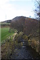
Nearby Images from Geograph Britain and Ireland:
©2016(licence)
©2006(licence)
©2006(licence)
©2006(licence)
©2005(licence)
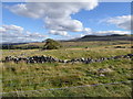
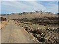
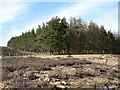
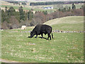
The above images may not be of the site on this page, they are loaded from Geograph.
Please Submit an Image of this site or go out and take one for us!
Click here to see more info for this site
Nearby sites
Key: Red: member's photo, Blue: 3rd party photo, Yellow: other image, Green: no photo - please go there and take one, Grey: site destroyed
Download sites to:
KML (Google Earth)
GPX (GPS waypoints)
CSV (Garmin/Navman)
CSV (Excel)
To unlock full downloads you need to sign up as a Contributory Member. Otherwise downloads are limited to 50 sites.
Turn off the page maps and other distractions
Nearby sites listing. In the following links * = Image available
1.7km N 355° Glen Cochill 1 (Little Dunkeld) Rock Art (NN9080039842)
3.1km N 355° White Cairn Aberfeldy* Round Barrow(s) (NN9072841161)
3.1km N 355° Glen Cochill South (Little Dunkeld) Ancient Village or Settlement (NN9073241196)
3.2km N 353° Shaman's Lodge (Glen Cochill) Ancient Village or Settlement (NN9059141247)
3.4km N 349° Glen Cochill Cairnfield 1 (Little Dunkeld) Cairn (NN90354145)
3.4km N 349° Glen Cochill Hut Circle 1 (Little Dunkeld) Ancient Village or Settlement (NN9032441487)
3.6km E 80° Little Findowie* Standing Stone (Menhir) (NN94483865)
5.0km E 82° Airlich Stone Circle* Stone Circle (NN9590838678)
5.3km ENE 78° Meikle Findowie* Standing Stone (Menhir) (NN961391)
5.4km E 85° Airlich (Cup and Ring Marks)* Rock Art (NN963384)
5.9km WNW 287° Turrerich* Rock Art (NN8526839926)
6.9km NE 43° Salachill* Rock Art (NN95714300)
7.0km WNW 296° Shian Burn* Stone Circle (NN84644131)
7.1km ENE 61° Ballinloan* Rock Art (NN97244141)
7.6km S 189° Clach Ossian* Natural Stone / Erratic / Other Natural Feature (NN8953130593)
8.2km NNW 349° Sheriff Stone Standing Stone (Menhir) (NN895462)
8.5km S 182° Saddlin' Mare (Sma' Glen)* Standing Stone (Menhir) (NN90422964)
8.5km S 181° Sma' Glen* Cairn (NN90502956)
8.6km ESE 103° Sack Stone* Standing Stone (Menhir) (NN9925535973)
8.7km SW 225° Conichan East (Glen Almond) Ancient Village or Settlement (NN8464532074)
9.4km WSW 237° Well of the Mosses (Glen Almond) Holy Well or Sacred Spring (NN8286533096)
9.5km SW 235° Clach Na Tiompan* Stone Circle (NN82963286)
9.7km WSW 237° Glenshervie Burn* Stone Circle (NN82593299)
10.3km SE 140° Kor Stone* Standing Stone (Menhir) (NN97333004)
10.5km E 99° Tullybeagles* Stone Circle (NO013362)
View more nearby sites and additional images


 We would like to know more about this location. Please feel free to add a brief description and any relevant information in your own language.
 Wir möchten mehr über diese Stätte erfahren. Bitte zögern Sie nicht, eine kurze Beschreibung und relevante Informationen in Deutsch hinzuzufügen.
 Nous aimerions en savoir encore un peu sur les lieux. S'il vous plaît n'hesitez pas à ajouter une courte description et tous les renseignements pertinents dans votre propre langue.
 Quisieramos informarnos un poco más de las lugares. No dude en añadir una breve descripción y otros datos relevantes en su propio idioma.